Trisha Shetty (Editor)

Uplengen

Updated on
Edit
Like
Comment
Share on FacebookTweet on TwitterShare on LinkedInShare on Reddit
Country
  
Germany

District
  
Leer

Time zone
  
CET/CEST (UTC+1/+2)

Area
  
149 km²

Population
  
11,448 (31 Dec 2008)

State
  
Lower Saxony

Elevation
  
6 m (20 ft)

Postal codes
  
26670

Local time
  
Sunday 6:30 PM

Postal code
  
26670

Uplengen httpsuploadwikimediaorgwikipediacommonsthu

Weather
  
12°C, Wind NW at 16 km/h, 72% Humidity

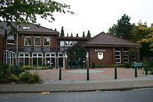
Uplengen is a municipality in the Leer district, in Lower Saxony, Germany.

Contents

Map of Uplengen, Germany

Parts of the municipality

  • Bühren
  • Großoldendorf
  • Großsander
  • Hollen
  • Jübberde
  • Klein Remels
  • Kleinoldendorf
  • Kleinsander
  • Meinersfehn
  • Neudorf
  • Neufirrel
  • Nordgeorgsfehn
  • Oltmannsfehn
  • Poghausen
  • Remels
  • Selverde
  • Spols
  • Stapel
  • Südgeorgsfehn
  • Population

  • Lutheranism - 84.29%
  • Reformed churches - 1.48%
  • Catholic - 2.71%
  • Different - 11,52%
  • Politics

    The 27 seats of the local council are distributed as follows:

  • CDU—20 seats
  • SPD—8 seats
  • References

    Uplengen Wikipedia