
 | ||
Isle of axholme model flying club dji 450
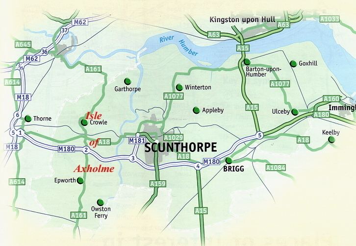
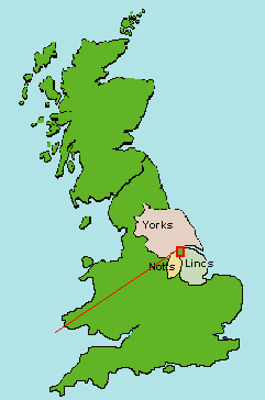
The Isle of Axholme is a geographical area of North Lincolnshire, England. It is the only part of Lincolnshire west of the River Trent. It is between the three towns of Doncaster, Scunthorpe and Gainsborough, in the traditional West Riding of Lindsey.
Contents
- Isle of axholme model flying club dji 450
- Description
- Etymology
- 1833 description
- Land drainage history
- Road and railway
- References
Description
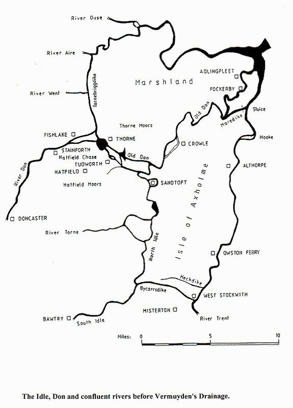
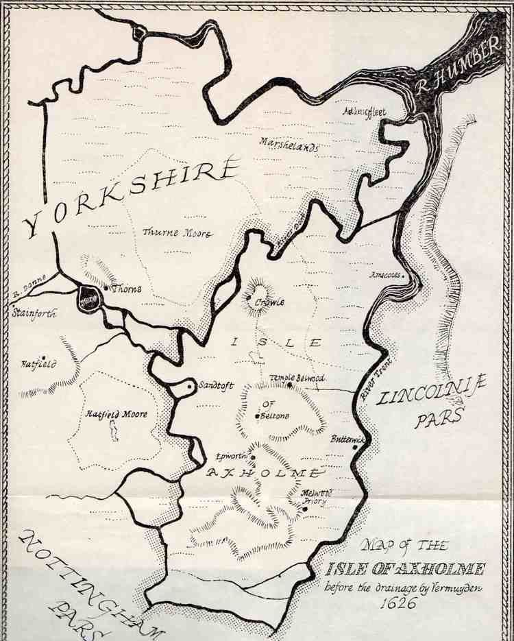
The name Isle is given to the area since, prior to the area's being drained by the Dutchman Cornelius Vermuyden, each town or village was built on areas of dry, raised ground in the surrounding marshland. The River Don used to flow to the north and west (it has since been diverted), dividing the Isle from Yorkshire; the River Idle separates the Isle from Nottinghamshire; and the River Trent separates the Isle from the rest of Lincolnshire. Three small towns developed here: Epworth – birthplace of John Wesley and his brother Charles – Crowle, and Haxey.
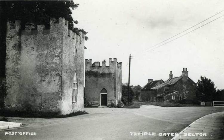
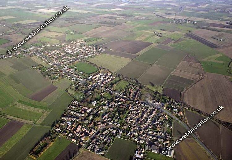
The boundaries of the Isle of Axholme usually match with those of the ancient wapentake of Epworth and its 17 communities: Belton, Crowle, Epworth, Haxey, Beltoft, (High and Low) Burnham, Owston Ferry, (East) Lound and (Graise)lound, Garthorpe, Luddington, Amcotts, (West) Butterwick, Althorpe, The Marshes, Waterton, Upperthorpe, and Westwoodside. Other settlements on the Isle include Eastoft, Sandtoft – home to Europe's largest trolleybus museum – and Wroot.
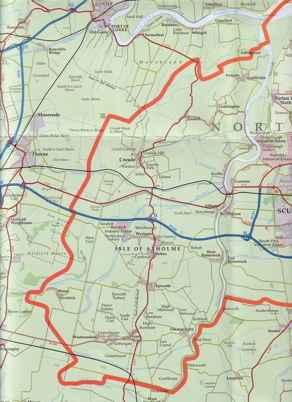
Much of the northern part of the Isle has flat topography, with rich farmland used mainly to grow wheat and sugar beets. The land is particularly fertile due to its history of annual flooding from the Trent and peat soil which was created by dense ancient woodland which covered much of the Isle. Even today, in many parts of the northern Isle, petrified wood can be found at about six feet below ground; relics from this woodland, these are locally called "bog oaks".
A long-distance walking route, the "Peatlands Way", traverses the Isle.
Etymology
Axholme means "island by Haxey", from the town name + Old Norse holmr "island". The name was recorded as Hakirhomle in 1196. (The Old English suffix "ey" in "Haxey" also indicates an island).
1833 description
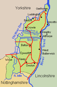
Axholme, Isle of Area of slight elevation above flat and formerly marshy tract bounded by the Rivers Trent, Torne and Idle. Towns include Crowle, Belton, Epworth and Haxey on higher ground and Owston Ferry and West Butterwick beside the River Trent
Land drainage history
The Isle is known for the early influence of the Dutchman, Cornelius Vermuyden, an engineer who initiated the realignment of several of the highland carriers flowing through the district, allowing increased agricultural production. This early agricultural activity has left a legacy in the unique strip farming which survives in the 21st century around Epworth. The watercourses of the Isle and the surrounding area are managed by the Isle of Axholme Internal Drainage Board which maintains 302 km of watercourse and 18 pumping stations, and manages the water levels of the adjacent Thorne Moors and Hatfield Moors, both environmentally sensitive areas.
Road and railway
The Axholme Joint Railway traversed the area, but the line has now been abandoned. There are still railway stations in Crowle and Althorpe on the line between Scunthorpe and Sheffield. The M180 motorway now crosses the centre of the area, dividing 'South Axholme', centred on Epworth, from 'North Axholme', centred on Crowle. The A161 road crosses the Isle from north to south.
There was an Isle of Axholme Rural District from 1894 to 1974, which covered the entire Isle after 1936. This became part of the Boothferry district of Humberside in 1974, and since 1996 has been in the North Lincolnshire unitary authority.