
Location West of Hong Kong Highest point Finger Hill Population 5,000(2011) | Highest elevation 95 m (312 ft) District Islands District Area 99 ha | |
 | ||
Constituency Peng Chau and Hei Ling Chau Similar Hei Ling Chau, Po Toi Islands, Cheung Chau, Lamma Island, Sunshine Island - Hong Kong | ||
Peng chau 5 best island getaways in hong kong
Peng Chau (Chinese: 坪洲) is a small island located off the north-eastern coast of Lantau Island, Hong Kong. It is known for its temples, its small island lifestyle and accessibility to fresh seafood.
Contents
- Peng chau 5 best island getaways in hong kong
- Map of Peng Chau Hong Kong
- Peng chau island hong kong gopro dji ii
- GeographyEdit
- FeaturesEdit
- TransportationEdit
- Famous peopleEdit
- References
Map of Peng Chau, Hong Kong
Peng chau island hong kong gopro dji ii
GeographyEdit
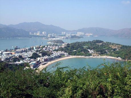
Peng Chau has an area of 0.99 square kilometres (0.38 square miles). The tallest point of the island is Finger Hill, which is 95 metres (312 feet) in height and provides hiking opportunities for those who seek them.
In 2003, the island was undergoing land degradation restorative work.
FeaturesEdit
There are several temples on Peng Chau, including:
TransportationEdit
The main mode of transportation on the island is the bicycle; there are no motor cars apart from small construction and emergency vehicles.
Peng Chau is accessible by a ferry (Hong Kong and Kowloon Ferry) from Central on Hong Kong Island, or by ferries from Mui Wo, Chi Ma Wan and Cheung Chau (New World First Ferry), or by Kai-to ferries from Discovery Bay on Lantau Island. Helicopters are sometimes used in medical emergencies.
Peng Chau is linked to Tai Lei Island by a bridge. The bridge is part of Peng Lei Road. It is a popular fishing spot.
Famous peopleEdit
Hong Kong footballer Lee Kin Wo lives on Peng Chau with his family.