Location Saint Lawrence River Highest elevation 234 m (768 ft) Province Québec | Total islands 320 Highest point Mont Royal Elevation 234 m | |
 | ||
Major islands Île de Montréal, Île Jésus, Île Perrot, Île Bizard Islands Island of Montreal, Saint Helen's Island, Notre Dame Island, Île Bizard, Île Jésus Points of interest Montreal Botanical Garden, Montreal Biodome, Old Port of Montreal, Old Montreal, Notre‑Dame Basilica | ||
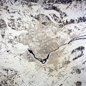
The Hochelaga Archipelago, also known as the Montreal Islands (French: archipel d'Hochelaga), is a group of islands at the confluence of the Saint Lawrence and Ottawa Rivers in the southwest part of the province of Quebec, Canada.
Contents
- Map of Archipel dHochelaga QuC3A9bec Canada
- SizeEdit
- IslandsEdit
- List of Named IslandsEdit
- NameEdit
- References
Map of Archipel d'Hochelaga, Qu%C3%A9bec, Canada
SizeEdit
Estimates of the number of islands in the archipelago vary. The most widely accepted number seems to be 234, although the number has been put as high as 325.
IslandsEdit
The largest island in the group is the Island of Montreal, which forms the main portion of the City of Montreal. The city has jurisdiction over 74 smaller islands in the archipelago, most notably Nuns' Island, Île Bizard and the two islands that served as the site of Expo 67, Saint Helen's Island and the man-made Île Notre-Dame.
The second-largest island in the archipelago is Île Jésus, which along with the Îles Laval and several smaller islands makes up the city of Laval.
Other islands include the Îles de Boucherville, featuring a Quebec National Park, Île Perrot, Salaberry-de-Valleyfield and neighbouring Grande-Île, Quebec, as well as the smaller Dorval and Dowker islands.
List of Named IslandsEdit
NameEdit
The archipelago takes its name from Hochelega, an Iroquois settlement on Island of Montreal that was later settled by the French, growing to become the modern city of Montreal.
