
Population 16,791 (Nov 2014) | Area 115.7 km² Local time Thursday 9:30 AM | |
 | ||
Weather 5°C, Wind NW at 32 km/h, 61% Humidity | ||
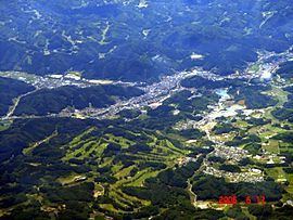
Ishikawa (石川町, Ishikawa-machi) is a town located in Ishikawa District, Fukushima Prefecture, in northern Honshū, Japan. As of November 2014, the town had an estimated population of 16,791 and a population density of 145 persons per km². The total area was 115.71 square kilometres (44.7 sq mi).
Contents
- Map of Ishikawa Ishikawa District Fukushima Prefecture Japan
- Geography
- Neighboring municipalities
- History
- Economy
- Education
- Railway
- Highway
- Local attractions
- References
Map of Ishikawa, Ishikawa District, Fukushima Prefecture, Japan
Geography
Ishikawa is located in south-central Fukushima prefecture.
Neighboring municipalities
History
The area of present-day Ishikawa was part of ancient Mutsu Province. After the Meiji Restoration, it was organized as part of Nakadōri region of Iwaki Province.
The village of Ishikawa was formed on April 1, 1889 with the creation of the municipalities system. It was promoted to town status on March 27, 1894. During World War II, the town had a secret uranium mine for the Japanese atomic bomb project. The town expanded by annexing the neighboring villages of Sawada, Nogisawa, Bobata, Nakatani and Yamahashi on March 31, 1955.
Economy
The economy of Ishikawa is primarily based on agriculture.