- Flower Dandelion Population 6,445 (Nov 2014) | Area 93.53 km² Local time Sunday 11:54 AM | |
 | ||
Weather 6°C, Wind SW at 11 km/h, 53% Humidity | ||
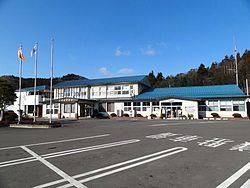
Hirata (平田村, Hirata-mura) is a village located in Ishikawa District, Fukushima Prefecture, in northern Honshū, Japan. As of November 2014, the village had an estimated population of 6,445 and a population density of 68.9 persons per km². The total area was 93.53 square kilometres (36.1 sq mi).
Contents
- Map of Hirata Ishikawa District Fukushima Prefecture Japan
- Geography
- Neighboring municipalities
- History
- Economy
- Education
- Railway
- Highway
- Local attractions
- References
Map of Hirata, Ishikawa District, Fukushima Prefecture, Japan
Geography
Hirata is located in southeast Fukushima prefecture, approximately halfway between the cities of Iwaki and Kōriyama. The landscape consists of rolling hills with an altitude of between 500 and 700 meters.
Neighboring municipalities
History
The area of present-day Hirata was part of ancient Mutsu Province. After the Meiji Restoration, it was organized as part of Nakadōri region of Iwaki Province.
The village of Hirata was formed on March 31, 1955 through the merger of the villages of Yomogida and Odaira.
Economy
The economy of Hirata is primarily based on agriculture.
