
Country United States Time zone Eastern (EST) (UTC-5) Population 6,550 (2013) Area code 914 | State New York Area 10.4 km² Local time Wednesday 3:38 PM | |
 | ||
Weather -4°C, Wind W at 34 km/h, 55% Humidity Points of interest Scenic Hudson Park, Matthiessen Park, Armour–Stiner House, Villa Lewaro, Great Hunger Memorial | ||
Unparalleled grandeur in irvington new york
Irvington, sometimes known as Irvington-on-Hudson, is an affluent suburban village in the town of Greenburgh in Westchester County, New York, United States. It is located on the eastern bank of the Hudson River, 20 miles (32 km) north of midtown Manhattan in New York City, and is served by a station stop on the Metro-North Hudson Line. To the north of Irvington is the village of Tarrytown, to the south the village of Dobbs Ferry, and to the east unincorporated parts of Greenburgh, including East Irvington. Irvington includes within its boundaries the community of Ardsley-on-Hudson, which has its own ZIP code and Metro-North station, but which should not be confused with the nearby village of Ardsley, New York.
Contents
- Unparalleled grandeur in irvington new york
- Map of Irvington NY USA
- History
- American Revolution
- A change of name
- Recent events
- Geography
- Demographics
- Economy
- Government and politics
- 2005 mayoral election
- Infrastructure
- Primary and secondary schools
- Colleges
- Religion
- Local media
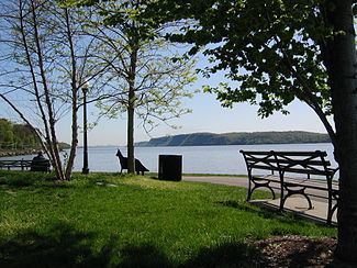
- Points of interest
- Quality of life
- Parks and recreation
- Restaurants
- Notable past residents
- Notable current residents
- In popular culture
- References
Map of Irvington, NY, USA
The population of Irvington at the 2010 census was 6,420. Because many of Irvington's residents – especially those in the upper income brackets – live in Irvington and work in New York City, the village has a reputation as a "commuter town" or a "bedroom community".
The village's Main Street area has been designated an historic district by New York State and on January 15, 2014 was added to the National Register of Historic Places. In 2010, Westchester Magazine ranked Irvington as the "Best Place to Live in Westchester".
History
Before the area where Irvington is now located was settled by Europeans, it was inhabited by the Wickquasgeck Indians, a band of the Wappingers, related to the Lenape (Delaware) tribes which dominated lower New York state and New Jersey. The Wickquasgeck still lived in the area as late as 1775.
After the Dutch came to the area, the land was part of the Bisightick tract of the Van der Donck grant, which was purchsed by Frederick Philipse in 1682, after the British had taken over the area in 1664. At first it was settled by tenant farmers, and but by the 1700s, most of the settlers were artisans. The King's Highway, which connected New York City with Albany, was built through the settlement by the 1720s, which created a need for inns and taverns. In 1785, the state of New York confiscated the Phillipse's land from his grandson, Frederick Philipse III, after he sided with the British in the American Revolution, and sold it to local patriot farmers who had been tenants of the Phillipse family. This is presumably how part of it came to be the farm of William Dutcher. Dutcher sold half of his farm to Justus Dearman in 1817, who then sold it to Gustavo F. Sacchi in 1848 for $26,000. Sacchi sold the parcel to John Jay – the grandson of the American Founding Father by the same name – that same year, and Jay laid it out as a village which he called "Dearman", after Justus Dearman, and sold lots at auction in New York City starting on April 25, 1850.
The organization of the streets into a right-angled grid pattern was criticized by Andrew Jackson Downing, who was at the time the foremost expert on landscape design. Downing condemned the use of the street grid outside of cities and saw the hilly and heavily wooded site of Dearman as particularly suited to his own theories, which called for curvilinear roads and irregular lots which followed the contours of the land. With the frequent steamboat, stagecoach, and train transportation available, he felt that Dearman could have been an ideal suburb, instead of "mere rows of houses upon streets crossing each other at right angles and bordered with shade trees".
The side streets off the village's Main Street – or "Main Avenue", as an 1868 map has it – were originally designated "A", "B", "C", and so forth, but are today named after many of the area's early settlers, such as Barent and William Dutcher, Captain John Buckhout (who lived to 103) and Wolfert Ecker (or "Acker").
American Revolution
Wolfert Ecker's house, then owned by Jacob van Tassel, was burned by the British in the Revolutionary War because it had become a notorious hang-out for American patriots. Washington Irving later wrote about it under the name of "Wolfert's Roost" ("roost" meaning "rest"), and purchased and re-modeled another house on the land to become "Sunnyside". Another early settler was Capt. Jan Harnse, and the Harnse-Conklin-Odell Tavern on Broadway was built in 1693 and became an inn in 1743. (See below) It was at Odell's Tavern that the Committee of Safety, the executive committee of the legislature of the new State of New York, officially received the news that George Washington had lost the Battle of Long Island, and, later, British troops camped nearby, putting Jonathan Odell into custody in the Old Dutch Church in Tarrytown. No major battles of the Revolutionary War were fought in the area, only minor skirmishes between residents and soldiers.
With the capture of New York City by the British, Irvington and the rest of southern Westchester County became the "Neutral ground", an unofficial 30-mile (48 km) wide zone separating British-occupied territory from that held by the Americans, and the people of the area who remained – many of the Patriot population had fled – traded with both sides to great profit. However, there was also a great deal of pillaging and plundering, even of Tory households, both by the regular British army and loyalist militias and irregulars, all in the name of hunting down rebels. By the time the war was over, the countryside had been ravaged:
The country is rich and fertile, and the farms appear to have been advantageously cultivated, but it now has the marks of a country in ruins, a large portion of the proprietors having abandoned their homes. On the high road where heretofore was a continuous stream of travelers and vehicles, not a single traveler was seen from week to week, month to month. The countryside was silent. The very tracks of the carriages were grown over with grass or weeds. Travelers walked along bypaths. The villages are abandoned, the residents having fled to the north, leaving their homes, where possible, in charge of elder persons and servants.
Eventually, the area recovered and continued to develop. The Hudson River Railroad reached the settlement on September 29, 1849; the first passengers on a regularly scheduled run through the village paid fifty cents to travel from Peekskill to Chambers Street in Manhattan on September 29, 1849. By 1853, a ferry ran across the Hudson from Dearman to Piermont on the west bank, the village had a population of around 600, a hotel, six stores, a lumber yard and around 50 houses, and the hamlet of "Abbotsford" – which would later become Ardsley-on-Hudson – was forming along Clinton Avenue.
A change of name
In 1854 the Dearman and Abbotsford combined, and by popular vite adopted the common name "Irvington", to honor the American author Washington Irving, who was still alive at that time and living in nearby "Sunnyside" – which is today preserved as a museum. Influential residents of the village prevailed upon the Hudson River Railroad, which had reached the village by 1849, to change the name of the train station to "Irvington", and also convinced the Postmaster to change the name of the local post office as well. It was thus under the name of "Irvington" that the village incorporated on April 16, 1872.
By the census of 1860, the population of the village was 599. A few years later, in 1863, Irvington was touched by the New York Draft Riots. Fearing that the violence in the city, which had to be put down by Federal troops, would spread to Westchester, special police were brought in and quartered in a schoolhouse on Sunnyside Lane. They were commanded by James Hamilton – the third son of Alexander Hamilton – whose estate, Nevis, was on South Broadway. The presence of this special force deterred any violence a group of draft protestors which passed through Greenburgh on their way to Tarrytown may have intended. This was the only instance in which Civil War-related activity directly affected Irvington.
With convenient rail transportation now available, the village's cool summer breezes off the Hudson and the rural riparian setting began to attract wealthy residents of New York City – businessmen, politicians and professionals – to the area to buy up farms and build large summer residences on their new estates, setting a pattern which would hold until the early 20th century. Still, the village continued to expand, with various commercial enterprises opening along the waterfront. Pateman & Lockwood, a lumber, coal and building supply company, opened in the village in 1853, and Lord & Burnham, which built boilers and greenhouses, in 1856. Both expanded to newly created land across the railroad tracks, in 1889 and 1912 respectively, and the Cypress Lumber Company opened on a nearby site in 1909. Nothwithstanding this commercial activity, for many years, through the 19th and early 20th centuries, Irvington was a relatively small community surrounded by numerous large estates and mansions where millionaires, aristocrats and captains of industry lived – the population was reported as 2,299 in 1890 and 2,013 in 1898. After World War I, some of the bigger estates in the area were broken up into smaller lots. Many of the estates and mansions are now gone, having been replaced by suburban sub-divisions, although a small number still exist. After World War II, cooperative apartment complexes were built in the village, but despite these changes, Irvington still has many large houses, and is still an overwhelmingly well-heeled community.
Recent events
In June 2016, Irvington Fire Chief Christopher D. DePaoli was one of 23 recipients of the Carnegie Hero Fund Commission medal for heroism. In April 2015, DePaoli stepped in when he saw a woman being attacked by a man with a knife at the Irvington Metro-North Station. DePaoli was able get between the man and the woman, the man's girlfriend, who was on the ground being stabbed, and distract him with a baseball bat until the police arrived. The man was arrested and the woman survived the attack.
Geography
The village has a total area of 4.0 square miles (10 km2), of which 2.8 square miles (7.3 km2) or about 1,850 acres (750 ha) is land and 1.2 square miles (3.1 km2), or 30.94%, is water.
The village's main thoroughfare is Broadway (Route 9) originally an Indian footpath which gradually became a horse track and then a dirt road. It came to be called the "King's Highway" around the time that it reached Albany. Later, it was called the "Queen's Highway", after Queen Anne, the "Highland Turnpike" after 1800 – a name still preserved in the nearby town of Ossining – the "Albany Post Road" and, after 1850, "Broadway". The stretch that runs through Irvington was completed by 1723. During his tenure as Postmaster General, Benjamin Franklin had 3-foot-high (0.91 m) sandstone milestone markers placed along the Broadway, inscribed with the distance from New York City. Milestone #27 is still in place in Irvington, near the driveway to 30 South Broadway.
Broadway runs north-south parallel to the river, and connects Irvington to Dobbs Ferry in the south and Tarrytown in the north. All of the village's major streets, including Main Street, extend east and west from Broadway, and are designated as such. Broadway is designated "North Broadway" above Main Street, and "South Broadway" below it. Main Street begins at the Metro-North train station, just off the Hudson River, and travels uphill to Broadway. Side streets off of Main, which were originally designated A Street, B Street, C Street, etc. when the village grid was laid out, now have names, most of which come from local history: Astor, Buckhout, Cottenet, Dutcher, Ecker, Ferris and Grinnell.
The southbound Saw Mill River Parkway can be reached via Harriman Road/Cyrus Field Road, past the village reservoir, or East Sunnyside Lane/Mountain Road through East Irvington. The northbound Saw Mill and the New York State Thruway are accessible via Ardsley, and the Tappan Zee Bridge is nearby in Tarrytown.
Commuter train service to New York City is available at the Irvington and Ardsley-on-Hudson train stations, served by the Metro-North Railroad of the MTA. Bus service is provided on Broadway by the Westchester County Beeline Bus System via route #1T (The Bronx-Yonkers-Tarrytown) and #1W (The Bronx-Yonkers-White Plains).
As with all river communities in Westchester, Irvington is traversed by a stretch of the old Croton Aqueduct, about 3 miles (4.8 km) long, which is now part of the Old Croton Trailway State Park. The Aqueduct is a National Historic Landmark.
Demographics
As of the census of 2000, there were 6,631 people, 2,518 households, and 1,812 families residing in the village. The population density was 2,377.4 people per square mile (917.7/km²). There were 2,601 housing units at an average density of 932.5 per square mile (359.9/km²). The racial makeup of the village was 88.66% White, 1.45% African American, 0.11% Native American, 6.95% Asian, 1.16% from other races, and 1.67% from two or more races. Hispanic or Latino of any race were 3.79% of the population. 18.1% were of Italian, 17.3% Irish, 7.3% German and 5.9% Russian ancestry according to Census 2000. 88.0% spoke English, 4.2% Japanese, 3.6% Spanish, 1.8% Italian and 1.0% German as their first language.
There were 2,518 households out of which 37.7% had children under the age of 18 living with them, 62.2% were married couples living together, 7.6% had a female householder with no husband present, and 28.0% were non-families. 24.3% of all households were made up of individuals and 9.5% had someone living alone who was 65 years of age or older. The average household size was 2.60 and the average family size was 3.13.
In the village, the population was spread out with 28.2% under the age of 18, 3.9% from 18 to 24, 28.1% from 25 to 44, 26.3% from 45 to 64, and 13.6% who were 65 years of age or older. The median age was 40 years. For every 100 females there were 93.7 males. For every 100 females age 18 and over, there were 86.5 males.
The median income for a household in the village was $96,467, and the median income for a family was $120,895. Males had a median income of $85,708 versus $50,714 for females. The per capita income for the village was $59,116. About 1.2% of families and 3.1% of the population were below the poverty line, including none of those under age 18 and 0.9% of those age 65 or over. The average cost for a one-family house in 2010 was $585,780, below the Westchester County average of $725,000, although in 2009 the median home price was reported to be $790,000.
As of 2013, according to the Town of Greenburgh's assessor's office, the village had 1,182 singe-family homes, as well as 103 homes for two families, 12 for three families and an additional 344 multi-families buildings, both co-ops and condos and some rentals. Legend Hollow, the village's one housing development, was constructed in the 1990s and has 69 large houses on lots of a half acre or larger. The Hudson Gateway Multiple Listing Service reported that the median sale price for a single-family home was $1.080 million, up from $790,000 in 2008. Co-ops went from $223,000 to $263,000 and condos went down from $592,000 to $549,000.
Economy
Although Irvington is still a suburban "bedroom community", with a large number of people commuting into New York City to work, there are also several notable businesses and institutions located in the village, such as:
Government and politics
Irvington is governed by a Mayor, who is elected every two years in odd-numbered years, and four Trustees, who also serve two year terms. Two of the Trustees are elected in odd-numbered years with the Mayor, and the other two in even-numbered years. Each year, the Mayor appoints one of the Trustees to be Deputy Mayor. A paid Village Administrator is responsible for the day-to-day operations of the village, assisted by a Clerk-Treasurer. The administration is divided into eleven departments:
In addition, the Mayor and Board of Trustees are assisted in the governance of the village by a number of voluntary boards and committees:
Irvington is protected by its own 22-person police department, along with a volunteer fire department and volunteer ambulance corps, all of which are located on Main Street. Irvington's government communicates with the village's citizens through a newsletter, e-mail notifications and the village website.
2005 mayoral election
The controversial 2005 Irvington mayoral election was held on March 15, 2005, but was not decided until October 27, 2005. The race between Republican incumbent Dennis P. Flood and Democratic challenger Erin Malloy ended up being decided "by lots", as required by New York state law when a village election is tied (847 votes for each candidate).
The count that took place on election night gave Flood a one-vote lead. On March 18, the Westchester County Board of Elections recounted the votes, giving Malloy a one-vote lead. Turning to two unopened absentee ballots, the board found that one was for Flood, resulting in a tie. The other absentee ballot was not opened as the name on the envelope did not match any names on the voter-registration list. Susan B. Morton, who had registered to vote as Susan Brenner Morton, stepped forward three days later and demanded that her vote for Malloy be counted. For several months afterward, various suits, motions, and appeals were filed in state courts. On October 20, the Court of Appeals, New York State's highest court, denied requests by Malloy and Morton, leaving the election in a tie. To comply with state law, the village had to use random lots to decide the winner.
State law does not specify the method of drawing lots, so the village opted to draw quarters from a bag. Eight quarters were used. Four had a bald eagle on the back and represented Malloy. Flood was represented by four quarters with the Statue of Liberty on the back. Village Trustee/Deputy Mayor Richard Livingston, a Republican, drew a quarter from the bag. It was handed to Village Clerk Lawrence Schopfer, who declared Flood to be the winner. Flood was then sworn in for his sixth two-year term as mayor of Irvington.
Months later, to complicate the situation even more, it was learned that an Irvington resident who has two houses and was registered to vote in both Irvington and a Long Island suburb, inadvertently broke the law by voting in both elections, although his intent was to cancel his Irvington voter registration. He was an adamant supporter of Flood.
Erin Malloy was elected mayor in the election of 2007, but resigned in 2008 to spend more time with her injured daughter.
Infrastructure
Irvington is one of 83 communities in New York State which are being considered by the New York State Energy and Research Development Authority for the installation of a microgrid system, which would run under Main Street. The village's power lines would be moved underground and solar and natural gas generators would be utilized to make it 80% power self-sufficient. In the initial phase, the Board of Trustees is in discussion with a possible technology provider. There are no current community microgrids in New York.
Primary and secondary schools
Irvington is part of the Irvington Union Free School District, which also includes East Irvington, an unincorporated area of the Town of Greenburgh, and the Pennybridge section of Tarrytown, Irvington's northern neighbor. The schools are Dows Lane School (K-3), Main Street School (4&5), Irvington Middle School (6-8), and Irvington High School (9-12). The Middle School and High School are sited together on a combined campus on Heritage Hill Road off of North Broadway, on the site where the Stern castle, "Greystone", once stood. Stern purchased the property from Augustus C. Richards in the late nineteenth century.
The school system, the student population of which was around 1,900 in 2013, is known for its small class size and emphasis on academics; and about 98% of graduates go on to higher education. In 2012, the average SAT scores were 571 (reading), 583 (math) and 573 (writing), compared to the statewide averages of 496. 514 and 488, and 74.7 percent of fourth grade students met state standards in English, and 66.1 percent in math, compared to statewide averages of 30.3 and 36.3 percent.
In 2015, U.S. News & World Report rated Irvington High School as number 32 in New York State, making it the ninth-best in Westchester, while the next year it was ranked as #198 in the United States, and #35 in New York, with a college readiness index of 70.3, and a student-teacher ration of 12:1. In June 2016, Niche.com, a rating and ranking website, rated the school district as #42 in New York State. Earlier that same year, 2016, Niche listed Irvington High School as the #83 high school in New York, and the 595th high school in the country. In October 2016, Niche also listed Irvington as New York State's #16 best school district to teach in. In January 2017, Niche rated the Irvington school system as #29 among all the public school systems in New York state.
Located in Irvington, but not part of the regular public school district, was the Abbott School, which served homeless, neglected, abused, or developmentally disabled boys in grades 2 through 9. The students came both from the residential Abbott House, where the school was located, and as day students from community schools in Westchester County, Rockland County, and New York City. The school graduated its last class in 2011, and as of 2013 legislation is pending to dissolve the special school district, and the 15-acre property is listed for sale. Abbot House's administrative offices remain in the former school building in Irvington.
The Immaculate Conception School, a Catholic elementary school located in Irvington, was closed by the Archdiocese of New York in June 2008, after 100 years of existence. In the 2009-2010 school year, John Cardinal O'Connor School, a Catholic non-denominational school for students in grades 2 through 8 with learning disabilities, which had formerly been St. Ursula's Learning Center in Mount Kisco, moved into the vacant building.
Colleges
There are no colleges located totally in Irvington, although part of the campus of Mercy College, founded in 1950, is located in Irvington, while the majority is just over the southern border in Dobbs Ferry, very close to Irvington's Ardsley-on-Hudson train station, which is sub-labelled "Mercy College".
In 1890, Mary F. Bennett founded Bennett College in the village, but in 1907 it moved to Millbrook in Dutchess County. In that same year, Marymount College was founded in Tarrytown, north of the village. It later became a campus of Fordham University, but closed in 2007.
Columbia University maintains its Nevis Laboratories in Irvington.
Religion
Irvington has four Christian churches. Three of them, the Irvington Presbyterian Church (Presbyterian), the Immaculate Conception Church (Roman Catholic) and The Church of St. Barnabas (Episcopal), are clustered together on Broadway, just north of Main Street. The Calvary Chapel of Westchester (Evangelical) is located in the Trent Building on South Buckhout Street.
The Jewish community of Irvington is served by three nearby synagogues: the traditional/non-denominational Chabad of the Rivertowns, the conservative Greenburgh Hebrew Center in Dobbs Ferry and the dual reform/conservative synagogue Temple Beth Abraham in Tarrytown. Irvington itself features a "chavruah," or member-led Jewish congregation that follows in the conservative tradition, known as Rosh Pinah Chavruah of the Rivertowns.
Irvington is also the location of the Westchester Buddhist Center, whose Executive Director is interior designer Stacy T. Curchak.
Irvington is home to a number of members of the Unification Church, including several high-ranking families. There are several Church-owned estates and buildings located in Irvington and in the neighboring village of Tarrytown. Reverend Sun Myung Moon, the founder and, until his death in 2010, the spiritual leader the Church, had a large private estate of 17.67 acres (7.15 ha), the former Frederic Clark Sayles estate, on East Sunnyside Lane. As of 2012, the estate was still owned by the church, under its legal name "Holy Spirit Association for the Unification of World Christianity".
Local media
From 1912 to 1998, Irvington's daily newspaper was the Tarrytown Daily News. In 1998, the Gannett Company, the last owner of the newspaper, folded all their area local papers, including the Daily News, into The Journal News, which serves Westchester, Rockland and Putnam counties, an area also referred to as the Lower Hudson Valley.
In the 1950s, 1960s and 1970s, the village was also served by the Irvington Gazette, a weekly newspaper which was published on Aqueduct Street. From 1975 to the present, the Rivertowns Enterprise, a weekly newspaper, has reported on local government, schools, sports, arts and business in Irvington as well as Ardsley, Dobbs Ferry, and Hastings-on-Hudson. Additionally, the Hudson Independent, a monthly free newspaper begun in 2006, serves Irvington, Sleepy Hollow, and Tarrytown, an area also covered by the River Journal, an online news site.
Points of interest
that area of Irvington bounded by the Hudson River to the West, and Broadway to the East (to include Saint Barnabus and the Presbyterian Churches), by the gates of Barney Park to the South, and by the gates of Matthiessen Park to the North. This boundary being consistent with the original 1850's layout of Dearman, later renamed Irvington-on-Hudson.
This proposal did not result in an historic district being created. In 2011, a second attempt was made, with a Historic District Committee being created and another application being made, this time coveringPortions of Main St., W. Main St., River St., Bridge St., N. and S. Astor St., N. and S. Buckhout St., N. and S. Cottenet St., N. and S. Dutcher St., N. and S. Eckar St., N. and S. Ferris St., E. and W. Home Pl., Grinnel St., Aqueduct Ln., N. and S. Dearman St., and Broadway
In September 2013, the proposal was accepted by the state, and in January 2014 by the National Register for Historic Places. The district includes 212 contributing and 43 non-contributing buildings, and 1 contributing site.Quality of life
In an October 2010 ranking of the "Best Places to Live", Westchester Magazine listed Irvington as #1, remarking that the village is:
Charming, quiet, green, with a darling Main Street, stunning river views, [and] a burgeoning dining scene ... this unassuming rivertown is pretty near perfect. ... [The village] scored the highest in our tally, getting a perfect 10 for safety and proximity to water ... a 9 for its schools ... and an 8 for its green space ... All in all, a great mix.
Factors in which Irvington did not score well in this ranking were "Diversity" and "Property tax", both with a score of four out of ten, and "Housing cost", which earned a five.
In May 2015, the village released a report which indicated that its water supply exceeded the requirements laid down by the State of New York, and later that year, it was reported that Irvington ranked #6 on a list of the safest places in New York based on FBI crime data.
On the other hand, in February 2016 the website RoadSnacks, in an article which made clear that it was "opinion based on fact" and intended as "infotainment", not as serious science, listed Irvington as the third most boring place in New York State, after Briarcliff Manor and Rye Brook in Westchester, and just above Croton-on-Hudson, also in Westchester, and Chestnut Ridge in Rockland.
In November 2016, Irvington was rated as #17 on a list of the "30 Safest Places To Live In New York – 2016". Its violent crime rate per 1000 was 0.2, and its property crime rate, also per 1000, was 2.7.
Parks and recreation
As of 2013 about a third of Irvington's land is undeveloped public land, and, as of 2010, 23 percent of the land in Irvington is set aside for parks and recreation. Three of Irvington's parks, Memorial Park (Dows Lane or Station Road), Matthiessen Park (Bridge Street off Astor Street), and Halsey Pond Park, are open only to village residents with a permit, but others are accessible by the general public. The Irvington Parks and Recreation Department is located in the Isabel K. Benjamin Community Center on Main Street.
Restaurants
In 2009, Westchester Magazine named Irvington as the best place for "foodies" to live on the west side of Westchester County, although the article named only two restaurants in the village itself – "Red Hat" and "Chutney Masala" – as well as others in nearby Dobbs Ferry, Hastings and Tarrytown. In May 2012, chef Michael Psilakis opened "MP Taverna" in an old warehouse near the river. In 2013, the Sixty One Bistro opened at 61 Main Street, and in November 2014, "Wolfert's Roost" – named after the original name of Washington Irving's Sunnyside estate – opened at 100 Main Street with an "exuberant" menu, which includes a 38-ounce steak for $129 that "looks like something Fred Flintstone might have slapped on the grill"; in October 2016 it was announced that it would be closing as a full-time restaurant in favor of catering and occasional "pop up" restaurants. The owner, Eric Korn, was also opening a traditional pizza shop on the same block. Also on Main Street is "La Chinita Poblana", which also opened in 2014, a strong, un-"kitschy" Mexican restaurant decorated with paintings by Diego Rivera, and "Chutney Masala", a Tandoori restaurant, which moved in 2016 from the Irvington waterfront to 76 Main Street. In October 2016, the owner of "Chutney Masala" opened "Sambal Thai and Malaysian" on Main Street.
In addition, Irvington's former New York Central Railroad station house, which was a ticket office from 1889 to 1957, is now, in 2016, with the addition of an outdoor garden, "Brrzaar", a 20-seat café serving frozen yogurt.
Notable past residents
Notable past residents of Irvington include: John Jacob Astor III, the wealthiest man in America at the time; Amzi Lorenzo Barber, the asphalt king; Albert Bierstadt, a noted landscape painter; Chauncey M. Depew, President of the New York Central Railroad and a United States senator; Composer George Drumm lived in Irvington's Half Moon apartment complex in his later life; Cyrus W. Field, who laid the first transatlantic telegraph cable, who once owned 800 acres (320 ha) in the area– now known as Ardsley Park – and whose 8,000 square feet (740 m2) house "Inanda" – meaning "pleasant place" in Zulu – he built in 1875 for one of his daughter and her husband went on the market in 2016 for $2.95 million., later reduced to $2.85 million; Frank Jay Gould, the philanthropist son of Jay Gould; Frederick W. Guiteau and David Dows, who made their millions in grain commissions and railroads.
The Reverend Sun Myung Moon, head of the Unification Church, had a residence in Irvington at the time of his death; Lillian Nordica, a noted opera singer of the late 19th and early 20th centuries; Charles Lewis Tiffany the founder of Tiffany & Co., whose son, Louis Comfort Tiffany, designed the Tiffany glass which can be seen in the clock tower and lighting fixtures in the Town Hall and the stained glass windows in the Presbyterian Church; Madam C. J. Walker (see "Villa Lewaro" in Points of Interest above); and Justine Bayard Cutting Ward, who developed the Ward method of music education.
Jazz saxophonist Stan Getz lived in Irvington – his estate, "Shadowbrook", is less than a mile from Washington Irving's home, at the intersection of Broadway and West Sunnyside Lane; Getz's contemporary, jazz drummer and bandleader Mel Lewis (né Melvin Sokoloff) also lived in Irvington.
Silent film and Broadway theater actor William Black was born in Irvington, as was Julianna Rose Mauriello, the star of the children's television series LazyTown. Actress Joan Blondell lived in Irvington for a time, in the late 1940s and early 50's, with her husband - movie producer Mike Todd - and Blondell's children, including Norman S. Powell (the adopted son of Dick Powell), who went to Irvington's public schools.
In the 1970s, actors Jack Cassidy and Shirley Jones, who were married, lived for a time in Irvington, along with their son Shaun Cassidy – but not David Cassidy, who no longer lived with the family by then. Shaun attended the Irvington Public Schools for a short time.
Ted Mack, for many years the host of Ted Mack's Original Amateur Hour on television, was also a resident, as was actress Patricia Neal, who lived in Irvington for a while. Oscar-winning cinematographer Wally Pfister, noted for his work on Inception (2010) and Christopher Nolan's Batman films, was raised in Irvington in the 1960s and 70s, and attended the local schools. The acting couple Debra Winger and Arliss Howard also lived in Irvington. Singer Julius La Rosa lived in Irvington for over 40 years, until November 2015.
Poet Lucia Perillo – who received a MacArthur "Genius grant in 2000, and died of multiple sclerosis in 2016 – grew up in Irvington in the 1960s. Larry Smith, author of Beyond Glory: Medal of Honor Heroes in Their Own Words, which was adapted into a 2015 film starring Stephen Lang and Gary Sinise,
Notable current residents
Irvington is currently home to number of notable residents, including: ABC News weatherman Storm Field; designer Eileen Fisher; Sesame Workshop co-founder Monica Getz; jazz musician Bob James; the "Sneaky Chef" Missy Chase Lapine; choreographer Peter Martins; writer Robert K. Massie; Fox News newscaster Jon Scott; and television host Meredith Vieira;
In popular culture
Films and television
Literature