
Congressional district 16th Website www.co.iroquois.il.us Founded 1833 | Area 2,898 km² Population 28,982 (2013) Unemployment rate 4.8% (Apr 2015) | |
 | ||
Rivers Iroquois River, Sugar Creek, Spring Creek | ||
Iroquois County is a county located in the northeast part of the U.S. state of Illinois. According to the 2010 census, it has a population of 29,718. It is the only county in the United States to be named Iroquois, after the American Indian people. The county seat is Watseka. The county is located along the border with Indiana.
Contents
- Map of Iroquois County IL USA
- History
- Geography
- Climate and weather
- Adjacent counties
- Transportation
- Demographics
- Cities
- Townships
- References
Map of Iroquois County, IL, USA
History
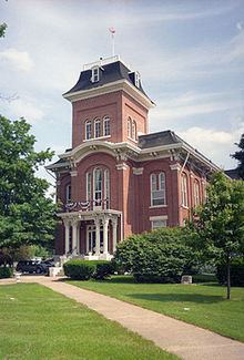
Iroquois County was created on February 26, 1833 out of a portion of Vermilion County. It was named for the Iroquois River, which was itself named for the Iroquois people. The first county seat was established at the town of Iroquois in 1837, though no official buildings were constructed there and offices were rented. Several other sites for the county seat were examined, and in 1839 it was moved to Middleport; a court house and jail were built there. There was a long battle between Middleport and Watseka (also known as South Middleport) as to which should be the county seat; in 1865, it was finally moved to Watseka. The town of Middleport no longer exists, but there is a township of that name. A courthouse was built in Watseka in 1866 at a cost of $28,000 and included a jail in the basement; this building was expanded in 1881, and a new jail was built in 1893 just east of the courthouse.
Geography
According to the U.S. Census Bureau, the county has a total area of 1,119 square miles (2,900 km2), of which 1,117 square miles (2,890 km2) is land and 1.6 square miles (4.1 km2) (0.1%) is water. It is the third-largest county in Illinois by land area and the fifth-largest by total area.
The northern border of the county is about 60 miles (97 km) south of the city of Chicago. The county is bordered on the east by the state of Indiana and its counties of Benton and Newton. To the north lies Kankakee County. Vermilion County, out of which Iroquois County was originally formed, lies to the south. To the west is Ford County.
The Iroquois River enters the county from Indiana and flows westward along the south side of the village of Iroquois, then along the north side of the city of Watseka, whereupon it veers to the north and joins the larger Kankakee River near the city of Kankakee in the county of the same name; the Kankakee River then flows into the Illinois River further to the northwest in Will County. Sugar Creek, further to the south, also flows from the east to the west, entering from Indiana east of Stockland; it passes through the south edge of Milford, is joined by Mud Creek coming up from the south, and winds to the north past the village of Woodland and meets the Iroquois River near Watseka.
The Iroquois County State Wildlife Area, a 2,400-acre (970 ha) state park, is located in the northeast corner of the county. There are also three nature preserves: Bonnie's Prairie, Hooper Branch Savanna, and Loda Cemetery Prairie.
Climate and weather
In recent years, average temperatures in the county seat of Watseka have ranged from a low of 14 °F (−10 °C) in January to a high of 84 °F (29 °C) in July, although a record low of −28 °F (−33 °C) was recorded in January 1999 and a record high of 105 °F (41 °C) was recorded in August 1988. Average monthly precipitation ranged from 1.61 inches (41 mm) in January to 4.62 inches (117 mm) in June.
Adjacent counties
Transportation
Interstate 57 passes through the west part of the county on its route between Champaign and Chicago. From north to south, it passes through or near Chebanse, Clifton, Ashkum, Danforth, Gilman, Onarga, Buckley, and Loda.
The county is bisected by the east–west U.S. Route 24, which passes through Gilman, Crescent City, the county seat of Watseka, and Sheldon.
Several railroad lines pass through the county. The Toledo, Peoria and Western Railway operates a line that begins in Peoria and runs from east to west through Iroquois County, passing through Gilman and Watseka and continuing into Indiana. A Norfolk Southern Railway line runs nearly parallel with Interstate 57 on its way to Chicago. A CSX Transportation line passes from north to south through the eastern part of the county; a Union Pacific line joins it south of Woodland. Further east, the Kankakee, Beaverville and Southern Railroad operates a north–south line.
Demographics
As of the 2010 United States Census, there were 29,718 people, 11,956 households, and 8,175 families residing in the county. The population density was 26.6 inhabitants per square mile (10.3/km2). There were 13,452 housing units at an average density of 12.0 per square mile (4.6/km2). The racial makeup of the county was 94.7% white, 0.8% black or African American, 0.3% Asian, 0.2% American Indian, 2.6% from other races, and 1.3% from two or more races. Those of Hispanic or Latino origin made up 5.3% of the population. In terms of ancestry, 36.5% were German, 14.1% were Irish, 12.2% were American, and 10.1% were English.
Of the 11,956 households, 30.2% had children under the age of 18 living with them, 54.7% were married couples living together, 9.3% had a female householder with no husband present, 31.6% were non-families, and 27.2% of all households were made up of individuals. The average household size was 2.45 and the average family size was 2.95. The median age was 43.4 years.
The median income for a household in the county was $47,323 and the median income for a family was $56,541. Males had a median income of $43,416 versus $27,908 for females. The per capita income for the county was $23,400. About 8.2% of families and 10.0% of the population were below the poverty line, including 14.1% of those under age 18 and 7.8% of those age 65 or over.
Cities
Townships
In 1855, a popular vote resulted in the adoption of township government, which was implemented in 1856. At that time, eleven townships were created; they are listed below.
Over the next several decades, more townships were created from the existing ones, for a final total of twenty-six. The newer townships are listed below in order of creation.