
Founded 1837 Website www.co.green.wi.gov Population 37,090 (2013) | Area 1,513 km² County seat Monroe | |
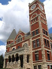 | ||
University Paul Mitchell The School – Monroe Points of interest New Glarus Woods St, New Glarus Historical, Twining Park, Green County Historical, Chalet of the Golden Fleece M | ||
Green County is a county located in the U.S. state of Wisconsin. As of the 2010 census, the population was 36,842. Its county seat is Monroe. Green County is included in the Madison WI Metropolitan Statistical Area.
Contents
- Map of Green County WI USA
- History
- Geography
- Airport
- Adjacent counties
- Demographics
- Cities
- Villages
- Census designated place
- Ghost towns
- References
Map of Green County, WI, USA
History
The county was created in 1837 from the Wisconsin Territory. It is named for General Nathanael Greene, who commanded the Southern Campaign in the American Revolutionary War.
Geography
According to the U.S. Census Bureau, the county has a total area of 584 square miles (1,510 km2), of which 584 square miles (1,510 km2) is land and 0.5 square miles (1.3 km2) (0.09%) is water.
Airport
Monroe Municipal Airport (KEFT) serves the county and surrounding communities.
Adjacent counties
Demographics
As of the census of 2000, there were 33,647 people, 13,212 households, and 9,208 families residing in the county. The population density was 58 people per square mile (22/km²). There were 13,878 housing units at an average density of 24 per square mile (9/km²). The racial makeup of the county was 98.14% White, 0.26% Black or African American, 0.21% Native American, 0.29% Asian, 0.36% from other races, and 0.75% from two or more races. 0.97% of the population were Hispanic or Latino of any race. 31.9% were of German, 20.3% Swiss, 14.9% Norwegian, 6.7% Irish, 5.7% English and 5.5% American ancestry. 96.5% spoke English, 2.0% German and 1.1% Spanish as their first language.
There were 13,212 households out of which 33.70% had children under the age of 18 living with them, 58.30% were married couples living together, 7.50% had a female householder with no husband present, and 30.30% were non-families. 25.00% of all households were made up of individuals and 11.20% had someone living alone who was 65 years of age or older. The average household size was 2.51 and the average family size was 3.01.
In the county, the population was spread out with 26.50% under the age of 18, 6.70% from 18 to 24, 29.20% from 25 to 44, 22.90% from 45 to 64, and 14.70% who were 65 years of age or older. The median age was 38 years. For every 100 females there were 96.90 males. For every 100 females age 18 and over, there were 94.20 males.