
Area 17,684 km² Population 12,662 (2013) | Founded 1852 | |
 | ||
Website [ ]Cities Points of interest Utah Territorial Statehouse, Cove Fort, Eagle's Landing Petting Zoo, Great Basin Museum, Notch Peak | ||
Drum mountain range millard county utah gre inc gold rush expeditions 2008
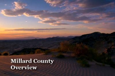
Millard County is a county located in the U.S. state of Utah. As of the 2010 census, the population was 12,503. Its county seat is Fillmore, and the largest city is Delta. The county was created in 1851. The county and its seat were named for Millard Fillmore, thirteenth President of the United States.
Contents
- Drum mountain range millard county utah gre inc gold rush expeditions 2008
- Map of Millard County UT USA
- Walking across sevier dry lake millard county utah
- Geography
- Adjacent counties
- National protected area
- Great Stone Face
- Notch Peak
- Little Sahara Sand Dunes
- Demographics
- Economy
- Japanese internment camp
- Cities
- Census designated places
- Other unincorporated places
- References
Map of Millard County, UT, USA
Walking across sevier dry lake millard county utah
Geography
According to the U.S. Census Bureau, the county has a total area of 6,828 square miles (17,680 km2), of which 6,572 square miles (17,020 km2) is land and 255 square miles (660 km2) (3.7%) is water. It is the third-largest county in Utah by area.
The Sevier Desert covers much of Millard County, being the seafloor of ancient Lake Bonneville. Near the center of the county lies Sevier Lake, a mostly dry remnant of Lake Bonneville. Mountains rim the area, some of which harbor beautiful forests, contrasting with the deserts below, especially the Pahvant Mountains, which form the county's eastern boundary. Fillmore and other farming communities lie at the base of the Pahvant Mountains. Delta sits several miles from the banks of the Sevier River in the middle of the basin.
Adjacent counties
National protected area
Great Stone Face
The Pahvant valley in Millard County has several ancient lava flows and extinct volcanoes, including the "Black Rock" lava flow. About 17 miles southwest of Delta, near Black Rock's northwest perimeter is a feature named the "Great Stone Face", which protrudes about four stories above the general elevation. For many years locals have claimed that this rock formation, when viewed at the correct angle, appears similar to a profile of Joseph Smith's face. At ground level, within view of the "Great Stone Face", is a large, smooth-faced rock covered in Native American petroglyphs.
Notch Peak
Notch Peak is located about 50 miles to the west of Delta. The skyline appears to have a notch taken out of it when viewed from Delta.
Little Sahara Sand Dunes
Little Sahara Recreation Area is about 25 miles north of Delta. It is a very popular area for ATV riders.
Demographics
As of the census of 2000, there were 12,405 people, 3,840 households, and 3,091 families residing in the county. The population density was 2 people per square mile (1/km²). There were 4,522 housing units at an average density of 1 per square mile (0/km²). The racial makeup of the county was 93.94% White, 0.10% Black or African American, 1.31% Native American, 0.48% Asian, 0.20% Pacific Islander, 2.76% from other races, and 1.21% from two or more races. 7.18% of the population were Hispanic or Latino of any race.
By 2005 86.7% of Millard County's population was non-Hispanic whites. The proportion of African Americans had doubled to 0.2%. Native Americans were now 1.5% of the county's population. Asians had fallen to only 0.4% of the population. 11.0% of the population was Latino, just above the 10.9% for Utah as a whole.
In 2000 there were 3,840 households out of which 46.10% had children under the age of 18 living with them, 70.60% were married couples living together, 7.10% had a female householder with no husband present, and 19.50% were non-families. 18.30% of all households were made up of individuals and 10.10% had someone living alone who was 65 years of age or older. The average household size was 3.19 and the average family size was 3.66.
In the county, the population was spread out with 37.30% under the age of 18, 8.00% from 18 to 24, 22.90% from 25 to 44, 19.40% from 45 to 64, and 12.30% who were 65 years of age or older. The median age was 30 years. For every 100 females there were 104.90 males. For every 100 females age 18 and over, there were 101.90 males.
The median income for a household in the county was $36,178, and the median income for a family was $41,797. Males had a median income of $36,989 versus $20,168 for females. The per capita income for the county was $13,408. About 9.40% of families and 13.10% of the population were below the poverty line, including 17.20% of those under age 18 and 7.20% of those age 65 or over.
As of 2010 Millard County had a population of 12,310. The ethnic and racial makeup of the population was 84.7% non-Hispanic white, 0.1% black, 1.0% Native American, 0.6% Asian, 0.1% Pacific Islander, 1.5% reporting two or more races and 12.8% Hispanic or Latino.
Economy
One element of Millard County's economy is the digging of fossils. Trilobite fossils are relatively common in the region west of Delta (part of the Wheeler Shale of Middle Cambrian age).
15% of Millard county's economy is from farming.
Millard County is working hard to make it easier to build Earthships, straw bale homes, and other ecological and sustainable housing.
Millard County is the home of the Telescope Array Project ultra-high-energy cosmic ray observatory.
Japanese internment camp
The Topaz War Relocation Center was a World War II Japanese internment camp located in Millard County 15 miles (24 km) west of Delta. The location is open to the public with a memorial at the northwest corner.