
Length 4.517 km | Counties: Greene | |
 | ||
West end: SR 54 east of Bloomfield | ||
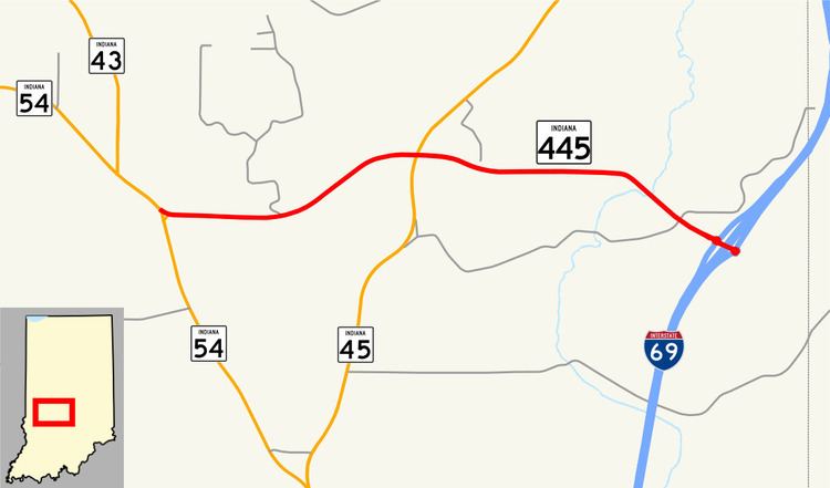
State Road 445 (SR 445) is a short connector route, just 2.807 miles (4.517 km) long, in eastern Greene County, just north of the small town of Cincinnati. It connects SR 54, SR 45, and I-69 (Exit 104).
Contents
Map of IN-445, Bloomfield, IN 47424, USA
Route description
SR 445 begins at SR 54 with a flashing light, near the Greene County Inn (also a cafe). It then runs east to a three-way intersection where it meets SR 45. It then continues east, coming to its eastern terminus at exit 104 on Interstate 69 (I-69).
History
SR 445 originally terminated at SR 45, but when I-69 opened, it was extended east.
Major intersections
The entire route is in Center Township, Greene County.
References
Indiana State Road 445 Wikipedia(Text) CC BY-SA