South end: SR 250 Constructed 1 October 1926 | North end: SR 62 Length 90.13 km | |
 | ||
Existed: October 1, 1926 – present | ||
State Road 11 in the U.S. State of Indiana is located in south central Indiana and is divided into a northern and southern section. These sections were never connected.
Contents
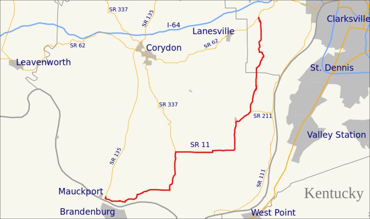
Map of IN-11, Indiana, USA
Southern section
The southern portion is a southwest-northeast road in Floyd and Harrison counties. Its southern terminus is at State Road 135 near the town of Mauckport, which is on the Ohio River. From there, the highway runs roughly northeast for a distance of about 30 miles (48 km) and ends where it meets State Road 62, east of the town of Lanesville.
Northern section
The northern portion is a north–south road in Bartholomew and Jackson counties. Its southern terminus is at State Road 250 in the small town of Dudleytown a few miles south of Seymour; the highway runs north through Seymour to Columbus, a distance of about 26 miles (42 km), and ends where it meets U.S. Route 31.
Southern section
Before 1935 the southern section of SR 11 was number State Road 33 (SR 33). Then in 1935 U.S. Route 33 (US 33) was commissioned in Indiana and SR 33 was decommissioned.
Northern section
In the 1970s the northern section of SR 11 was numbered U.S. Route 31 Alternate.
