
Existed: 1935 – present Length 57.78 km | Constructed 1935 | |
 | ||
Counties | ||
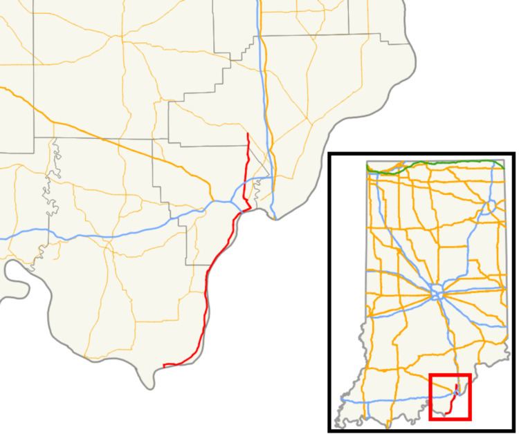
State Road 111 (SR 111) in the U.S. State of Indiana is a rural two lane highway which passes between New Boston and New Albany in the far southern portion of the state. It has existed since 1935. Some of the highway was decommissioned in October 2012 and more was decommissioned in January 2013.
Contents
Map of IN-111, Indiana, USA
Route description
The southern terminus of State Road 111 is at a dead end on the shores of the Ohio River, near the small community of New Boston. From here, it runs to the north and east, closely following the course of the river for about 13 miles (21 km), at which point it intersects with the east–west State Road 211. It continues to follow the river toward Bridgeport. It continues north, entering downtown New Albany. From there, it turns to meet at its current northern terminus at I-64.
History
Before 1935, SR 111 was known as SR 133. When U.S. Route 33 (US 33) commissioned in Indiana, SR 33 was decommissioned. SR 133 followed the same route as SR 111. In October 2012, the portion of SR 111 in Clark County was turned over to the county, with the Floyd County portion turned over to the county in January 2013.