
Country India Website www.idukki.nic.in Area 4,358 km² ISO 3166 code ISO 3166-2:IN | Time zone IST (UTC+5:30) Elevation 1,200 m Population 1.107 million (2011) | |
 | ||
Vehicle registration KL-06 (Idukki)KL-37 (Vandipperiyar)KL-38 (Thodupuzha)KL-68 (Devikulam)KL-69 (Udumbanchola)KLI (Old). Colleges and Universities Government Engineering College, Idukki Points of interest Destinations | ||
Idukki is one of the 14 districts of Kerala state, India, created on 26 January 1972. At that time, the district headquarters was at Kottayam. In June 1976 it was moved to Painavu. Idukki which lies in the Western Ghats of Kerala. Idukki is the second largest district in area but has the lowest population density. Idukki has a vast forest reserve area; more than a half of the district is covered by forests. The urban areas are densely populated whereas villages are sparsely populated.
Contents
- Map of Idukki Kerala
- Etymology
- Geography
- Demographics
- Technology
- Munnar
- Vagamon
- Ramakkalmedu
- Thekkady
- Marayur
- Wildlife sanctuaries
- Eravikulam Wild Life Sanctuary
- Periyar Tiger Reserve
- Pampadumshola National Park
- Kurinjimala Sanctuary
- Protected areas
- Waterfalls
- Cheeyappara
- Thommankkuthu
- Administrative divisions
- Municipalities
- Towns
- Culture
- Road
- Rail
- Air
- Neriamangalam Bridge
- References
Map of Idukki, Kerala
Etymology
The name of the district is derived from the Malayalam word Idukku (ഇടുക്ക്), meaning narrow gorge.
Geography
Idukki has an area of 4,358 km2 (1,683 sq mi) and is the second largest District of Kerala (the largest being Palakkad). Rugged mountains and forests cover about 97 percent of the total area of the District. The district borders the Kerala districts of Pathanamthitta to the south, Kottayam to the southwest, Ernakulam to the northwest and Thrissur to the north and Coimbatore, Dindigul and Theni Districts in Tamil Nadu to the east. The district is accessible only by road. Rail and airlink is not available. National Highway NH 49 and State highways 13 and 33 passes through the district.
Anamudi, the highest peak in India south of the Himalayas, is in the Kuttampuzha Panchayat of Adimali Block, in the Kannan Devan Hills Village of Devikulam taluk. Thirteen other peaks in the district exceed a height of 2,000 m (6,600 ft). The Periyar, Thodupuzhayar and Thalayar are the important rivers of the district. Idukki Dam, Asia's largest Arch Dam is located at Idukki Township of Idukki Taluk. The point where the Periyar flows through the gorge formed between two high massive rocks known as "Kuravan" and "Kurathi" is the site of the Idukki arch dam. The Idukki Hydroelectic project caters for more than 60% of the power requirements of the state of Kerala.
Demographics
According to the 2011 census Idukki district has a population of 1,107,453. This ranks it as 416th among the 640 districts of India. The district has a population density of 254 inhabitants per square kilometre (660/sq mi). Its population growth rate over the decade 2001–2011 was −1.93%. Idukki has a sex ratio of 1006 females for every 1000 males, and a literacy rate of 92.2 per cent. According to the 2011 census, Hindus make up 48. 86% (541,854) of the population, Christians 43.42% (481,507), Muslims 7.41%(82,206).
Technology
Idukki district is the first district in India to get connected with super-fast broad band system as a part of Digital India
Munnar
Munnar was the summer resort of the British Government in the south. The town is situated at the convergence of three mountain streams namely Muthirappuzha, Nallathanni and Kundala. Munnar has some of the largest tea plantations in the world. This hill station, which is more than 5000 feet above sea level, is a well-known tourist attraction noted for its scenic and picturesque landscapes.Most of the native flora and fauna of Munnar have disappeared due to severe habitat fragmentation resultant from the creation of the plantations. However, some species continue to survive and thrive in several protected areas nearby, including the new Kurinjimala Sanctuary to the east, the Chinnar Wildlife Sanctuary, Manjampatti Valley and the Amaravati reserve forest of Indira Gandhi Wildlife Sanctuary to the north east, the Eravikulam National Park and Anamudi Shola National Park to the north, the Pampadum Shola National Park to the south and the proposed Palani Hills National Park to the east.These protected areas are especially known for several threatened and endemic species including Nilgiri Thar, the grizzled giant squirrel, the Nilgiri wood-pigeon, elephant, the gaur, the Nilgiri langur, the sambar, and the neelakurinji (that blossoms only once in twelve years).
Vagamon
Vagamon is a hill station situated 1200 meters above sea level,37 km from Palai and 42 km from Thodupuzha.
This hill station provides option of trekking, paragliding or rock climbing for adventurous seekers. The place has many variety of flora and fauna located in various parts of hilly region. Evergreen tress, tall grasses and shrubs are present in the lower regions of Vagamon. Many rare species of birds, insects, wild buffaloes and elephants can be easily located in the forests. The main attractions here are mist-covered mountains and lakes, Pilgrim centers – Kurishumala, Murugan temple, Burial chamber of Sufi saint and pine forests
Ramakkalmedu
Ramakkalmedu (രാമക്കൽമേട്) is a hill station and a hamlet in Idukki district in the Indian state of Kerala. It is located about 15 km from Nedumkandam on the Munnar-Thekkady route.
Ramakalmedu stands tall in the Western Ghats at a height of 3500 feet above sea level. The ecosystem of the area consists largely of grass land Shola forest type which is laced by sporadic bamboo forests.
Constant wind is another factor which makes Ramakkalmedu unique. Wind blows at a speed around 35 km/ hour at Ramakkalmedu throughout the year irrespective of the season and time.Tourism villages like Pushpakandam and Kuruvikanam near Ramakkalmedu is one of the places in Kerala where wind energy farm is installed,though it is private holdings. Currently the capacity is at about 12.5 MW.This electricity is distributed to Kerala State Electricity Board. Ramakkalmedu has potential to produce more electricity, as it is said to be one of Asia's largest windiest area.
Thekkady
Thekkady is located about 257 km (160 mi) from Trivandrum, 140 km from Madurai City and Madurai Airport, 145 km from Cochin International Airport and 114 km from Kottayam railway station. Thekkady is located near to Kerala-Tamil Nadu border. The sanctuary is famous for its dense evergreen, semi-evergreen, moist deciduous forests and savanna grass lands. It is home to herds of elephants, sambar, tigers, gaur, lion-tailed macaques and Nilgiri langurs.
The Periyar Wildlife Sanctuary is spread across 777 km2 (300 sq mi), of which 360 km2 (140 sq mi) is thick evergreen forest. The wildlife sanctuary was declared a tiger reserve in 1978. The splendid artificial lake formed by the Mullaperiyar Dam across the Periyar River adds to the charm of the park. The greatest attractions of Periyar are the herds of wild elephants, deers, bisons that come down to drink in the lake. The sanctuary can be accessed through a trekking, boating or jeep safari.
Thekkady is considered as a heaven of natural spices such as black pepper, cardamom, cinnamon, nutmeg, nutmace, ginger, and clove.
Marayur
Marayur is a remote village on the eastern slopes of the Western Ghats. The relics of new stone-age civilisation has been unearthed here. It has ancient stone cabins, called 'Muniyaras', and is the only place in Kerala having natural growths of sandal wood trees. Marayur has more than 1000 species of flowering plants and is a well known repository of medicinal plants. There are 114 endemic species and the sighting of Aibizia lathamii, a critically endangered tree, was recently reported from the dry forests. Chinnar - the wildlife sanctuary in Marayur - has recorded the largest number of reptilian species, including the mugger crocodile, in Kerala. With 225 recorded species of birds, it is one of the richest areas of south India in avian diversity. The forests in Marayur preserve a population of the endangered grizzled giant squirrel. The rare white bison has been recently reported in Chinnar wildlife sanctuary. Other important mammals found are elephant, tiger, leopard, guar, sambar, spotted deer, Nilgiri thar, common langur, bonnet macaque etc. The phenomenon of butterfly migration occurs in between the monsoons.
Maryoor has got a number of sandalwood forests, and is the only place in Kerala where natural sandalwood forest is present. Processing of sandalwood and its associated oil forms part of local economy and a depot near Marayur town is supporting this industry. Sandal wood or Santalum album is a parasitic tree having a fragrant and close-grained yellowish heartwood. Sandalwood oil, also known as ‘liquid gold,’ is extracted from the roots and wood of sandalwood. This oil is a costly item marketed at a few choosy outlets all over the state. A climate with low rainfall is suitable for the growth of choice sandalwood trees from which good quality oil can be extracted. The 93 km2 Marayur reserve forest is believed to have about sixty thousand naturally grown sandalwood trees, of which nearly 2,000 trees had been allegedly plundered in just one year since January 2004, when the last survey was conducted. The auction rate for first quality Marayur sandal is quoted at Rs. 1100 per kg, according to forest department sources (2004).
Wildlife sanctuaries
''''Idukki Wildlife Sanctuary
A land-locked district, Idukki is one of the most nature-rich areas of Kerala. The Idukki Wildlife Sanctuary here spreads over an area of 105.364 sq km in the Thodupuzha and Udumpanchola taluks of the district. Situated at an altitude of 450-748 m above sea level, this sanctuary occupies the forest land between the Cheruthoni and Periyar rivers. There is a scenic lake around the sanctuary, covered by an enchanting canopy of tropical ever-green and deciduous trees, and offers boat rides.
Elephants, sambar deer, wild dogs, jungle cats, wild boar etc. are seen here apart from various species of snakes including cobra, viper, kraits and numerous non-poisonous ones. Birds include grey jungle fowl, Malabar grey hornbill, several species of woodpeckers, bulbuls, flycatchers, etc. The wildlife here is similar to that of Thekkady. This sanctuary lies adjacent to the world renowned Idukki Arch Dam.
Contact Address:
The Wild Life Warden, Idukki Wildlife Division Painavu P.O. Idukki – 685603 Phone: +91 486 2232271 Mobile:8547603182,9496821481
The Asst. Wildlife Warden Vellapara, Painavu P.O, Idukki Phone : +91 4862 322025
Eravikulam Wild Life Sanctuary
Eravikulam is another wild life sanctuary proclaimed as a National Park. It supports the largest population of Nilgiri tahr in the world. Anamudi peak is on the southern part of this park. Most of the park is grassland and the average altitude is more than 5000 feet above sea level. Heavy rain and gushing winds makes the area inaccessible during the monsoon season. The famous Neelakurinji (Strobilanthes kunthiana) grows here. It has a flowering cycle of 12 years. Twenty six species of mammals have been recorded in the park including the largest surviving population of Nilgiri tahr, estimated at about 750 individuals. The other ungulates are gaur, Indian muntjac and sambar deer. Golden jackal, jungle cat, wild dog, dhole, leopard and tiger are the main predators. Some little-known animals such as Nilgiri langur, stripe-necked mongoose, Indian porcupine, Nilgiri marten, small clawed otter, ruddy mongoose, and dusky palm squirrel are also found. Elephants make seasonal visits.
132 species of birds have been recorded which include endemics like black-and-orange flycatcher, Nilgiri pipit, Nilgiri wood pigeon, white bellied shortwing, Nilgiri flycatcher and Kerala laughingthrush.
Endemic butterflies confined to the shola-grass land ecosystem like the red disk bushbrown and Palni four wing are among the 101 species in the park.
Periyar Tiger Reserve
Periyar Tiger Reserve, Thekkady, is an example of nature’s bounty, with great scenic charm, rich biodiversity and providing veritable visitor satisfaction. Sprawled over an area of 925 km2., Periyar is one of the 27 tiger reserves in India. Zealously guarded and efficiently managed reserve is a repository of rare, endemic and endangered flora and fauna and forms the major watershed of two important rivers of Kerala, the Periyar and Pamba.
Periyar National Park and Wildlife Sanctuary (PNP) is a protected area in the districts of Idukki and Pathanamthitta in Kerala, India. It is notable as an elephant reserve and a tiger reserve. The protected area covers an area of 925 km2 (357 sq mi). 305 km2 (118 sq mi) of the core zone was declared as the Periyar National Park in 1982
Pampadumshola National Park
Pampadum Shola National Park is the smallest national park in Kerala state, South India. The park is administered by the Kerala Department of Forests and Wildlife, Munnar Wildlife Division, together with the nearby Mathikettan Shola National Park, Eravikulam National Park, Anamudi Shola National Park, Chinnar Wildlife Sanctuary and the Kurinjimala Sanctuary. The park adjoins the Allinagaram Reserved Forest within the proposed Palani Hills Wildlife Sanctuary and National Park. The Western Ghats, Anamalai Sub-Cluster, including these parks, is under consideration by the UNESCO World Heritage Committee for selection as a World Heritage Site.
Kurinjimala Sanctuary
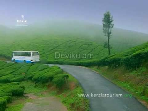
Kurinjimala Sanctuary protects the approximately 32 km2 core habitat of the endangered Neelakurinji plant in Kottakamboor and Vattavada villages in Devikulam Taluk, Idukki district of Kerala State in South India. map
Protected areas
This district has several protected areas including: Periyar Tiger Reserve in the south, Kurinjimala Sanctuary to the east, Chinnar Wildlife Sanctuary to the northeast, Eravikulam National Park and Anamudi Shola National Park to the north and Pampadum Shola National Park to the south. These protected areas are well known for several threatened and endemic species including tiger, Nilgiri tahr, grizzled giant squirrel, Nilgiri wood-pigeon, elephant, gaur, sambar deer, purple frog and neelakurinji.
Waterfalls
Idukki district alone has about 50 small and big waterfalls; many of which are not included here because they are not well known and because they tend to be active only during monsoon season.
Cheeyappara
The Cheeyappara Waterfall (ച്ചീയ്യപ്പാറ) is on the Kochi - Madurai Highway (National Highway 49), between Neriamangalam and Adimali. It is in Idukki district, Kerala, India.
The Cheeyappara Waterfall cascades down in seven steps. This is also a great place for trekking.
Thommankkuthu
Thommankuthu (തൊമ്മൻകുത്ത്) is a very scenic waterfall near Thodupuzha, in the southern state of Kerala, India and is named after the great hunter, Mr. Thommachen Kuruvinakunnel, who let the world know of this beautiful waterfall in the jungle in the late 1920s. Thommachen also played a big part in the discovery of the site for the Idukki Dam. This panchayat, belonging to Thodupuzha Thaluk in Idukki District, is one of the major eco-tourism centres in Kerala. A song of the Malayalam movie Chattakaari was shot here.
Administrative divisions
Idukki District is divided into eight community development blocks (block panchayats). The community development blocks are further divided into talukas. The blocks are:
Municipalities
Towns
Culture
Culture in Idukki is mixed type since it constitutes of migrated people and native tribals. Indigenous art forms in Idukki is still not known to the out side world. Tourist areas like Munnar and Thekkady welcome people by hosting various art forms.
Road
The roads in Idukki are part of Ghat roads .The major roads connect city of Kochi to Tamil Nadu.The KK road(Kumili-Kottayam),The PT road(Puliyanmala-Thodupuzha State Highway-33) are some of the other busy roads.
Rail
At present there is no railway in and to Idukki district of Kerala. The nearest railway stations are Kottayam (station code - KTYM), Aluva (Alwaye, station code - AWY), Ernakulam South (Ernakulam Jn., station code - ERS) and Ernakulam North (Ernakulam Town, station code - ERN).
Air
The nearest airport to Idukki is Cochin International Airport and Coimbatore Airport. Airport Authority of India's plan to set up an airport in Anakkara is in a conflict of environmental issues. Anakkara Airport will be a great leap in Idukki's complete development. The government claims this project will improve the tourism in the area. However, with Anakkara being situated in environmentally sensitive Western Ghats, environmentalists and villagers argue that this can significantly impact the area's climatic conditions and livelihood of people. Also the land identified for the project is one of the very few remaining paddy fields of the district, currently cultivating some of the rare indigenous varieties of rice which increases the concern about the project. Those opposing the airport also cite the economic benefits as Munnar, one of the key target destinations for the airport lies at about 100 km from Anakkara and the time taken to reach there from Cochin International Airport is less than the time taken to reach from Anakkara. Though there are no clear references online from the government on the objectives, benefits and purpose of the proposed airport, anti-anakkara-airport groups have set up social networking campaign sites such as Save Anakkara Blog and Anti-Anakkara Airport on Facebook explaining reasons why they claim the airport project should not be implemented.
Neriamangalam Bridge
The Neriamangalam Bridge, built across the Periyar river, is often referred as 'The Gateway to the Highranges' as it is on the way to the higher regions of Idukki district, especially Munnar. The bridge was made by His Highness The Maharaja of Travancore in 1935.