
Time zone IST (UTC+5:30) Area 52.77 km² Area code 04868 | Named for Spices Elevation 1,100 m Population 42,646 (2011) Local time Saturday 10:20 AM | |
 | ||
PIN 685508 (Kattappana), 685515 (Kattappana south) Weather 24°C, Wind W at 6 km/h, 69% Humidity Colleges and Universities Government College, Kattappana, College of Applied Science, Kattappana | ||
Kattappana is a fast growing municipality in the Sahyadri (or Western Ghats) of Kerala state, India. It is the main urban centre in the high ranges of Idukki district, situated about 3,600 feet (1,100 m) above mean sea level, in the High Ranges, the high altitude region of Kerala has recently raised to the status of municipality. Kattappana is a CLASS III urban centre. It is the first municipality in high range of Idukki district with the real terraineous touch of Idukki as Thodupuzha municipality is situated in low range. It is a major commercial town and flourished with the boost in production of agriculture and spices. Based on the 2011 Census, it had a total population of 42646, consisting of 21,159 males and 21,487 females.
Contents
- Map of Kattappana Kerala
- Municipal administration
- Etymology
- Demographics
- Agriculture
- Tourism
- Climate
- Infrastructure
- Landmarks
- Schools
- Colleges
- Tourist attractions
- Filming locations
- Transportation
- Night bus services
- Distances to nearby towns
- References
Map of Kattappana, Kerala
People migrated to this place mainly during 1950s from different parts of nearby townships like Palai, Kottayam etc. However, there were inhabitants even before 100 years. The main occupation was cultivation of commercial crops and spices like Tea, Coffee, Pepper, Cardamom, Black Pepper etc., and the majority of them are farmers. One of the anchor institutions in Kattappana is St. John's Hospital. When it was started in 1968, it was one of the main hospitals in a 100-km radius. Managed by the Hospitaller Brothers of St. John of God, the hospital has grown to a tertiary level of 450 - bedded multi-speciality hospital with sixteen clinical disciplines. Even today, it is the only tertiary level referral center in this area.
Municipal administration
Previously, Kattappana was included in the Udumbanchola tehsil of Idukki district and was later included in the newly formed Idukki tehsil. In 1962, it became a grama panchayath and the first council was held under the presidentship of V.T Sebastian in 1964. It was officially declared as municipality by the state government on November 1, 2015. It became the second municipality in the district, while Thodupuzha became the first one within the low ranges. The current municipal chairperson is Jhony Kulampalliy, elected in the previous year representing the Congress or UDF (right wing). Bindu Sebastian is the Vice Chairperson.
Etymology
It is believed that the name Kattappana derived from the Malayalam word Koottappana (Kootta means a group and Pana means palm tree) which later became Kattappana.
Demographics
It is one of the more important commercial centre in the high ranges and was on a fast track in terms of development and infrastructure building. Kattappana became a grama panchayat in 1962 and the first panchayat council under the presidency of V.T. Sebastian was formed in 1964.
However, it was the development of the Kottayam–Kattappana road and the Puliyanmala–Thodupuzha State highway that turned the town into a commercial centre. It was the agriculture sector that played a pivotal role in economically uplifting the town
As of 2011 census data, the population was 42,646, with 21,159 males and 21,487 females. The population in the age group 0–6 years are 4,412. The Scheduled Castes (SC) were 2,585 and the Scheduled Tribes (ST) were recorded as 524. The number of literates are 36,418 with the average literacy rate at 95.25%.
The town had a large population of Syrian Catholic families who migrated to Kattappana in early 1950s from Central Travancore. The migrations were majorly from Palai, Chenganassery and Kanjirapally taluks of Kottayam district and Pathanamthitta. Apart from the Catholics, the Nadar, Viswakarma, Nair, and Ezhava communities also make up a good part of the population. The landmark of the town is an edifice dedicated to Narayana Guru. There are also Muslim families and the Juma Masjid caters to their religious needs.
Descendants of earlier inhabitants, the tribals of the forest, can still be seen. The Mannan tribe is now concentrated around Kovilmala, near Kanchiyar. Before large scale migration and settlement took place in Kattappana and surrounding areas in early 1950s, there were Tamil farmers. There is a sizable number of Tamil labor force forming part of the floating population of Kattappana.
Agriculture
Kattappana is the center for spices trade and the primary producer of cardamom and black pepper. The main occupation of people of Kattappana is agriculture. A specific type Njallani high yielding variety of cardamom, was developed in Kattappana. It is also the centre of production and marketing of coffee, cocoa and ginger. There are also several reputed tea plantations (Tata Tea, A V Thomas & Co, Malayalam Plantations, Kannan Devan etc.) in adjoining areas of the district.
Spices Board (erstwhile Cardamom Board under Government of India) has an office in Kattappana. A Spices Park is established at Puttadi near Kattappana. Cardamom Research Institute is situated at Pampadumpara.
Njallani high yielding variety of cardamom was developed by Sebastian Joseph Njallani of Kattappana, who migrated to Kattappana in 1952.
Tourism
Tourism thrives in the rural areas of Kattappana. The main tourist attractions are Thekkady, Kumily, Idukki Dam and Munnar. Calvari Mount (Kalyanathandu) and Anchuruli are also famous tourist spots. A scenic view of Idukki dam, which is a part of the largest hydro-electric project in the state of Kerala, is visible from Kattappana. Calvari Mount has a bird's eyes view of the reservoir from 200 m (660 ft) above the reservoir. Within 17 km we can reach Ramakkalmedu near Thookkupalam.Panoramic views of Anchuruly from Nirmalacity Hills,Neelakkurinji hills of Vazhavara , sceneries from Muneeswrapuram are some of the important tourist destinstions in Kattappana Municipality
Climate
The climate of Kattappana falls under the Köppen climate classification. The palace normally experiences a moderate climate. The humidity rises from the month of March to April and mid May. The average annual temperature here is 23°C. The months of June, July, August and October receives significant amount of rainfall. November and December are the coldest months in the year.
Infrastructure
Raising of Kattappana Panchayat into a municipality paves the way for developmentioned of the town. Kattappana is changing its face with multi-storey buildings, developed roads and rated facilities. Kattappana is presently a new aim of some MNC and hospitality sector. Like all developing towns in Kerala, Kattappana is also facing stiff traffic congestion due to absence of a well defined road network.
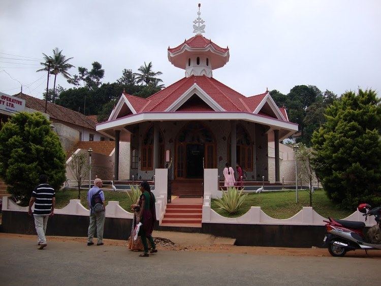
Landmarks
Schools
Colleges
Tourist attractions
Filming locations
Transportation
Kattappana has a well established road system to other districts as well as to nearby state Tamil Nadu. It lies on the Thodupuzha - Kumily state highway (SH-33), about 34 km from Kumily, 85 km from Thodupuzha and 25 km from Nedumkandam. Recently one new 'National highway 185' announced to Idukki district, through Adimali - Cheruthoni - Kattappana - Kumily.