
Area 1,119 km² Population 7,141 (2013) | Founded 1851 | |
 | ||
Website www.idacounty.org/default.asp Rivers Little Sioux River, Maple River, Odebolt Creek, Hog Run | ||
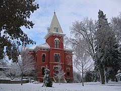
Ida County is a county located in the U.S. state of Iowa. As of the 2010 census, the population was 7,089. The county seat is Ida Grove. The county was formed on January 15, 1851. It was probably named after Ida Smith, the first child of European immigrants to be born in this region.
Contents
- Map of Ida County IA USA
- Geography
- Major highways
- Adjacent counties
- 2010 census
- 2000 census
- Communities
- Population ranking
- References
Map of Ida County, IA, USA
Geography
According to the U.S. Census Bureau, the county has a total area of 432 square miles (1,120 km2), of which 432 square miles (1,120 km2) is land and 0.5 square miles (1.3 km2) (0.1%) is water.
Major highways
Adjacent counties
2010 census
The 2010 census recorded a population of 7,089 in the county, with a population density of 16.4207/sq mi (6.3401/km2). There were 3,426 housing units, of which 3,052 were occupied.
2000 census
As of the census of 2000, there were 7,837 people, 3,213 households, and 2,184 families residing in the county. The population density was 18 people per square mile (7/km²). There were 3,506 housing units at an average density of 8 per square mile (3/km²). The racial makeup of the county was 99.02% White, 0.10% Black or African American, 0.06% Native American, 0.24% Asian, 0.15% from other races, and 0.42% from two or more races. 0.47% of the population were Hispanic or Latino of any race.
There were 3,213 households out of which 29.40% had children under the age of 18 living with them, 59.50% were married couples living together, 5.90% had a female householder with no husband present, and 32.00% were non-families. 29.30% of all households were made up of individuals and 15.90% had someone living alone who was 65 years of age or older. The average household size was 2.39 and the average family size was 2.95.
In the county, the population was spread out with 25.50% under the age of 18, 6.10% from 18 to 24, 24.00% from 25 to 44, 22.70% from 45 to 64, and 21.80% who were 65 years of age or older. The median age was 42 years. For every 100 females there were 93.90 males. For every 100 females age 18 and over, there were 91.40 males.
The median income for a household in the county was $34,805, and the median income for a family was $43,179. Males had a median income of $29,002 versus $19,417 for females. The per capita income for the county was $18,675. About 5.70% of families and 8.80% of the population were below the poverty line, including 9.10% of those under age 18 and 8.60% of those age 65 or over.
Communities
Population ranking
The population ranking of the following table is based on the 2010 census of Ida County.
† county seat