
Named for Sauk people Congressional district 4th Website www.saccounty.org Founded 15 January 1851 County seat Sac City | Largest city Sac City Time zone Central: UTC-6/-5 Area 1,497 km² Population 10,071 (2013) Unemployment rate 3.2% (Apr 2015) | |
 | ||
Cities Sac City, Odebolt, Lake View, Wall Lake, Schaller, Early, Nemaha Rivers Boyer River, North Raccoon River, Odebolt Creek | ||
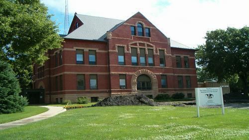
July 27 2011 sac county iowa law enforcement press brief
Sac County is a county located in the U.S. state of Iowa. As of the 2010 census, the population was 10,350. The county seat is Sac City.
Contents
- July 27 2011 sac county iowa law enforcement press brief
- Map of Sac County IA USA
- History
- Geography
- Major highways
- Adjacent counties
- 2010 census
- 2000 census
- Geocaching
- Population ranking
- References
Map of Sac County, IA, USA
In February 2007, in its third annual list of the “Best Places to Live in Rural America”, Progressive Farmer magazine placed Sac County as #7 in the overall rankings. In 2009, the magazine ranked Sac County as the tenth "Best Place" in the Midwest Region.
History
Sac County was formed on January 15, 1851. It was named after the Sauk people, formerly referred to as the Sac Indians. Sac City was appointed the county seat in 1856, and the first Sac County Courthouse was erected in 1862. The courthouse served its purpose well until 1873 when citizens of Sac County realized the county had outgrown the tiny building. Thus, a second courthouse was built. The building was eighty-five feet by fifty-six feet, a beautiful building of brick with limestone foundations and an impressive tower on the top. It was declared to be one of the best county buildings in Iowa. This courthouse was first used in January 1874, and the old courthouse was sold shortly thereafter. Unfortunately, in 1888 a prisoner set fire to the jail attached to the courthouse while attempting to escape, and both buildings were destroyed. Sac City erected a third courthouse at a cost of thirty thousand dollars. This courthouse has been in use since with minimal structural changes, except for an extensive addition which was completed in the 1980s.
Geography
According to the U.S. Census Bureau, the county has a total area of 578 square miles (1,500 km2), of which 575 square miles (1,490 km2) is land and 3.3 square miles (8.5 km2) (0.6%) is water.
Major highways
Adjacent counties
2010 census
The 2010 census recorded a population of 10,350 in the county, with a population density of 17.974/sq mi (6.940/km2). There were 5,429 housing units, of which 4,482 were occupied.
2000 census
As of the census of 2000, there were 11,529 people, 4,746 households, and 3,198 families residing in the county. The population density was 20 people per square mile (8/km²). There were 5,460 housing units at an average density of 10 per square mile (4/km²). The racial makeup of the county was 98.53% White, 0.26% Black or African American, 0.09% Native American, 0.14% Asian, 0.02% Pacific Islander, 0.40% from other races, and 0.57% from two or more races. 0.96% of the population were Hispanic or Latino of any race.
There were 4,746 households out of which 28.60% had children under the age of 18 living with them, 58.30% were married couples living together, 6.20% had a female householder with no husband present, and 32.60% were non-families. 29.40% of all households were made up of individuals and 16.40% had someone living alone who was 65 years of age or older. The average household size was 2.37 and the average family size was 2.92.
In the county, the population was spread out with 24.10% under the age of 18, 6.90% from 18 to 24, 23.50% from 25 to 44, 22.80% from 45 to 64, and 22.70% who were 65 years of age or older. The median age was 42 years. For every 100 females there were 95.50 males. For every 100 females age 18 and over, there were 91.80 males.
The median income for a household in the county was $32,874, and the median income for a family was $40,504. Males had a median income of $26,183 versus $19,753 for females. The per capita income for the county was $16,902. About 6.80% of families and 9.90% of the population were below the poverty line, including 14.00% of those under age 18 and 8.20% of those age 65 or over.
Geocaching
Sac County is a rich area for geocaching. The county was "put on the map" when geocachers hid a series of caches a mile wide and 8 miles high to spell "SAC" along rural roads between Sac City and Lytton in August 2011.
Population ranking
The population ranking of the following table is based on the 2010 census of Sac County.
† county seat