
 | ||
Similar Mount Titiroa, Mount Tutoko, Wilmot Pass, Manapouri Power Station, Kepler Track | ||
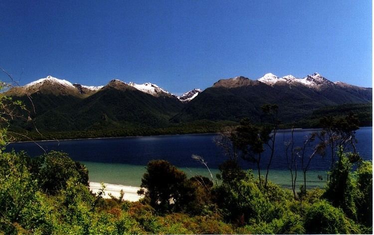
The Hunter Mountains of Lake Manapouri, New Zealand, were named by surveyor James McKerrow after the famous anatomist John Hunter. The Hunter Mountain Range covers an area between The South Arm and Hope Arm of Lake Manapouri South to the Green Lake.
Contents
Map of Hunter Mountains, Fiordland National Park 9691, New Zealand
The Hunters contains several impressive peaks, 1,495 metres (4,905 ft) Cone Peak, 1,497 metres (4,911 ft) Mount Moturau, 1,639 metres (5,377 ft) Mount Crescent, 1,645 metres (5,397 ft) Mt Burns, 1,695 metres (5,561 ft) Eldrig Peak, the Highest Named Point is 1,749 metres (5,738 ft) Mt Flat, the highest point is an 1,804 metres (5,919 ft) unnamed peak at the head of the Garnoch Burn. Mount Moturau is accessible Via the Bicycle spur track from Hope Arm and Mt Burns is very accessible Via the Borland Saddle Road, built through Fiordland National Park in the 1960s for the construction of the power pylons and power pines for the Manapouri Hydroelectric Power Station, and is open to the public throughout the summer months.
Fauna
Giant Snails known as Powelliphanta spedeni are found in the Green Lake area of the Hunter Mountains.
The skink species Oligosoma nigriplantare polychroma (related to the Chatham Islands skink) inhabit the tussock grasslands areas from Lake Manapouri to Lake Monowai.
The Short Horned Grasshopper Alpinacris tumidicauda ranges throughout the Hunter Mountains.
The endemic moth species Pyrgotis consentiens is found in the Hunter Mountains.