Trisha Shetty (Editor)

Huancavelica Province

Updated on
Edit
Like
Comment
Share on FacebookTweet on TwitterShare on LinkedInShare on Reddit
Country
  
Peru

Area
  
4,216 km²

Capital
  
Huancavelica

UBIGEO
  
0901

Region
  
Huancavelica Region

Huancavelica Province httpsuploadwikimediaorgwikipediacommonsthu

The Huancavelica Province is one of seven provinces located in the Huancavelica Region of Peru. The capital of this province is the city of Huancavelica.

Contents

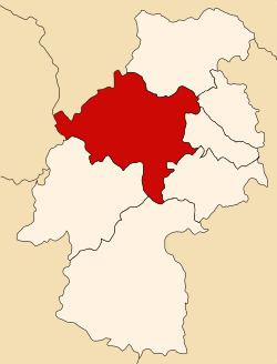
Map of Huancavelica Province, Peru

Boundaries

  • North: Tayacaja Province
  • East: Acobamba Province, Churcampa Province and Angaraes Province
  • South: Huaytará Province and Castrovirreyna Province
  • West: Lima Region and Junín Region
  • Geography

    There are a couple of large lakes in the province like Anqasqucha, Astuqucha, Chiliqucha, Chunchuqucha, Kanllaqucha, Milluqucha, Papaqucha, Qiwllaqucha, Tipiqucha, Warmiqucha and Ñawinqucha some of which belong to the largest lakes of Peru.

    The Chunta mountain range traverses the province. Some of the highest peaks of the province are listed below:

    Political division

    The province is divided into nineteen districts, which are:

  • Acobambilla (Acobambilla)
  • Acoria (Acoria)
  • Ascensión (Ascención)
  • Conayca (Conayca)
  • Cuenca (Cuenca)
  • Huachocolpa (Huachocolpa)
  • Huancavelica (Huancavelica)
  • Huando (Huando)
  • Huayllahuara (Huayllahuara)
  • Izcuchaca (Izcuchaca)
  • Laria (Laria)
  • Manta (Manta)
  • Mariscal Cáceres (Mariscal Cáceres)
  • Moya (Moya)
  • Nuevo Occoro (Occoro)
  • Palca (Palca)
  • Pilchaca (Pilchaca)
  • Vilca (Vilca)
  • Yauli (Yauli)
  • Ethnic groups

    The people in the province are mainly indigenous citizens of Quechua descent. Quechua is the language which the majority of the population (55.06%) learnt to speak in childhood, 44.70% of the residents started speaking using the Spanish language (2007 Peru Census).

    References

    Huancavelica Province Wikipedia