Rahul Sharma (Editor)

Angaraes Province

Updated on
Edit
Like
Comment
Share on FacebookTweet on TwitterShare on LinkedInShare on Reddit
Country
  
Peru

Area
  
1,959 km²

Region
  
Huancavelica Region

UBIGEO
  
0903

Capital
  
Lircay, Peru

Angaraes Province turismoipeuploadsprovinceimage903mediumanga

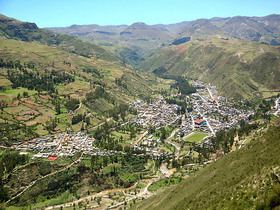
The Angaraes Province is one of seven provinces located in the Huancavelica Region of Peru. The capital of this province is the city of Lircay.

Contents

Map of Angaraes Province, Peru

Boundaries

  • North: Acobamba Province
  • East: Ayacucho Region
  • South: Huaytará Province
  • West: Huancavelica Province
  • Political division

    The province is divided into twelve districts, which are:

  • Anchonga (Anchonga)
  • Callanmarca (Callanmarca)
  • Ccochaccasa (Ccochaccasa)
  • Chincho (Chincho)
  • Congalla (Congalla)
  • Huanca-Huanca (Huanca-Huanca)
  • Huayllay Grande (Huayllay Grande)
  • Julcamarca (Julcamarca)
  • Lircay (Lircay)
  • San Antonio de Antaparco (Antaparco)
  • Santo Tomás de Pata (Santo Tomás de Pata)
  • Secclla (Secclla)
  • Ethnic groups

    The people in the province are mainly indigenous citizens of Quechua descent. Quechua is the language which the majority of the population (78.63%) learnt to speak in childhood, 21.12% of the residents started speaking using the Spanish language (2007 Peru Census).

    References

    Angaraes Province Wikipedia