
UBIGEO 0904 Region Huancavelica Region | Area 3,985 km² | |
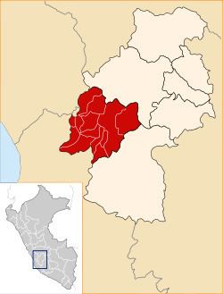 | ||
The Castrovirreyna Province is one of seven provinces located in the Huancavelica Region of Peru. The capital of this province is the city of Castrovirreyna.
Contents
Geography
The Chunta mountain range traverses the province. Some of the highest peaks of the province are listed below:
Political division
The province is divided into thirteen districts, which are:
Ethnic groups
The province is inhabited by indigenous citizens of Quechua descent. Spanish is the language which the majority of the population (77.20%) learnt to speak in childhood, 22.30% of the residents started speaking using the Quechua language (2007 Peru Census).
References
Castrovirreyna Province Wikipedia(Text) CC BY-SA