
Population 170,563 (2015 est) University Emmaus Bible College | Area 462 km² | |
 | ||
Mayor Steve Russell (Liberal) State electorate(s) HornsbyHawkesburyEppingKu-ring-gai Points of interest Koala Park Sanctuary, Fagan Park, Crosslands Reserve, Ruddock Park, Lisgar Gardens | ||
Hornsby shire who lives here
Hornsby Shire is a local government area in the northern region of Sydney, in the state of New South Wales, Australia. The Shire stretches from the M2 Hills Motorway in the south to the Hawkesbury River town of Wisemans Ferry, some 53 kilometres (33 mi) to the north. As at the 2011 Census the Shire had an estimated population of 156,847.
Contents
- Hornsby shire who lives here
- Map of Hornsby NSW Australia
- Suburbs towns and localities in the local government area
- Demographics
- Current composition and election method
- See also
- History
- Geography
- Transport
- Education
- Hospitals
- Epping Community Centre
- Other facilities
- References
Map of Hornsby, NSW, Australia
The Mayor of Hornsby Shire is Cr Steve Russell, a member of the Liberal Party.
A 2015 review of local government boundaries by the NSW Government Independent Pricing and Regulatory Tribunal recommended that Hornsby Shire merge with adjoining councils. The government considered two proposals. The first proposed a merger of part of Hornsby with the Ku-ring-gai Council to form a new council with an area of 540 square kilometres (210 sq mi) and support a population of approximately 270,000. The second proposed a merger of parts of Parramatta, Auburn, The Hills, Hornsby, and Holroyd to form a new council with an area of 82 square kilometres (32 sq mi) and support a population of approximately 215,725. The outcome of the review, to be determined by the New South Wales Minister for Local Government, is expected in early 2017
Suburbs, towns and localities in the local government area
Suburbs in the Hornsby Shire are:
Towns and localities in the Hornsby Shire are:
Demographics
At the 2011 census, there were 156,847 people in the Hornsby local government area, of these 48.7% were male and 51.3% were female. Aboriginal and Torres Strait Islander people made up 0.4% of the population. The median age of people in the Hornsby Shire was 39 years. Children aged 0 – 14 years made up 19.4% of the population and people aged 65 years and over made up 14.4% of the population. Of people in the area aged 15 years and over, 57.9% were married and 8.0% were either divorced or separated.
Population growth in the Hornsby Shire between the 2001 Census and the 2006 Census was 4.58% and in the subsequent five years to the 2011 Census, population growth was 3.65%. When compared with total population growth of Australia for the same periods, being 5.78% and 8.32% respectively, population growth in the Hornsby local government area was lower than the national average. The median weekly income for residents within the Hornsby Shire was higher than the national average.
Current composition and election method
Hornsby Shire Council is composed of ten Councillors, including the Mayor, for a fixed four-year term of office. The Mayor is directly elected while the nine other Councillors are elected proportionally as three separate wards, each electing three Councillors. The most recent election was held on 8 September 2012, and the makeup of the Council, including the Mayor, is as follows:
The current Council, elected in 2012, in order of election by ward, is:
See also
History
Hornsby Shire was originally occupied by the Dharug and Gu-ring-gai tribes of Indigenous Australians. While the northern part of the Shire (via the Hawkesbury River) was visited by the first European settlers in late 1788, due to the Shire's rugged landscape permanent European settlement did not begin until almost half a century later.
Hornsby Shire got its name from the town of Hornsby at the eastern end of the Shire, is derived from Convict-turned-Constable Samuel Horne, who earned distinction by capturing bushrangers Dalton and MacNamara on 22 June 1830. In return he was granted land in the locality known as "Hornsby Place".
Hornsby Shire has remained largely rural for many decades. The construction of the Main North railway line in the 1880s opened up the Shire to the rest of Sydney and also to Newcastle, but it was not until motor vehicles became commonplace in the 1950s that the southern part of the Shire truly became part of Sydney's suburbia.
Geography
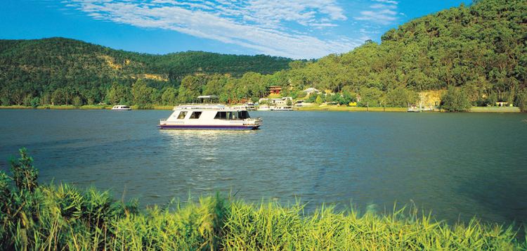
Hornsby calls itself the 'Bushland Shire'. This is in reference to its location on a high ridge separating two expansive areas of natural bushland: The Ku-ring-gai Chase National Park on the eastern side and the Berowra Valley Regional Park on the western side. These provide large areas of natural parkland that form a green belt running from Sydney at the south to the Hawkesbury River at the Shire's northern end. These parks are extremely popular with day-trippers from all areas of Sydney and provides diverse recreations such as bushwalking and boating.
The northern half of Hornsby Shire remains a semi-rural area, retaining a number of farmlands and market gardens. The village of Galston is the centre of this rural area.
The southern half of the Shire is urban, forming part of Sydney's suburbia. Traditionally most of the Shire's residents live in free-standing houses, but in recent years a number of semi-detached housings as well as high-density apartments have appeared around Hornsby's central business district.
The Shire has two industrial areas, in Hornsby and Thornleigh. The major commercial centres of the Shire, apart from Hornsby's central business district, are the suburbs of Pennant Hills, Epping and Carlingford.
Local attractions in the Hornsby Shire include its easily accessible wilderness areas including part of the Great North Walk, parkland recreational facilities such as Fagan Park at Galston, Pennant Hills Park, Koala Park Sanctuary in West Pennant Hills, and the village of Brooklyn on the Hawkesbury River.
Transport
The urban areas of Hornsby are serviced by two branches of the North Shore, Northern & Western Line) of the Sydney Trains network. The branches connect Hornsby to Chatswood via either Macquarie Park or Gordon. From Chatswood both branches proceed to the Sydney central business district.
Because Hornsby Shire is somewhat deficient in bus transport, its residents rely heavily on cars. Being the northern gateway of Sydney means that thousands of heavy trucks pass through Hornsby Shire every day and night. The main roads within the Shire are the Sydney–Newcastle Freeway (F3) running from Pacific Highway in Wahroonga northward to Hexham in Newcastle's northwestern suburbs; Pacific Highway, which joins Sydney with the Central Coast; Pennant Hills Road (part of Cumberland Highway), running from Wahroonga to Parramatta; and part of the M2 Motorway.
Education
Hornsby Shire contains a number of schools, both government and private. Government schools can either be selective or comprehensive; private schools are typically run by Catholic, Anglican, or non-denominational Christian groups. Single-sex schools are somewhat more common in Hornsby Shire than in other parts of Sydney. Regardless of the type of school, however, their academic results are generally above that of the state average.
The Northern Sydney Institute of TAFE has a college in Hornsby.
Hospitals
Hornsby Ku-ring-gai Hospital at the town of Hornsby is the main public hospital for the Upper North Shore. There are a number of private hospitals in the nearby area including the Sydney Adventist Hospital which is a major hospital serving the North Shore Region, which is actually located in the adjacent Municipality of Ku-ring-gai. The Poplars was a private hospital in Epping, which was converted and re-opened as an aged care facility in December 2013.
Epping Community Centre
Formerly known as the Epping School of Arts, the community centre was built in three stages between 1906 and 1916. It was officially opened in 1909 and all stages were designed by Lord Livingstone Ramsay, an architect who was President of Hornsby Shire from 1909 until 1913. The building has a large auditorium with a stage, two meeting rooms, a commercial standard kitchen, and a second smaller hall.
Other facilities
Hornsby Shire has four public libraries (at Hornsby, Pennant Hills, Berowra and Galston, two public swimming pools ("Aquatic Centres"), and a range of other sporting and community facilities.