
Country Norway Area rank 384 in Norway Area 191.6 km² Local time Tuesday 9:11 PM | Demonym(s) Horndøl Population 1,238 (2013) | |
 | ||
Weather 4°C, Wind W at 21 km/h, 71% Humidity Points of interest The Marriage Stone/Vir, Anders Svor Museum, Hornindalsrokken | ||
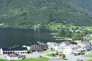
Hornindal is a municipality in the county of Sogn og Fjordane, Norway. It is located in the traditional district of Nordfjord. The administrative centre of the municipality is the village of Grodås. The municipality sits at the eastern end of the lake Hornindalsvatnet, the deepest lake in Northern Europe. The rest of the lake lies inside neighboring Eid municipality.
Contents
- Map of Hornindal 6763 Norway
- General information
- Name
- Coat of arms
- Churches
- Government
- Municipal council
- Mayor
- Location
- Mountains
- Hornindalsvatnet
- Anders Svor Museum
- Famous people
- References
Map of Hornindal, 6763, Norway
Hornindal municipality was separated from Eid Municipality in 1867. Hornindal was part of the municipality of Stryn from 1965–1977, but was then separated again.
The European route E39 highway is being re-routed through Hornindal municipality to complete a ferry-free highway route along the western coast of Norway. The Kviven Tunnel was completed in 2012 as part of the new E39 route connecting Hornindal to Volda Municipality in Møre og Romsdal county to the north and avoiding the ferry crossing over the Voldsfjorden.
General information
Since ancient times, Hornindal was a sub-parish (sokn) of Eid prestegjeld (see formannskapsdistrikt). In 1865, Hornindal became a parish of its own and then two years later, on 1 January 1867, Hornindal was established as a separate municipality. At this time, Hornindal had a population of 1,612.
On 1 January 1965, the municipality of Hornindal was dissolved and it was divided between the neighboring municipalities of Eid and Stryn. Navelsaker and Holmøyvik and all of Hornindal west of there (population: 310) was transferred to Eid, and the 1,184 residents to the east of those areas went to Stryn.
On 1 January 1977, the municipality of Hornindal was separated from Stryn. The portions of Hornindal that were moved to Eid in 1964 remained there. The new municipality had a population of 1,202.
Name
The municipality (originally the parish) is named after the farm Horne (Old Norse Hornvin), since the first church (Hornindal Church) was built there. The first element is horn which means "horn" (here referring to a pointed mountain behind the farm), the last element is vin which means "meadow" or "pasture". So the meaning of the compounded name Hornindal is "the valley/dale of Horne".
Coat of arms
The coat of arms was introduced in 1987 and was designed by Petter Eide. It shows three silver blades of scythes on a blue background. Historically, farming and blacksmithing were vital industries in Hornindal. At one point, there were as many as 200 blacksmiths in the area. There was also a rich tradition of making handmade scythes and this was very symbolized by putting scythes on the coat-of-arms.
Churches
The Church of Norway has one parish (sokn) within the municipality of Hornindal. It is part of the Nordfjord deanery in the Diocese of Bjørgvin.
Government
All municipalities in Norway, including Hornindal, are responsible for primary education (through 10th grade), outpatient health services, senior citizen services, unemployment and other social services, zoning, economic development, and municipal roads. The municipality is governed by a municipal council of elected representatives, which in turn elect a mayor.
Municipal council
The municipal council (Kommunestyre) of Hornindal is made up of 17 representatives that are elected to every four years. For 2011–2015, the party breakdown is as follows:
Mayor
The mayor (ordførar) of a municipality in Norway is a representative of the majority party of the municipal council who is elected to lead the council. Anne-Britt Øen Nygård of the Centre Party was elected mayor for the 2011–2015 term.
Location
Hornindal is located on the northern border of Sogn og Fjordane county. Hornindal is bordered to the west by the municipality of Eid, to the south by Stryn, to the east by Stranda (in Møre og Romsdal county), and to the north by Ørsta and Volda (both in Møre og Romsdal county).
Mountains
Hornindalsvatnet
The Hornindalsvatnet lake is the deepest lake in Europe at 514 metres (1,686 ft) deep. None of the glacier streams run out into the lake and this has resulted in one of Europe's clearest lakes.
Anders Svor Museum
Anders Svor was born in 1864 on the Svor Farm in Hornindal. At the age of 21 he left for Denmark where he enrolled at the Copenhagen Academy of Art. He later participated in many art exhibitions in Kristiania, Copenhagen, Paris, and Chicago. The Anders Svor Museum was opened in 1953 and features 450 of his works. His art is characterised by simple, clean lines, and deep authenticity.