
Location Sogn og Fjordane Primary outflows Eidselva river Max. length 22 km (14 mi) Surface elevation 53 m Volume 12.06 km³ Mean depth 236 m | Primary inflows Max. width 4 km (2.5 mi) Area 51 km² Length 22 km Cities Hornindal, Eid | |
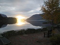 | ||
Morning on hornindalsvatnet
Hornindalsvatnet is Norway's and Europe's deepest lake, officially measured to a depth of 514 metres (1,686 ft). Its surface is 53 metres (174 ft) above sea level, which means that its bottom is 461 metres (1,512 ft) below sea level. The village of Grodås lies at the eastern end of the lake in Hornindal Municipality and the village of Mogrenda is located on the western end of the lake in Eid Municipality. The European route E39 highway runs near the lake. The village of Heggjabygda and Heggjabygda Church lie on the northern shore of the lake.
Contents
- Morning on hornindalsvatnet
- Map of Hornindalsvatn Lake Norway
- Hornindalsvatnet lake monster photographed in norway
- References
Map of Hornindalsvatn Lake, Norway
Its volume is estimated at 12 cubic kilometres (2.9 cu mi), its area is 50 square kilometres (19 sq mi) and ranks 19th in area among Norway's lakes. It is located in Sogn og Fjordane county, about a kilometer south of the county border with Møre og Romsdal county. The lake lies within the borders of Eid and Hornindal municipalities. The main outflow is the river Eidselva, which flows into the Eidsfjorden, an arm off the main Nordfjorden.
The lake is also the site of the Hornindalsvatnet Marathon, held annually in July.