
OS grid reference SK257532 Local time Tuesday 5:05 PM | Sovereign state United Kingdom Postcode district DE4 | |
 | ||
Weather 12°C, Wind W at 21 km/h, 69% Humidity | ||
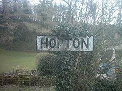
Hopton is a hamlet in the English county of Derbyshire.
Map of Hopton, UK
It is south west of Wirksworth and at the northern end of Carsington Water.
The village had a long association with the Gell family who had extensive lead mining interests in the Wirksworth area and lived at Hopton Hall. Notable members include Sir John Gell who was a Parliamentarian in the English Civil War and Sir William Gell who was an archaeologist.
The famous Hopton Incline of the Cromford and High Peak Railway, (now disused and part of the High Peak Trail and Pennine Bridleway), is about 1 mile north of the village.
References
Hopton, Derbyshire Wikipedia(Text) CC BY-SA