
OS grid reference SK250534 Post town MATLOCK | Sovereign state United Kingdom Local time Sunday 7:41 PM | |
 | ||
Population 251 (including Godfreyhole, 2011) Weather 2°C, Wind NW at 16 km/h, 97% Humidity | ||
Holiday cottage carsington water emily barn carsington peak district review
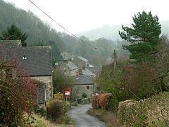
Carsington is a village in the middle of the Derbyshire Dales, England; it adjoins the hamlet of Hopton, and is close to the historic town of Wirksworth and village of Brassington.
Contents
- Holiday cottage carsington water emily barn carsington peak district review
- Map of Carsington Matlock UK
- In and around carsington water derbyshire uk
- History
- Carsington today
- References
Map of Carsington, Matlock, UK
According to the 1991 Census, the population was 111, increasing to 251 at the 2011 Census.
In and around carsington water derbyshire uk
History
Carsington has a long history, including Roman occupation (an old Roman settlement now lies beneath the reservoir). In prehistoric times, woolly rhinos lived in the area; the remains of one such animal were discovered nearby in the "Dream Cave" adjacent to the Callow and Hopton end of Summer Lane in the late 20th century.
The Channel 4 archaeology series Time Team once visited Carsington to investigate the archaeology and ancient remains in the pastures, where they visited a cave, discovered by the Pegasus Caving Club, full of ancient human bones.
Carsington today
Today, Carsington has one pub, the Miner's Arms, and a primary school. The community is primarily composed of a strong commuter and retiree contingent to replace the traditional agricultural, mining and quarrying community.
Carsington Reservoir, opened in 1992, stores water from the River Derwent and is operated by Severn Trent Water. It is open all year for recreation, with an extensive cycle path, several bird hides, a water sports and sailing centre. Inside the visitor centre are a trail, several specialist shops and a café/restaurant.