
Named for George A. Hinsdale Founded 1874 Unemployment rate 3.9% (Apr 2015) | Area 2,909 km² Population 813 (2013) Cities Lake City | |
 | ||
Website www.hinsdalecountycolorado.us Rivers Cebolla Creek, Little Elk Creek, Lean Creek, Spring Creek Points of interest Lake San Cristobal, Slumgullion Pass, Handies Peak, North Clear Creek Falls, Wetterhorn Peak | ||
Hinsdale County is one of the 64 counties of the U.S. state of Colorado. As of the 2010 census, the population was 843, making it the third-least populous county in Colorado. With a population density of only 0.75 inhabitants per square mile (0.29/km2), it is also the least-densely populated county in Colorado. The county seat and only incorporated municipality in the county is Lake City. The county is named for George A. Hinsdale, a prominent pioneer and former Lieut. Governor of Colorado.
Contents
- Map of Hinsdale County CO USA
- Geography
- Adjacent counties
- Demographics
- National forests
- National wilderness areas
- Trails
- Scenic byways
- Communities
- References
Map of Hinsdale County, CO, USA
Geography
According to the U.S. Census Bureau, the county has a total area of 1,123 square miles (2,910 km2), of which 1,117 square miles (2,890 km2) is land and 5.9 square miles (15 km2) (0.5%) is water.
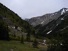
Hinsdale County is one of the most remote counties in Colorado and the United States. The county is covered by mountains, including multiple fourteeners, and contains one of the most roadless areas in the country. The continental divide crosses the county twice. Most of the county is divided among several different national forests and the Weminuche Wilderness area.
Adjacent counties
Demographics
As of the census of 2000, there were 790 people, 359 households, and 246 families residing in the county. The population density was 0.7 people per square mile (0.3/km²). There were 1,304 housing units at an average density of 1.2 per square mile (0.5/km²). The racial makeup of the county was 97.34% White, 1.52% Native American, 0.25% Asian, 0.38% from other races, and 0.51% from two or more races. 1.52% of the population were Hispanic or Latino of any race.
There were 359 households out of which 23.4% had children under the age of 18 living with them, 61.0% were married couples living together, 4.7% had a female householder with no husband present, and 31.20% were non-families. 24.8% of all households were made up of individuals and 3.1% had someone living alone who was 65 years of age or older. The average household size was 2.2 and the average family size was 2.6.
In the county, the population was spread out with 19.5% under the age of 18, 4.7% from 18 to 24, 29.5% from 25 to 44, 34.7% from 45 to 64, and 11.6% who were 65 years of age or older. The median age was 44 years. For every 100 females there were 105.7 males. For every 100 females age 18 and over, there were 109.9 males.
The median income for a household in the county was $37,279, and the median income for a family was $42,159. Males had a median income of $26,210 versus $23,750 for females. The per capita income for the county was $22,360. About 4.5% of families and 7.2% of the population were below the poverty line, including none of those under age 18 and 2.2% of those age 65 or over.
National forests
National wilderness areas
Trails
Scenic byways
Communities
Ghost Towns