
Type Highway Length 958 km | Opened 1955 Constructed 1955 | |
 | ||
Route number(s) M1(Traralgon to Winchelsea) A1(NSW border to Traralgon)(Winchelsea to SA border) | ||
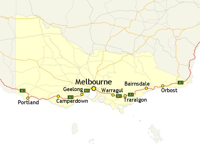
In Victoria, Highway 1 is a 958-kilometre (595 mi) long route that follows the coastline of the state, from the New South Wales border near Genoa to the South Australian border near Dartmoor. Highway 1 continues around the rest of Australia, joining all mainland state capitals, and connecting major centres in Tasmania. All roads within the Highway 1 system are allocated a road route numbered 1, M1, A1, or B1, depending on the state route numbering system. In Victoria, the highway is designated as State Route M1 between Traralgon and Winchelsea, and route A1 elsewhere.
Contents
History
Highway 1 was created as part of the National Route Numbering system, adopted in 1955. The route was compiled from an existing network of state and local roads and tracks.
Route description
The Victorian section of Highway 1 travels south from the New South Wales border to Morwell as the Princes Highway. The highway then becomes the M1 motorway, following the Princes Freeway to the Melbourne suburb of Berwick, and then the Monash Freeway to central Melbourne. Highway 1, as the CityLink Tollway bypasses the actual city centre, connecting to the West Gate Freeway. Beyond the Western Ring Road interchange, the route is once again named Princes Freeway, which leads to Geelong, with the dual carriageway M1 ending in Winchelsea. Highway 1 continues, designated as A1, along the rest of the Princes Highway, through to the South Australian border, west of Dartmoor.
The following sections, which are freeways or dual carriageways, are designated as route M1: