
Type Freeway | Length 181 km | |
 | ||
Route number(s) (1997-present)Entire route East end Princes HighwayTraralgon, Victoria Via Geelong, Little River, Werribee, Warragul, Trafalgar, Moe, Morwell, Traralgon | ||
Geelong to melbourne via princes freeway
The Princes Freeway is a 159-kilometre (99 mi) Australian freeway, divided into two sections both located in Victoria. The freeway links Melbourne to Geelong on the west (47 kilometres (29 mi)) and Traralgon on the east (112 kilometres (70 mi)). It continues beyond these extremities as the Princes Highway towards Adelaide to the west and Sydney to the northeast. The freeway bears the designation M1.
Contents
- Geelong to melbourne via princes freeway
- Man nearly hit by truck while walking on princes freeway
- Current route
- Exits and interchanges
- Traralgon Bypass Duplication to Sale
- Geelong Ring Road
- Duplication to Winchelsea and Colac
- Pakenham bypass
- Safety improvements
- Princes Highway East
- Princes Highway West
- References
The western section linking Geelong and Melbourne is an important commuter and freight route between the two cities; the eastern section links Melbourne with the Latrobe Valley. The entire freeway is one of the busiest sections of rural highway in Victoria, used by large numbers of freight and commercial vehicles and provides access to tourist attractions in central and east Gippsland. It supports Victoria's rural industries and tourism.
Man nearly hit by truck while walking on princes freeway
Current route
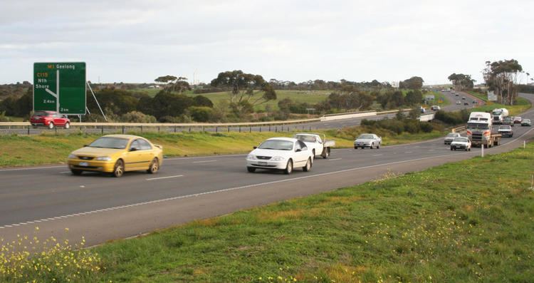
The western section (also known as Princes Freeway West or Geelong Road) starts from Altona at the West Gate Interchange, where the Western Ring Road and the old Geelong Road can be accessed by off ramps, and ends at Geelong. This section ranges from six lanes (three in each direction) between Geelong and Werribee, to ten lanes near the Ring Road interchange. Between 1999 and 2003 the section from Hoppers Crossing to Geelong was progressively widened to provide a third lane in each direction, in addition to a number of other safety upgrades being completed. Following this upgrade the speed limit was lowered from 110 kilometres per hour (68 mph) to 100 kilometres per hour (62 mph) in response to the freeway's poor safety record.
The eastern section (also known as Princes Freeway East) starts from Berwick, a four lane (two lanes in each direction) divided freeway. There are also several highway standard at-grade intersections, most notably between Nar Nar Goon and Longwarry. These intersections are speed limited to 100 kilometres per hour (62 mph), with the only 110 kilometres per hour (68 mph) section on the freeway from Longwarry to Morwell. However, traffic still travel through the towns of Yarragon and Trafalgar, therefore urban speed limits apply to these towns (between 60 and 80 kilometres per hour (37 and 50 mph)) where the road reverts to the Princes Highway (though planning for bypasses of these towns are underway).
The western and eastern sections are connected together through the Melbourne suburbs by the West Gate Freeway, CityLink Tollway and the Monash Freeway. These five sections of road together constitute the route M1 which is part of National Highway 1.
The Princes Freeway subsumes and bypasses most sections of the older Princes Highway. Former bypassed sections of the Princes Highway are generally signed with a National Route Alt 1 shield (within eastern Melbourne) or designated from C101 to C104 and C109.
In March 2010 it was announced by the State Government that trucks would be banned from the right-hand lane along a 38-kilometre (24 mi) section of freeway between Geelong and Melbourne. Suggestions of a ban began in 2005 but increased after the fatal 2007 Burnley Tunnel fire that killed three people. The ban was put into place from 1 July 2010 between Kororoit Creek Road, Altona, and Avalon Road, Lara and covers all heavy vehicles weighing more than 4.5 tonnes (4.4 long tons; 5.0 short tons), except buses and caravans. A fine of $358 applies to those breaking the rules, the ban being a trial before a full roll-out on the other major roads in the state.
On the urban section of the Princes Freeway (between Laverton North and Werribee), the standard travel time, is 9 minutes. (6 minutes between the Western Ring Road and Forsyth Road and 3 minutes between Forsyth Road and Duncans Road).
The usual peak period travel time, is between 12–18 minutes. However, in times of extreme congestion, including being residual from an incident, the travel time can well exceed 20 minutes.
Exits and interchanges
The road is divided in two distinct sections that do not meet; yet the sections are connected by the Monash Freeway and the West Gate Freeway. In the east, the section is 122 kilometres (76 mi); while the western section is 37 kilometres (23 mi) in length.
Traralgon Bypass & Duplication to Sale
Vicroads has completed a final strategy and plans for the M1 Traralgon Bypass. 4 options were put to the public, with Option 2 chosen as the preferred route. No further work on the project since 2012 has been made. East of Traralgon, the A1 section between Traralgon and Sale is currently being duplicated and upgraded to M road standard.
Geelong Ring Road
The Federal and State Government announced the construction of a new bypass extending 23 kilometres along Geelong's western outskirts from the Princes Freeway in Corio to the Princes Highway in Waurn Ponds. Drivers using the Bypass between Corio and Waurn Ponds will avoid up to 29 sets of traffic lights, with a travel time at freeway speeds of less than 15 minutes compared with the current 25 - 60 minute trip through Geelong.
The Federal Government allocated $186 million in funding with the State Government providing the remainder, giving a total of $380 million. Construction works for Section 1, between Corio and Bell Post Hill commenced in February 2006. Contracts for Section 2, between Hamlyn Heights and Fyansford, commenced in September 2006 and construction of Section 3, between Fyansford and Waurn Ponds, commenced in November 2007. All 3 stages were scheduled for completion in June 2009.
Duplication to Winchelsea and Colac
West of Geelong, duplication of the Princes Highway between Waurn Ponds and Winchelsea commenced in 2011 and was to be completed by late 2014, though opened in May 2016 after substantially being delayed. Construction for the Winchelsea - Colac section is now underway (which began in early 2016), with both the Victorian and Australian governments contributing $515 million for this project. Once completed around 2018 and beyond, it will be an M standard road.
Pakenham bypass
The Pakenham Bypass was the final missing link of a continuous freeway from Melbourne to Gippsland in the East of Victoria (excluding the single sets of traffic lights in the small rural towns of Yarragon and Trafalgar). Federal and State Governments jointly funded construction of the bypass at a cost of $242 million which commenced in April 2005 and was completed on 1 December 2007. The 24 km freeway which runs from Beaconsfield to Nar Nar Goon bypasses the townships of Pakenham and Officer and provides an important link between Gippsland and Melbourne.
Sources:
Safety improvements
Proposed safety improvements, Princes Freeway East - Nar Nar Goon to Longwarry North, included in the Victorian Government's Auslink 2 funding statement National Transport Links - Growing Victoria's Economy (aka "the Mothership") [1].
Princes Highway East
Proposed duplication of the Princes Highway - Traralgon to Sale, to be funded by Auslink 2 (2009–2014) [2].
Princes Highway West
Proposed duplication of the Princes Hwy - Waurn Ponds to Colac, as well as possible upgrades to Warrnambool, to be funded by Auslink 2 (2009–2014) [3].