
Elevation 1,051 m (3,448 ft) | ||
 | ||
Parent range | ||
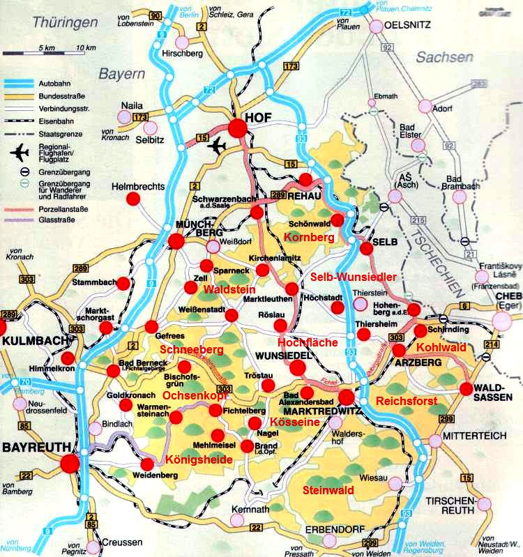
The High Fichtel Mountains (German: Hohes Fichtelgebirge), or High Fichtel, form a mountainous and heavily forested range consisting of several mountain chains in the shape of a horseshoe, the Fichtel Mountain Horseshoe (Fichtelgebirgs-Hufeisen), that rings the Selb-Wunsiedel Plateau.
Contents
As a natural region the High Fichtel Mountains are major unit 394 within the major unit group of the Thuringian-Franconian Highlands (39), that run from the Thuringian Forest to the Fichtel Mountains. Since September 2010 there is a new system for classifying the natural regions of northeast Bavaria, whereby the natural region of the High Fichtel only covers the central mountain region of the Scheeberg, Ochsenkopf and Kösseine, whilst the Waldstein ridge, the Steinwald and lower parts of the horseshoe represent special subordinate natural regions of the Fichtel Mountains.
GeographyEdit
The High Fichtel Mountains begin in the northeast at the Kornberg, continue via the Waldstein, Schneeberg, Ochsenkopf and Königsheide in the southwest to the Kösseine, then over the Steinwald and Reichsforst to the Kohlwald in the southeast.
In the geomorphological division of the neighbouring Czech Republic, the Asch Hills (German: Ascher Hügelland; Czech: Ašská vrchovina), the Haslau Hills (Haslauer Hügelland or Hazlovská pahorkatina) and the Eger Hills (Egerer Hügelland or Chebská pahorkatina) are counted as part of the (High) Fichtel range.
GeologyEdit
Geologically the mountain range consists mainly of granite. The history of its orogeny begins in the Pre-Cambrian about 750–800 million years ago – covering almost 20 % of the earth's history, something which only applies to a few of the surviving ranges of the truncated Central Uplands of Germany today.
MountainsEdit
The mountains of the High Fichtel include the following, sorted by their elevation in metres (m) above sea level (NN):