
Elevation 361 m (1,184 ft) Area 95.94 km² Local time Sunday 7:13 AM Administrative region Darmstadt | Time zone CET/CEST (UTC+1/+2) Population 7,972 (30 Jun 2009) Postal code 65321 | |
 | ||
Weather 9°C, Wind W at 18 km/h, 94% Humidity | ||
Heidenrod is a municipality in the Rheingau-Taunus-Kreis in the Regierungsbezirk of Darmstadt in Hesse, Germany. Seat of municipal administration is to be found in the most populated municipal district, in Laufenselden.
Contents
- Map of 65321 Heidenrod Germany
- Location
- Neighbouring communities
- Constituent communities
- History
- Municipal council
- Municipal partnerships
- Education
- Famous people
- References
Map of 65321 Heidenrod, Germany
Location
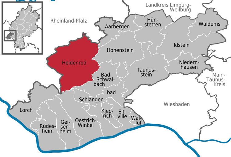
Heidenrod lies in the western Taunus north of the main ridge and west of the Aar, between Koblenz and Wiesbaden, roughly halfway between the Rhine and the Lahn. The municipal area stretches east and west of the high ridge along which runs Bundesstraße 260, also known as the Bäderstraße (“Bath Road”). The two highest settlements in the western Taunus, Kemel (village centre, 510 m above sea level) and Mappershain (village centre, 500 m above sea level) are Heidenrod municipal districts. The Mappershainer Kopf, some 500 m northwest of its namesake place, is at 548 m above sea level the highest mountain in the western Hintertaunus (“Hinder Taunus”).
Within municipal limits, west of the municipal district of Kemel, rise the headwaters of the Wisper, which run together between the constituent communities of Wisper and Geroldstein. In the constituent community of Mappershain rises the Dörsbach. Some 60% of the municipal area is wooded.
Neighbouring communities
Heidenrod borders in the north on the municipalities of Holzhausen an der Haide, Rettert, Berndroth, Dörsdorf, Eisighofen and Reckenroth (all in the Rhein-Lahn-Kreis in Rhineland-Palatinate), in the northeast on the municipality of Aarbergen, in the east on the municipality of Hohenstein, in the southeast on the town of Bad Schwalbach, in the southwest on the town of Oestrich-Winkel, and in the west on the town of Lorch and the municipalities of Welterod, Strüth, Weidenbach, Diethardt and Nastätten (all in the Rhein-Lahn-Kreis).
Constituent communities
Heidenrod’s 19 Ortsteile, with population figures for some, are Algenroth (100), Dickschied (600), Egenroth, Geroldstein (100), Grebenroth, Hilgenroth (140), Huppert (550), Kemel (1500), Langschied (300), Laufenselden (2500), Mappershain (220), Martenroth (100), Nauroth (620), Niedermeilingen, Obermeilingen (110), Springen (500), Watzelhain, Wisper (100) and Zorn (509).
History
In 1972, the first merger took place when 17 self-governing municipalities amalgamated. Last but not least in 1977 Hilgenroth became part of Heidenrod by law.
Municipal council
The municipal election held on 26 March 2006 yielded the following results:
Municipal partnerships
Heidenrod maintains partnerships with the following places: