
Country United States Incorporated May 22, 1661 Elevation 39 m Population 5,250 (2010) | State Massachusetts Settled 1659 Time zone Eastern (UTC-5) Zip code 01035 Local time Tuesday 10:32 AM | |
 | ||
Weather -4°C, Wind N at 24 km/h, 93% Humidity | ||
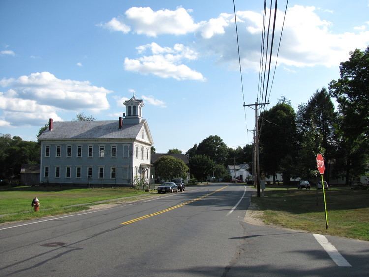
Hadley (/ˈhædli/, HAD-lee) is a town in Hampshire County, Massachusetts, United States. The population was 5,250 at the 2010 census. It is part of the Springfield, Massachusetts Metropolitan Statistical Area. The area around Hampshire Mall and Mountain Farms Mall along Route 9 is a major shopping destination for the surrounding communities.
Contents
- Map of Hadley MA USA
- Early
- Recent
- Education
- Geography
- Demographics
- Government
- Town administrator
- Selectboard
- Points of interest
- Notable residents
- References
Map of Hadley, MA, USA
Early
Hadley was first settled in 1659 and was officially incorporated in 1661. The former Norwottuck was renamed for Hadleigh, Suffolk. Its settlers were primarily a discontented group of families from the Puritan colonies of Hartford and Wethersfield, Connecticut, who petitioned to start a new colony up north after some controversy over doctrine in the local church. The settlement was led by John Russell. The first settler inside of Hadley was Nathaniel Dickinson, who surveyed the streets of what is now Hadley, Hatfield, and Amherst. At the time, Hadley encompassed a wide radius of land on both sides of the Connecticut River (but mostly on the eastern shore) including much of what would become known as the Equivalent Lands. In the following century, these were broken off into precincts and eventually the separate towns of Hatfield, Amherst, South Hadley, Granby and Belchertown. The early histories of these towns are, as a result, filed under the history of Hadley.
Edward Whalley and General William Goffe, two Puritan generals hunted for their role in the execution (or "regicide") of Charles I of England, were hidden in the home of the town's minister, John Russell. During King Philip's War, an attack by Native Americans was, by some accounts, thwarted with the aid of General Goffe. This event, compounded by the reluctance of the townsfolk to betray Goffe's location, developed into the legend of the Angel of Hadley, which came to be included in the historical manuscript History of Hadley by Sylvester Judd.
In 1683, eleven years before the Salem witch trials, Mary Webster, wife to William Webster son of the former governor of Connecticut and a founder of the very town of Hadley (John Webster), was accused and acquitted of witchcraft. She was unsuccessfully hanged by rowdy town folk. A description is given in Cotton Mather's Magnalia Christi Americana.
The Civil War general Joseph Hooker was a longtime resident of Hadley. Levi Stockbridge, one of the founders of the Massachusetts Agricultural College (now the University of Massachusetts Amherst), was also from Hadley where he was a farmer.
Recent
Hadley's transformation from an old agricultural order to the new form is the direct result of expansion of the nearby University of Massachusetts Amherst during the 1960s. Much of its former farmland was swallowed in the housing market stimulated by incoming faculty and off-campus students. Route 116 was redirected in an attempt to solve traffic congestion. Route 9, which runs east–west through the town to connect Amherst and Northampton, became a hotpoint for commercial development, and large corporations such as Stop & Shop and McDonald's opened stores along the strip. Today, the Hadley economy is a mixture of agriculture and commercial development, including big-box stores and the Hampshire Mall. Recently announced development plans included a Wal-Mart Supercenter, a Home Depot and a Lowe's, plus more than a dozen other stores. These stores cut through a bison farm, angering some. Residents recently passed a limit on retail store size at 75,000 square feet (7,000 m2), but it will not affect these large projects.
In 2003, an organization called Hadley Neighbors for Sensible Development was formed that has opposed continued large-scale commercial development in Hadley by emphasizing the down side of such growth. However, many local residents support commercial development, and about 1,000 people signed a petition asking for a new Wal-Mart, saying it would save them money on their groceries. In 2008, Wal-Mart pulled its plans to build the Supercenter after the Conservation Commission ruled that the plan did not comply with wetlands regulations. The developer of the site (Hampshire Mall) has filed and lost numerous appeals but continues its legal challenges of the commission's findings. Many residents also opposed rezoning to accommodate a new Lowe's store because they said it would be too big and would require more filling of wetlands than allowed by state law. However, the rezoning passed in 2004 and the store was finally built in 2009. Lowe's then sued the town because they didn't want to pay the required sewer hookup fees. And in 2010, the Massachusetts Department of Environmental Protection found that Lowe's had illegally filled large areas of wetlands on that site and fined the developer more than $15,000.
The World Monuments Fund listed the "Cultural Landscape of Hadley, Massachusetts" on the 2010 World Monuments Watch List of Most Endangered Sites.
The landscape of Hadley is largely open-field farming, which was only used in the earliest New England settlements and had mostly disappeared by the 18th century; its survival in Hadley on such a large scale is unique. According to the World Monument Fund 165 acres (0.67 km2) are zoned for residential and commercial use, providing no long-term protection for the historic landscape.
Education
Hadley is home to Hopkins Academy, the fourth oldest public school in the United States that is still in operation. It was founded in 1664 through money that was donated by Edward Hopkins, a wealthy London merchant. Hadley is also home to the Pioneer Valley Chinese Immersion Charter School.
Geography
According to the United States Census Bureau, the town has a total area of 24.6 square miles (63.7 km2), of which 23.1 square miles (59.8 km2) is land and 1.5 square miles (3.9 km2), or 6.18%, is water. The land boundaries of Hadley are Hatfield to the northwest, Sunderland to the north, Amherst to the east, and South Hadley to the south. Northampton borders to the west across the Connecticut River. There is also a tiny river border in the southwest with Holyoke and Easthampton. The Mount Holyoke Range forms the boundary with South Hadley and is where the highest point of Hadley is found. This is on Mount Hitchcock at an elevation of 990 to 1,000 feet (300 to 300 m). The Metacomet-Monadnock Trail traverses the Holyoke Range with panoramic vistas from several locations.
Demographics
As of the census of 2000, there were 4,793 people, 1,895 households, and 1,248 families residing in the town. The population density was 205.7 people per square mile (79.4/km²). There were 1,953 housing units at an average density of 83.8 per square mile (32.3/km²). The racial makeup of the town was 95.91% White, 0.75% African American, 0.6% Native American, 1.56% Asian, 0.58% from other races, and 1.13% from two or more races. Hispanic or Latino of any race were 1.67% of the population.
There were 1,895 households out of which 26.6% had children under the age of 18 living with them, 53.1% were married couples living together, 9.8% had a female householder with no husband present, and 34.1% were non-families. 24.7% of all households were made up of individuals and 12.2% had someone living alone who was 65 years of age or older. The average household size was 2.45 and the average family size was 2.90.
The population was spread out with 20.0% under the age of 18, 7.0% from 18 to 24, 27.7% from 25 to 44, 25.7% from 45 to 64, and 19.5% who were 65 years of age or older. The median age was 42 years. For every 100 females there were 88.5 males. For every 100 females age 18 and over, there were 87.4 males.
The median income for a household in the town was $51,851, and the median income for a family was $61,897. Males had a median income of $44,773 versus $34,189 for females. The per capita income for the town was $24,945. About 4.8% of families and 6.9% of the population were below the poverty line, including 6.6% of those under age 18 and 3.2% of those age 65 or over.
Government
Hadley is governed by open Town Meeting, a form of government most common to New England. The Board of Selectmen consists of five members and is elected annually on the second Tuesday in April. There is a Town Administrator as well. The Town Meeting takes place the first Thursday in May.