
Airport type Public 6/24 5,506 Elevation 441 m | Owner/Operator Habersham County Elevation AMSL 1,448 ft / 441 m 5,506 1,678 Phone +1 706-778-0198 | |
 | ||
Address Hwy 441 Bypass, Cornelia, GA 30531, USA | ||
Habersham county airport kajr landing
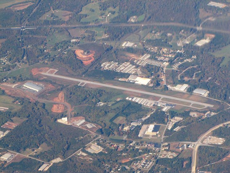
Habersham County Airport (ICAO: KAJR, FAA LID: AJR) is a county-owned public-use airport located two nautical miles (3.7 km) southwest of the central business district of Cornelia, in Habersham County, Georgia, United States.
Contents
Although most U.S. airports use the same three-letter location identifier for the FAA and IATA, this airport is assigned AJR by the FAA but has no designation from the IATA.
Facilities and aircraft
The airport covers an area of 133 acres (54 ha) at an elevation of 1,448 feet (441 m) above mean sea level. It has one asphalt paved runway designated 6/24 which measures 5,506 by 100 feet (1,678 x 30 m).
For the 12-month period ending May 26, 2009, the airport had 16,000 aircraft operations, an average of 43 per day, all of which were general aviation. At that time there were 61 aircraft based at this airport: 88.5% single-engine, 9.8% multi-engine and 1.6% helicopter.