
Lowest elevation 23 m (75 ft) Postal code 465200 | Highest elevation 1,025 m (3,363 ft) Time zone China Standard (UTC+8) Area 2,916 km² Area code 0376 | |
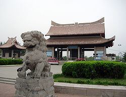 | ||
Country People's Republic of China Points of interest Panguo Gucheng Relic Site, Xiushui Park | ||
Gushi (Chinese: 固始; pinyin: Gùshǐ) is a county of 1,023,857 people directly governed by Henan province, People's Republic of China.
Contents
- Map of Gushi Xinyang Henan China
- Administration
- History
- Demographic
- Transportation
- Notable people
- References
Map of Gushi, Xinyang, Henan, China
Administration
Gushi has 3 subdistricts, 17 towns and 13 townships.
History
Gushi County was the capital of one of the two States of Liao during the Spring and Autumn period of Chinese history (771–436 BCE).
Demographic
Gushi is the most-populous county in the Henan Province, with an estimated record high of 1,734,100 citizens with registration as of 2013, according to the 2013 annual statistics report. As of the sixth national census in 2010, there are 1,023,857 residents living inside the county, showing that nearly half of the population moved out of the county without changing their residents registration status.
In 2010, the county had a population density of 348 people per square kilometer (901/mi²).
Transportation
The Nanjing–Xi'an Railway along as G40 Shanghai–Xi'an Expressway passing through the southern side of Gushi from the east to the west, connect the county with Xinyang and Hefei. A branch line, S39 Huaibin-Gushi Expressway links the county seat to the national expressway network from north to south. One major railway station located in the Town of Duanji in the southern part of the county and three intersections of the expressways have connections with local roads in the central and southern area. The national highway network, connecting other counties in this region, consists of three different routes: Line 220, Line 312 and Line 328. In the north border to Anhui, Huai River flowing from the west to the east serves as a class III Waterway.