
Basin area 174,000 km² Basin area 174,000 km² | Length 1,078 km Source Tongbai Mountain | |
 | ||
- average 1,110 m/s (39,199 cu ft/s) | ||
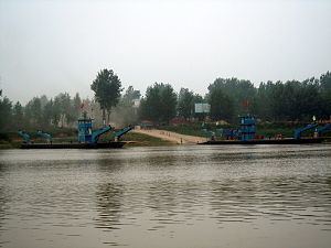
The Huai River, formerly romanized as the Hwai, is a major river in China. It is located about midway between the Yellow River and Yangtze, the two largest rivers in China, and like them runs from west to east. Historically draining directly into the Yellow Sea, floods have changed the course of the river such that it is now a major tributary of the Yangtze. The Huai is notoriously vulnerable to flooding.
Contents
Map of Huaihe River, China
The Huai River-Qin Mountains line is generally regarded as the geographical dividing line between Northern and southern China. This line approximates the 0 degree January isotherm and the 800 mm isohyet in China. It also reflects the boundary established in 1142 by the Treaty of Shaoxing between the Jin dynasty in North China and the Southern Song in South China.
The Huai River is 1,110 kilometres (690 mi) long with a drainage area of 174,000 square kilometres (67,000 sq mi).
Course
The Huai River originates in Tongbai Mountain in Henan province. It flows through southern Henan, northern Anhui, and northern Jiangsu, entering the Yangtze River at Jiangdu, Yangzhou.
Historically, the Huai River entered the Yellow Sea at Yuntiguan ("Escalade Pass") through a broad and level lower course. It was long used to irrigate the surrounding farmlands, and was the centre of an extensive network of canals and tributaries. Beginning in 1194, however, the Yellow River to the north repeatedly changed its course southwards to run into the Huai River. The resulting silting was so heavy that after the Yellow River changed back to its northerly course for the most recent time in 1897, the geography of the Huai River basin was changed significantly by the creation of new high lands, lakes, and the built-up silt of the Yellow River's historical southern course. As a result, water from the midsection of the river could not easily flow into the lower section, while water in the lower section could not find an outlet to the sea. The problem worsened in the Second World War, when the Chiang Kai-shek government, in an attempt to check the pace of the Japanese invasion, flooded the lower Huai basin by opening the Yellow River's southern levee. The main stem of the Yellow River flowed through the levee breach for the next nine years, further disrupting the Huai river system.
The result of these changes was that water from the Huai River pooled up into Lake Hongze, and then ran southwards towards the Yangtze River. Major and minor floods occurred frequently, with the area suffering droughts in between floods. In the 450 years to 1950, the Huai River saw, on average, 94 major floods per century.
Attempts to solve the Huai River's problems have focussed on building outlets for the Huai River into the Yangtze River and the sea. Currently, the major part of the river's flow enters the Yangtze River via Lake Hongze. The North Jiangsu Main Irrigation Canal also diverts some of its water along its old historical course to the sea, and is planned to be upgraded with a new parallel channel. Several former tributaries also carry some water to the sea.