
Country United States County Franklin FIPS code 13-35814 Elevation 223 m | Time zone Eastern (EST) (UTC-5) GNIS feature ID 1867242 Population 2,146 (2010) | |
 | ||
Area 41.7 km² (34.71 km² Land / 6.734 km² Water) | ||
Gumlog is an unincorporated area and census-designated place in Franklin County, Georgia, United States. The population was 2,146 at the 2010 census.
Contents
- Map of Gumlog GA USA
- Geography
- Demographics
- First Court in Franklin County
- What is in a Name
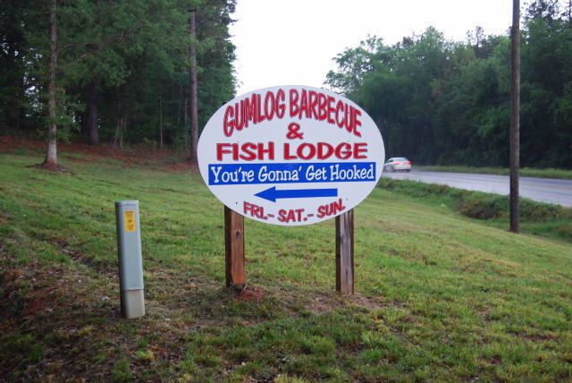
- Attractions
- References
Map of Gumlog, GA, USA
Geography
Gumlog is located in the northeast corner of Franklin County at 34°30′5″N 83°5′54″W (34.501493, -83.098341). It consists of extensive residential neighborhoods along the shores of Lake Hartwell on the Savannah River. The northeast border of the CDP is the centerline of the main stem of the lake, which also forms the state line with South Carolina. To the northwest, the CDP is bordered by Stephens County, and to the southeast it is bordered by Hart County. The southern edge of the CDP follows Interstate 85, and the southwest corner of the CDP borders the city of Lavonia. Access from I-85 is from Exit 173 (Georgia Highway 17) in Lavonia.
According to the United States Census Bureau, the Gumlog CDP has a total area of 16.1 square miles (41.6 km2), of which 13.4 square miles (34.8 km2) is land and 2.6 square miles (6.8 km2), or 16.32%, is water. Tugaloo State Park occupies a peninsula on Lake Hartwell in the eastern part of the CDP.
Georgia Highway 328 is called Gumlog Road and is nearly the only way in and out of the community of Gumlog. It is 10 miles (16 km) long and crosses over the Gumlog Cove branch of Lake Hartwell. Gumlog Road runs from Highway 59 in Lavonia to a junction with Highway 17 in Avalon. Gumlog Creek also starts near the same junction in Avalon. Avalon was going to be named "Gumlog" after Gumlog Creek, but when the charter came back from the State Legislature, the name had been changed instead to Avalon.
Demographics
As of the census of 2000, there were 2,025 people, 849 households, and 625 families residing in the CDP. The population density was 149.0 people per square mile (57.5/km²). There were 1,430 housing units at an average density of 105.2/sq mi (40.6/km²). The racial makeup of the community was 92.69% White, 4.40% African American, 0.94% Native American, 1.14% from other races, and 0.84% from two or more races. Hispanic or Latino of any race were 1.53% of the population.
There were 849 households out of which 26.1% had children under the age of 18 living with them, 61.6% were married couples living together, 7.8% had a female householder with no husband present, and 26.3% were non-families. 23.0% of all households were made up of individuals and 9.7% had someone living alone who was 65 years of age or older. The average household size was 2.39 and the average family size was 2.78.
In the CDP, the population was spread out with 20.2% under the age of 18, 6.7% from 18 to 24, 25.9% from 25 to 44, 30.4% from 45 to 64, and 16.7% who were 65 years of age or older. The median age was 43 years. For every 100 females there were 97.9 males. For every 100 females age 18 and over, there were 98.9 males.
The median income for a household in the CDP was $39,609, and the median income for a family was $42,813. Males had a median income of $29,405 versus $25,139 for females. The per capita income for the CDP was $20,859. About 6.0% of families and 6.9% of the population were below the poverty line, including 6.5% of those under age 18 and 5.2% of those age 65 or over.
First Court in Franklin County
In 1785, shortly after British rule, the Crackerhead State was roiling with scandal - where pigs would have died of disgust. In this tumultuous era, the Yazoo Land Scandal forced the federal government the take direct control from Georgia of what is now Alabama and Mississippi. South Carolina took advantage of the situation to move the boundary, established by King Charles II, from the main branch of the Keowee River to the Tugaloo branch. On top of that, there were many complaints of Indians stealing horses. The most pressing business of Franklin County's first court was to sort out the infamous Land Grant Fraud. Since there is no honor amongst thieves, over 5 million acres had been granted where only a half million actually existed. This situation was repeated in other Georgia counties. To sort out the legitimate deeds from the fraudulent deeds, a court was held on Gumlog Creek at the home of Warren Philpot. George Walton, a signer of the Declaration of Independence, was the Chief Justice. The assistant justices were Jesse Walton, Benjamin Cleveland, Larkin Cleveland, and John Gorham. These are prominent people in the development of Georgia. What today would be referred to as commissioners, or councilmen were referred to as judges in the past.
What is in a Name
The name "Gumlog" may come from a rough translation of the Native name Tsilula Yi or "Sweetgum Settlement". The area was a managed gum tree forest before Georgia exercised its right to expropriate Native lands. There may have been confusion at the time between the Native words for creek and log. Those doing the translating were not experts. In 1785 an important governmental meeting took place in Gumlog. The participants were provided improvised seating on gum logs. So it may have been spoken of as the Gum Log Court. Gumlog was the name given to a Georgia military district. These were militia companies of supposedly of one-hundred men in a similar manner of a Danish Wepntak ("Weapon Take") or English Hundred. The policy of the American and perhaps even that of the earlier British government was to favor Native, Spanish or French names and not to reuse names that belong to the British Isles. The Victorian word for this policy was euphonious to provide a better sense of place.