 | ||
A skyway, skybridge, or skywalk is a type of pedway consisting of an enclosed or covered bridge between two or more buildings in an urban area. This protects pedestrians from the weather. In North America skyways are usually owned by businesses, and are therefore not public spaces (compare with sidewalk). However, in Asia, such as Bangkok's and Hong Kong's skywalks, they are built and owned separately by the city government, connecting between privately run rail stations or other transport with their own footbridges, and run many kilometers. Skyways usually connect on the first few floors above the ground-level floor, though they are sometimes much higher, as in Petronas Towers. The space in the buildings connected by skyways is often devoted to retail business, so areas around the skyway may operate as a shopping mall. Non-commercial areas with closely associated buildings, such as university campuses, can often have skyways and/or tunnels connecting buildings.
Contents
The world's largest discontinuous skyway network – Calgary, Alberta's "+15 Walkway" system – has a total length of 18 km (11 mi). The Minneapolis Skyway System is the world's largest continuous system and spans 8 miles (13 km) connecting 69 blocks in downtown Minneapolis.
On a smaller scale, terminals of large airports are often connected by skywalk systems, as at Manchester Airport, United Kingdom.
Some cities have the equivalent of a skyway underground, and there are also mixed subway/skyway systems; see underground city.
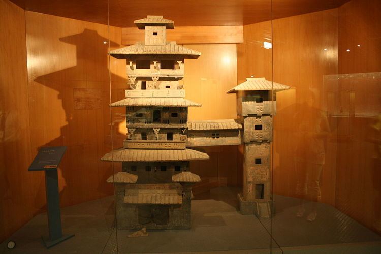
Early examples
Environmental factors
Besides pedestrian safety and convenience, the chief reasons assigned by urban planners for skywalk development are decrease of traffic congestion, reduction in vehicular air pollution and separation of people from vehicular noise. A number of cities (for example, Spokane, Washington) have given intricate analysis to skywalk systems employing computer models to optimize skywalk layout.
Negative impacts
There is debate about the negative impact on urban areas of skyways. Robertson (1998) noted the negative impacts to street activities, and reductions to the property value at ground level. Woo (2012) found that skywalk systems could be negatively associated with promoting consumerism. Cui (2015) called for more research into the impact of skyways in developing countries.
North America
There are significant skyway networks in many cities in the US Midwest, such as Saint Paul, Des Moines, Cedar Rapids, Rochester, and Duluth. Most networks in North America are privately owned. A notable exception in are the Saint Paul skyways, which are publicly owned.
Asia
In Bangkok, Thailand there are more than 5.4 km of covered wide dedicated elevated skywalks with lighting. These were developed due to lack of proper sidewalks as well as street hawkers and local merchants taking advantage of any sidewalk space as makeshift commercial real estate. Common reasons skywalks were built include to avoid street pollution, dust, wetness from food vendors and/or rain, potholes, long queues, crowds, and uneven pavement, supporting urbanism but probably most importantly, tourism receipts. Most skywalks connect to a BTS station and utilize space underneath the rail line and BTS pillar supports. These skywalks have connector ramps which connect stations to malls seamlessly and are paid for by the malls themselves, otherwise the city and BTS fund walkway development. A 50km long extension project was shelved in 2011 due to funding issues, nevertheless the system is growing organically.
In Hong Kong, China there are numerous foot bridge networks across the city. Particularly large networks exists around elevated or at grade MTR stations and connections between malls and housing estates in new town centers. The largest network spans Admiralty, Central and parts of Sheung Wan districts in the CBD and consists of the Central Elevated and Central–Mid-Levels Walkway systems which link up over 40 major office buildings. The Central–Mid-Levels walkway system is the longest outdoor covered escalator system in the world according to Guinness World Records.[9][10] Other large systems exist in Tsuen Wan and Mong Kok.
The Mumbai Skywalk Project is a planned discontinuous network of over 50 km of skywalks in Mumbai Metropolitan Region, India. The skyways will connect Mumbai Suburban Railway stations to important junctions, each 1 to 2 km in length. The first of these is a 1.3 km (0.8 mi) long skywalk connecting the suburban regions of Bandra and Kurla.
Additionally, short skyways are used to connect buildings in other locations. This includes a skywalk, 170 m above the ground and 58 m long between the two Petronas Twin Towers in Kuala Lumpur, Malaysia, between the two towers on 41st and 42nd floors, world's highest 2-story bridge.
Europe
Brussels, Belgium has a skyway between the two Belgacom Towers.
London has skywalks on the Barbican Estate and London Wall. The City of London Pedway Scheme was devised as part of the post World War II reconstruction plans for London, it was put into effect mainly from the mid-1950s to the mid-1960s and eventually abandoned by the 1980s.
