
Time zone CST (UTC-6) | Urban area 1,546 km² | |
 | ||
Principal cities San AntonioNew BraunfelsSchertzSeguin | ||
San Antonio–New Braunfels is an eight-county metropolitan area in the U.S. state of Texas defined by the Office of Management and Budget (OMB). Colloquially referred to as Greater San Antonio, the metropolitan area straddles South Texas and Central Texas and is on the southwestern corner of the Texas Triangle. The official 2011 U.S. Census estimate showed the metropolitan area's population at 2,194,927—up from a reported 1,711,103 in 2000—making it the 25th largest metropolitan area in the United States. Austin–Round Rock lies about 80 miles northeast of Greater San Antonio.
Contents
- Counties
- Communities
- Places with more than 1000000 people
- Places with 50000 to 100000 people
- Places with 25000 to 50000 people
- Economy
- Transportation
- Education
- Demographics
- References
San Antonio–New Braunfels is the third-largest metro area in Texas, after Dallas–Fort Worth–Arlington and Houston–The Woodlands–Sugar Land. It is also the second fastest-growing large metropolitan area in the state (over 1 million population), after Austin–Round Rock and just ahead of Houston–The Woodlands–Sugar Land.
Counties
There are eight counties that combine to form Greater San Antonio. The central county is Bexar.
The MSA covers a total of 7,387 sq. mi. 7,340 sq. mi. is land and 47 sq. mi. is water.
Communities
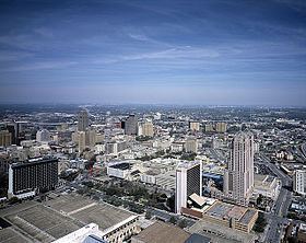
Greater San Antonio has a number of communities spread out across several counties and regions. It is centered around the City of San Antonio, the second largest city in Texas and the seventh largest city in the USA, with roughly 1.4 million residents spread across approximately 500 square miles. Other regions include the Randolph Metrocom and the surrounding counties.
Places with more than 1,000,000 people
Places with 50,000 to 100,000 people
Places with 25,000 to 50,000 people
Economy
San Antonio–New Braunfels is home to seven Fortune 1000 companies. Valero Energy Corp, Tesoro Petroleum Corp, Clear Channel Communications, USAA, NuStar Energy and CST Brands Inc are located in San Antonio. Rush Enterprises is located in New Braunfels.
Transportation
The San Antonio International Airport (SAT) is located in Uptown San Antonio, approximately eight miles north of Downtown. It has two terminals and is served by 21 airlines serving 44 destinations including six in Mexico.
VIA Metropolitan Transit is the metropolitan area's public transportation authority, serving the entire City of San Antonio and many of its suburbs throughout Bexar County.
San Antonio Station serves as the area's Amtrak train station.
Interstate Highways
Other major highways
Education
The City of San Antonio is home to many public institutions. The San Antonio area's largest university is the University of Texas at San Antonio (UTSA). Other public institutions include the University of Texas Health Science Center at San Antonio, Texas A&M University–San Antonio, and the five colleges of the Alamo Community College District.
The city has many private institutions as well, such as Our Lady of the Lake University and St. Mary's University on the inner west side. Trinity University and the University of the Incarnate Word are in Midtown. The Culinary Institute of America maintains its third campus in Downtown.
Texas Lutheran University in Seguin and Howard Payne University at New Braunfels, now offering classes at a local high school but will soon have a true campus in the Veramendi Development, are the only higher education institutions in the area outside of San Antonio city limits.
The San Antonio area has many public elementary and secondary schools sorted into the following independent school districts:
Demographics
As of the census of 2000, there were 1,711,703 people, 601,265 households, and 432,131 families residing within the MSA. The racial makeup of the MSA was 71.4% White, 6.2% African American, 0.8% Native American, 1.4% Asian, 0.1% Pacific Islander, 16.6% from other races, and 3.4% from two or more races. Hispanic or Latino of any race were 50.4% of the population. The median income for a household in the MSA was $40,764 and the median income for a family was $46,686. Males had a median income of $32,143 versus $24,007 for females. The per capita income for the MSA was $18,713.