
OS grid SE002739 Elevation 704 m | Topo map OS Landranger 98 Prominence 288 m | |
 | ||
Listing Marilyn, Hewitt, Nuttall Similar Buckden Pike, Whernside, Birks Fell, Dodd Fell Hill, Pen‑y‑ghent | ||
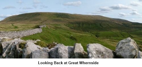
Great whernside
Great Whernside is a fell in the Yorkshire Dales, England, not to be confused with Whernside, some 17 miles (27 km) to the west. Its summit is the highest point of the eastern flank of Wharfedale above Kettlewell. The curving escarpment above the pass between Wharfedale and Coverdale is known as Whernside, of which Great Whernside is the highest point; Little Whernside is a few kilometres to the north-east.
Contents
- Great whernside
- Map of Great Whernside Skipton UK
- The walking englishman buckden pike and great whernside
- References
Map of Great Whernside, Skipton, UK
Great Whernside forms the watershed between Wharfedale and Nidderdale, and is on the boundary between the Yorkshire Dales National Park and Nidderdale Area of Outstanding Natural Beauty. Little Whernside forms the watershed between Coverdale and Nidderdale. The River Nidd rises on the eastern slopes of Great Whernside, above Angram Reservoir.
The summit of Great Whernside is a plateau strewn with rocks of millstone grit, from which the mountain takes its name (quern meaning "millstone").
Until 1997 no public right of way was established to the summit of Great Whernside. In that year two public footpaths were registered, one from Kettlewell in Wharfedale to the summit and one along the summit ridge. Following the Countryside and Rights of Way Act 2000 large parts of the fell became open access land. Great Whernside can be ascended from Kettlewell, or by a shorter route from Park Rash Pass on the minor road from Kettlewell to Coverdale. It can also be ascended by a longer, less popular, route from Scar House Reservoir. Routes from the East are often boggy even after prolonged dry weather.
Hag Dyke, halfway between Kettlewell and the summit, is a hostel run by 1st Ben Rhydding Scout Group in Ilkley.
The fell is the site of several aircraft crashes.
Tor Dike (situated on the north western flank) is an earthwork with ditch and rampart constructed in the limestone. It appears to have been built either by Iron Age tribes, perhaps in the 1st century AD, to protect themselves from the invading Romans, or in the Dark Ages.