
Length 94 km Source elevation 595 m | Basin area 516 km² Country United Kingdom | |
 | ||
Main source Nidd Head Spring, 1.3KM north of the summit of Great Whernside605 metres (1,985 ft) Basin size 516 square kilometres (199 sq mi) | ||
The River Nidd is a tributary of the River Ouse in the English county of North Yorkshire. In its first few miles it is dammed three times to create Angram Reservoir, Scar House Reservoir and Gouthwaite Reservoir which attract around 150,000 visitors a year. The Nidd can overflow the reservoirs, flooding the caves in the valley, in which case the river then flows along the normally dry river bed past Lofthouse through to Gouthwaite Reservoir. The Yorkshire Dales Rivers Trust YDRT has a remit to conserve the ecological condition of the river Nidd from its headwaters to the Humber estuary. The river gets its name for the Celtic word for brilliant.
Contents
- Map of River Nidd United Kingdom
- Course
- Water levels
- Reservoirs
- Angram Reservoir
- Scar House Reservoir
- Gouthwaite Reservoir
- Geology
- Leisure
- References
Map of River Nidd, United Kingdom
The upper river valley, Nidderdale, was designated an Area of Outstanding Natural Beauty in 1994.
Course
The Nidd rises in Nidderdale at Nidd Head Spring on the slopes of Great Whernside in the Yorkshire Dales. It flows east into Angram and Scar House Reservoirs before turning south just downstream of Newhouses. In dry conditions the river disappears underground into the sink hole known as Manchester Hole. If Scar House reservoir overflows, water flows past Manchester Hole to Goyden Pot, another sinkhole. In severe floods the river flows past Goyden Pot down the valley. The water sinking into the Nidderdale caves reappears at the rising Nidd Head to the south of the village of Lofthouse.
Below Lofthouse the river is joined by How Stean Beck, and turns south south-east towards Ramsgill before flowing into Gouthwaite Reservoir. Continuing on the same heading, the first major settlement is reached at Pateley Bridge. Turning more south-easterly it flows past Glasshouses and Summerbridge, where it turns south again past Dacre Banks. Passing by Darley, the river turns east before reaching Birstwith where it flow south-east to Hampsthwaite. A series of large bends in the river take the flow north, east and then south and then east again, to enter Nidd Gorge.
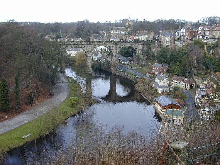
Below the gorge the river meanders south-east through the town of Knaresborough heading north and looping south again to enter flatter terrain. Near Little Ribston it meanders south-easterly and easterly crossing underneath the A1 and the A1(M) near the small village of Cowthorpe. The river continues meandering past Cattal north-easterly towards Moor Monkton towards its junction with the River Ouse at Nun Monkton.
Water levels
Reservoirs
The two most northerly reservoirs on the course of the river were built to provide water to the Bradford area in the early 1900s. As of 2011, they are maintained by Yorkshire Water.
Angram Reservoir
The reservoir takes its name from Angram, a settlement in the township of Stonebeck Up, submerged when the reservoir was built. Completed in 1919 with a dam height of 61 metres (200 ft) covering 34 hectares with a volume of 1,041 million gallons and a depth of 33.4 metres (110 ft).
Scar House Reservoir
A temporary village was built at Scar House to house the workers building the reservoirs and some remains can still be seen. The old Village Hall, was moved to Darley, where it now serves as the local Village Hall. The dam at Scar House was completed in 1936. The dam height is 71 m (233 ft) with the reservoir covering area 70 hectares and a depth of36.3 metres (119 ft) giving a volume of 2,200 million gallons. The reservoir is fed almost exclusively from the Angram dam.
Gouthwaite Reservoir
Gouthwaite reservoir is designated a Site for Special Scientific Interest. It provides a compensation release for the river. It covers an area of 126.2 metres (414 ft).
Geology
The head of the river is located on moorland and the river character is affected by the run-off levels from the three reservoirs. The upper valley is primarily millstone grit with fluvio-glacial deposits. The overlaying soil is prone to water-logging due to its slow permeability, being composed of loamy soils on top of clay with peat on the top layer. Around Lofthouse there are outcrops of Upper Yoredale limestone, which is more permeable than millstone grit and has created the Nidderdale Caves, where the river flows underground.
Lower down on the flood plain, the nature of the underlying ground is Magnesian limestone over alluvium and terrace drift deposits. On top of this is a combination of slowly permeable and well drained fine loam over clay.
Where the river passes through the Nidd Gorge, Carboniferous (Namurian) and Upper Permian rock is exposed.
Leisure
Along the river valley can be found the Nidderdale Museum, which is located in Pateley Bridge, and features sections about the traditional agriculture, industries, religion, transport and costume of Nidderdale.
Lower down the river is the town of Knaresborough, which is home to Knaresborough Castle and Knaresborough Museum.
There are many way-marked walking routes throughout the river valley, including the Nidderdale Way, a 53-mile circular walk whose usual starting point is Ripley.