
Length 150 mi (241 km) | Use Hiking, cycling | |
 | ||
Trailheads Cumberland, MarylandPittsburgh, Pennsylvania Elevation change western: 1,066 feet (325 m);eastern 1,786 feet (544 m) Designations National Recreation Trail, U.S. Bicycle Route 50 Similar Ohiopyle State Park, Montour Trail, Big Savage Tunnel, Three Rivers Heritage, Western Maryland Scenic R | ||
Bikepacking us gap spring 2014 720p great allegheny passage bicycle touring
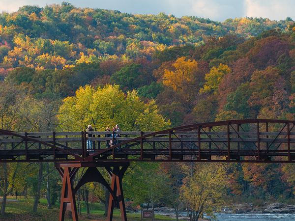
The Great Allegheny Passage (GAP) is a rail trail in Maryland and Pennsylvania—the central trail of a network of long-distance hiker-biker trails throughout the Allegheny region of the Appalachian Mountains, connecting Washington, D.C. to Pittsburgh, Pennsylvania.
Contents
- Bikepacking us gap spring 2014 720p great allegheny passage bicycle touring
- Map of Great Allegheny Passage United States
- Biking great allegheny passage and c o canal towpath pittsburgh to washington dc
- Landmarks
- References
Map of Great Allegheny Passage, United States
The GAP's first 9-mile (14 km) section near Ohiopyle, Pennsylvania, opened in 1986. The 9-mile (14 km) section between Woodcock Hollow and Cumberland opened on December 13, 2006. In June 2013, thirty-five years after construction first began, the final GAP section was completed (from West Homestead to Pittsburgh) at an overall cost of $80 million and gave Pennsylvania the "most open trail miles in the nation" (900 miles, with 1,110 miles under development). The completion project was titled The Point Made, because it was now possible to reach Point State Park in Pittsburgh from Washington, D.C. Celebrations took place on June 15, 2013.
The multi-use trail, suitable for biking and walking, uses defunct corridors of the Baltimore and Ohio Railroad, Pittsburgh and Lake Erie Railroad, Union Railroad and the Western Maryland Railway—extending 150 miles (240 km) from Cumberland, Maryland to Point State Park in downtown Pittsburgh (currently using Second Avenue in Pittsburgh, with plans underway to create an independent trail), and includes the 52-mile (84 km) branch (Montour Trail) to the Pittsburgh International Airport.
Completing a continuous, non-motorized corridor from Point State Park 335 miles (539 km) to Washington, D.C., the GAP connects with the Chesapeake and Ohio Canal towpath trail, which runs 184.5 miles (296.9 km) between Cumberland and Washington, D.C.
The Allegheny Trail Alliance (ATA)—a coalition of seven trail organizations related to the GAP (Friends of the Riverfront, Steel Valley Trail, Regional Trail Corporation, Ohiopyle State Park, and Mountains Maryland) maintains the 150–mile GAP, which is also a segment of the Potomac Heritage National Scenic Trail, one of eight nationally designated scenic trails.
The trail's formal name, the Great Allegheny Passage, was selected in 2001 by the ATA "after six years and more than 100 proposals" as "a name evocative of the geography and historical heritage" of the trail, having been suggested by Bill Metzger, editor of the ATA newsletter. The trail used a temporary name, the "Cumberland and Pittsburgh Trail", before its official name was adopted. The second runner-up title for the trail was the "Allegheny Frontier Trail".
Biking great allegheny passage and c o canal towpath pittsburgh to washington dc
Landmarks
The route is traversed by "through-travelers" including hikers, backpackers and cyclists—in portion or entirety. Notable landmarks along the trail include: