
Area 2,536 km² Population 122,353 (2013) | Website www.co.grayson.tx.us Founded 1846 | |
 | ||
Colleges and Universities Grayson College, Austin College, Diamonds Cosmetology College Destinations Sherman, Lake Ray Roberts, Lake Texoma, Denison, Eisenhower State Park | ||
Grayson County is a county in the U.S. state of Texas. As of the 2010 census, its population was 120,877. The county seat is Sherman. The county was founded in 1846 and is named after Peter Wagener Grayson, an attorney general of the Republic of Texas.
Contents
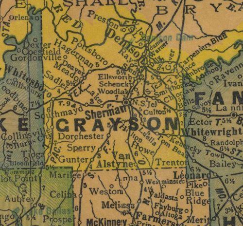
- Map of Grayson County TX USA
- History
- Geography
- Adjacent counties
- National protected area
- Demographics
- Census designated places
- Other unincorporated communities
- References
Map of Grayson County, TX, USA
Grayson County is included in the Sherman-Denison, TX Metropolitan Statistical Area, which is also included in the Dallas-Fort Worth-Arlington, TX Combined Statistical Area. It is also part of the Texoma region, with proximity to both Lake Texoma and the Red River.
History
The earliest known inhabitants of what is now Grayson County were Caddo amerindian groups, including Tonkawa, Ionis, and Kichai. These groups engaged in agriculture and traded with Spanish and French at trading posts along the Red River. This resulted in the establishment of trading posts at Preston Bend on the Red River, Warren, and Pilot Grove during 1836 and 1837.
After the establishment of Peters Colony in the early 1840s, settlement near the Red River became more rapid, and Grayson County was created from Fannin County by the Texas State Legislature on March 17, 1846. The county seat, Sherman, was also named by the Texas State Legislature.
In the 1850s, trading and marketing at Preston Bend became more important, as agriculture became more grew in the county. This was helped by Preston Road, the first trail in the state which went from Preston Bend to Austin, Texas. More growth occurred after the establishment of Sherman as station of the Butterfield Overland Mail route in 1856.
Opinions in the county about secession were not uniform, with the county voting by more than two to one in 1861 to remain in the Union. The Great Hanging at Gainesville, where more than 40 men were killed, was a polarizing event. Men from Grayson County served the Confederacy at locations in the South. The Eleventh Texas Cavalry captured Federal forts in the Indian Territory north of the Red River.
Economic depression occurred in Grayson County and much of Texas during the Reconstruction era following the Civil War. Movement of cattle herds north along Preston Road provided needed income for the county during this period.
Settlement in Grayson County flourished during the 1870s and 1880s, when the Houston and Texas Central railroad and the Missouri, Kansas, and Texas Railroad began operating in the county in 1872. This led to the emergence of cotton as the dominant agricultural product. Many towns, including Denison, Van Alstyne, Howe, Whitewright, Pottsboro, and Tom Bean, were founded during this time.
In 1879, a group of settlers who had settled in north Texas both before and after statehood came together in Grayson County for political discussions. They formed the Old Settlers Association of North Texas. The association accepted donations and purchased 26 acres. They continued to meet on an annual basis for many years.
On May 15, 1896, a tornado measuring F5 on the Fujita scale struck Sherman. The tornado's damage path was 400 yards (370 m) wide and 28 miles (45 km) long, and it killed 73 people and injured 200. About 50 homes were destroyed, with 20 of them being completely obliterated. During the Sherman Riot of 1930 (May 9, 1930), Grayson County's elegant 1876 courthouse was burned down by arson during the trial of an African American man, George Hughes. During the riot, Hughes was locked in the vault at the courthouse and died in the fire. After rioters retrieved Hughes' body from the vault, it was dragged behind a car, hanged, and set afire. Texas Ranger Frank Hamer was in Grayson County during this riot and reported the situation to Texas Governor Dan Moody. Governor Moody sent National Guard troops to Grayson County on May 9 and more on May 10 to control the situation. Grayson County's current courthouse was completed in 1936.
The Bridge War, also called the Red River Bridge War or the Toll Bridge War, was a 1931 bloodless boundary conflict between the U.S. states of Oklahoma and Texas over an existing toll bridge and a new free bridge crossing the Red River between Grayson County, Texas, and Bryan County, Oklahoma.
In 1938, construction of a dam on the Red River was authorized by the U.S. Congress. The dam's construction was completed in part by the use of labor provided by German prisoners of war held at Camp Howze, in Cooke County, Texas, during World War II. The dam is now known as Denison Dam. Lake Texoma is used for recreation, irrigation, and electrical power generation.
Perrin Air Force Base was constructed in 1941. The base closure in 1971 was a blow to the county, although the availability of labor from the base contributed to the opening of industrial plants. The effect was lessened by the base's conversion to a civilian airport: North Texas Regional Airport - Perrin Field.
The Eisenhower Birthplace State Historic Site, which is the birthplace of Dwight D. Eisenhower in Denison, was acquired and restored in 1952. Since 1993, the site is no longer maintained by the state, because of budget cuts, but it is maintained by a private nonprofit organization.
Grayson County is the only county in Texas where "deer may only be hunted with bows, no matter the season", according to an article by Thomas Phillips in the April 10, 2009, issue of Lone Star Outdoor News.
Geography
According to the U.S. Census Bureau, the county has a total area of 979 square miles (2,540 km2), of which 933 square miles (2,420 km2) is land and 46 square miles (120 km2) (4.7%) is water.
Adjacent counties
National protected area
Demographics
As of the census of 2000, 110,595 people, 42,849 households, and 30,208 families resided in the county. The population density was 118 people per square mile (46/km²). The 48,315 housing units averaged 52 per square mile (20/km²). The racial makeup of the county was 87.20% White, 5.85% Black or African American, 1.31% Native American, 0.57% Asian, 0.05% Pacific Islander, 2.90% from other races, and 2.13% from two or more races; 6.80% of the population were Hispanic or Latino of any race.
Of the 42,849 households, 32.10% had children under the age of 18 living with them, 55.20% were married couples living together, 11.40% had a female householder with no husband present, and 29.50% were not families. About 25.50% of all households were made up of individuals, and 11.40% had someone living alone who was 65 years of age or older. The average household size was 2.51 and the average family size was 3.00.
In the county, the population was distributed as 25.30% under the age of 18, 9.30% from 18 to 24, 27.60% from 25 to 44, 22.80% from 45 to 64, and 15.10% who were 65 years of age or older. The median age was 37 years. For every 100 females, there were 94.00 males. For every 100 females age 18 and over, there were 90.60 males.
The median income for a household in the county was $37,178, and for a family was $45,048. Males had a median income of $32,998 versus $23,414 for females. The per capita income for the county was $18,862. About 8.40% of families and 11.30% of the population were below the poverty line, including 13.80% of those under age 18 and 10.10% of those age 65 or over.