
Country Language spoken Capital Gorontalo Population 1.04 million (2010) | Area 11,257.07 km2 Governor Golkar | |
 | ||
University State University of Gorontalo | ||
Map of Gorontalo
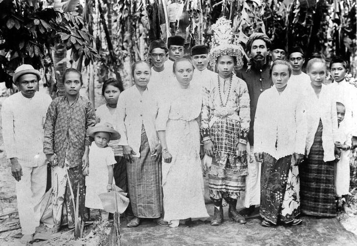
Gorontalo (Hulontalo) is a Province in Northern Sulawesi Island, Indonesia. (The namesake city is also the capital of the province) As a province, Gorontalo was officially created on December 5, 2000. Historically it is well-known as a center of the spread of Islam in Eastern Indonesia. Besides, classical Gorontalese fine art and culture are unique such as Karawo, Upiya Karanji (Songkok Gorontalo) or nickname "Peci Gusdur" (Gusdur being The 4th President of Indonesia), and poetry. (Gorontalo City is also known as "The Land Under Medina's Porch"). Gorontalo province is located on the peninsula (Gorontalo Peninsula) on the northern part of Sulawesi, located in the western part of the province of North Sulawesi. The total area of the province is 12,435 square kilometres (4,801 sq mi) with a population of 1, 133, 237(2016), with population density of 88 inhabitants / km². Gorontalo is mainly inhabited by several groups consisting of various Pohala'a (Family), among them Pohala'a Gorontalo (Ethnic Hulontalo), Pohala'a Suwawa (Ethnic Suwawa/Tuwawa), Pohala'a Limboto (Ethnic Limutu). Pohala'a Bolango (Ethnic Bulango/Bolango) and Pohala'a Atinggola (Ethnic Atinggola) are also categorized into Gorontalo tribes (also known as Hulontalo, Gorontalese or Gorontaloan). It is believed that the spread of Gorantalese Diasphora has reached five times the current population in Gorontalo and are now scattered throughout Indonesia and other countries .
Contents
- Map of Gorontalo
- Saronde island the beautiful peace of gorontalo
- Gorontalo hidden paradise diving experience
- History of Gorontalo
- Old Cities in Gorontalo
- Nickname of Gorontalo
- Etymology
- Geography
- Administrative divisions
- Gorontalo Tourism The Hidden Paradise
- Raja Island Conservation
- Limboto Lake
- References
Saronde island the beautiful peace of gorontalo
Gorontalo hidden paradise diving experience
History of Gorontalo
According to historical evidence, Gorontalo Peninsula had some type of human civilization dating back approximately 1300 years ago.The Kingdom of Suwawa has been found standing around in the 8th century AD. This is reinforced by the discovery of the tomb of the king located on the bank of upstream of Bulawa River.The tomb of King of Suwawa can be found in the river upstream Bone( ?), which is the tomb of King Moluadu (one of the king in Suwawa Kingdom) along with the tomb of his wife and son.
However, Gorontalo Peninsula did not just have historical records on the inscription King ancient tombs, but it also has prehistoric sites. Oluhuta sites, is a prehistoric site and has a prehistoric tomb in it. this may be evidence that Gorontalo has had very ancient civilization.
Meanwhile, the city of Gorontalo is one of the oldest city on Sulawesi in addition to the city of Makassar and Manado. It is estimated, Gorontalo has been around since approximately 400 years ago or around the 1500s in the 16th century.Previously Gorontalo City became one of the centers of Islamic religion in Eastern Indonesia, in addition to Ternate (now part of North Maluku Province).
Along with the spread of the religion, Gorontalo city eventually became the center of education and commerce for surrounding communities in the region "Tomini-Bocht" as Territory Bolaang Mongondow (North Sulawesi), Region Buol, Region Luwuk, Banggai, Donggala (Central Sulawesi) even to the Southeast. This is because of its strategic location, its position facing directly into the Gulf of Tomini (south) and the Sulawesi Sea (north).
Before the colonial period Gorontalo was governed under customary law.Kingdoms were united in a bond of kinship called "Pohala'a". According Haga (1931) there are five pohala'a Gorontalo area:
Based on the classification made by the customs Mr.C.Vollenhoven, the Peninsula Gorontalo included into 19 indigenous areas in Indonesia. Between religion and customs in Gorontalo was fused with the term "Adat bersendikan Syara 'and Syara' bersendikan Kitabullah". Pohalaa Gorontalo is the most prominent among the five Pohalaa. That is why Gorontalo is more widely known.
Before the independence of the Republic of Indonesia, the people of Gorontalo spearheaded by Mr. H. Nani Wartabone declared its independence on January 23, 1942. For approximately two years i.e. until 1944 Gorontalo area was a sovereign self-government. This is a milestone of the patriotic struggle for Indonesian independence and given the impact and inspiration to the surrounding area and even nationally. Mr. H. Nani Wartabone was honored and confirmed by the Government of Indonesia as a pioneer of Independence Hero
Old Cities in Gorontalo
Few other towns were known to be found in Gorontalo Province ever since the Dutch colonial era with the other old towns (in addition to the main city Gorontalo) such as:
Nickname of Gorontalo
There are several nicknames of gorontalo:
Etymology
There are several hypotheses about the etymology of the name Gorontalo.:
Geography
Gorontalo lies on the northern arm of Sulawesi Peninsula, also known as the Minahasa Peninsula. The province has an elongated shape area, stretching from west to east almost horizontally on a map, with a total area of 11,257.07 km2 (4,346.38 sq mi). To the north and the south of the province lies the Sulawesi Sea and the Gulf of Gorontalo or known as Gulf of Tomini, respectively. Prior to Year 2000CE, Gorontalo province was part of North Sulawesi province which lies on the eastern border. The western border of the province is Central Sulawesi province.
Topographically, the province is relatively low (0—40o), with the elevation ranging between 0—2,400 m (7,900 ft) above sea level. Its coastline length is more than 590 km (370 mi). Counting the Exclusive Economic Zone to the north where Philippines is at the border, the total sea area of the province is more than 50,500 km2 (19,500 sq mi). There are some small islands around the north and the south of the province, 67 of which have been identified and named.
Administrative divisions
The governor and vice-governor, who are elected directly by the people, head the provincial administration. The province is divided into five regencies (Indonesian: kabupaten) and only one city (Indonesian: kota). When the province was established in 2000, there were only two regencies and the city in the province. Splitting of regencies occurred in 2003 (when Pohuwato Regency was created from the western part of Boalemo Regency, and Bone Bolango Regency was created from the eastern part of Gorontalo Regency) and 2007 (when North Gorontalo Regency was created from the northern part of Gorontalo Regency).
As of 2010, the list of regencies and cities in Gorontalo province is given in the table below.
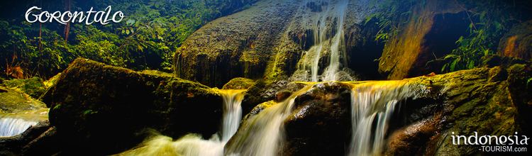
Gorontalo Tourism, The Hidden Paradise
Gorontalo province mostly consists of mountains that stretches from north to south of the province. Gorontalo Mountains has a beautiful panorama . The mountains and forests are homes to unique flora and fauna. Dwarf buffalo, Tarsier, maleo and Babirusa are ones of the rare species that can be found here. Maleo, for example, is a species of bird whose eggs are bigger than its own body. While Tarsier is the smallest primate in the world,with its length of about 10 cm. In the forest are to be found Gorontalo Ebony tree, lingua, Nantu, Meranti, and Rattan.
In the southern part of Gorontalo,in the Gulf of Tomini, it is scattered with several small islands.The islands are uninhabited with beautiful white sandy beaches.Golf of Tomini is bisected by the equator and is naturally inhabited by diversified species of sea animals. Tomini Bay is a paradise for divers. Here are some of the attractions in the province of Gorontalo:
Saronde Island, North Gorontalo Regency, Gorontalo, Indonesia
Pulo Cinta, Boalemo Regency, Gorontalo, Indonesia
Olele Marine Park and Salvador Dalí Sponge, Bone Bolango Regency, Gorontalo, Indonesia
Whale Shark Sites and Diving Center, Bone Bolango Regency, Gorontalo, Indonesia
Fort of Otanaha, Gorontalo City, Gorontalo, Indonesia
Limboto Lake and Ir. Sukarno Museum, Gorontalo Regency, Gorontalo, Indonesia
Pakaya Tower, Gorontalo Regency, Gorontalo, Indonesia
Torosiaje, Pohuwato Regency, Gorontalo, Indonesia
Bogani Nani Wartabone National Park, Bone Bolango, Gorontalo, Indonesia
Karawo Village, Gorontalo regency, Gorontalo, Indonesia
Raja Island Conservation
The islands of Pepaya, Mas and Raja islands, located in Sumalata Village - North Gorontalo Regency (about 30km from Saronde Island), have been named a nature reserve since the Dutch colonial time in 1936. Four of the only seven species of turtles can be found in the islands, the world's best turtle habitat. They include Penyu Hijau (Chelonia midas), Penyu Sisik (Eretmochelys imbricata), Penyu Tempayan (Caretta caretta) and Penyu Belimbing (Dermochelys coriacea). In 2011, the habitat was threatened by human activities such as illegal poaching and fish bombing activities; furthermore a lot of coral reefs, which represent a source of food for turtles, have been damaged.
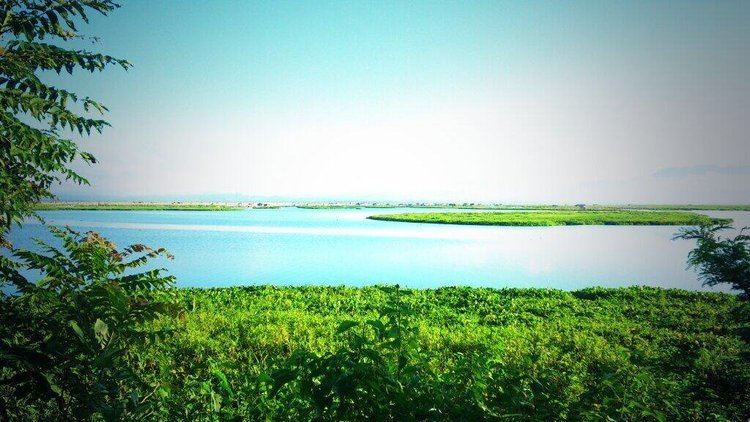
Limboto Lake
Limboto Lake has 40 bird species, 14 of them are migrating birds before resuming their journey which can be found in September and October every year from Europe, Russia, Alaska and Siberia to various destinations.