
Original author(s) Written in C++ | ||
 | ||
Initial release June 11, 2001; 15 years ago (2001-06-11) Stable release Windows, macOS, Linux7.1.8.3036 (January 17, 2017; 58 days ago (2017-01-17)) [±]Android8.0.0 (July 14, 2016; 7 months ago (2016-07-14)) [±]iOS7.1.6 (May 3, 2016; 10 months ago (2016-05-03)) [±] Preview release Windows, macOS, Linux7.1.2.2041 (October 31, 2013; 3 years ago (2013-10-31)) [±] | ||
Google Earth is a virtual globe, map and geographical information program that was originally called EarthViewer 3D created by Keyhole, Inc, a Central Intelligence Agency (CIA) funded company acquired by Google in 2004 (see In-Q-Tel). It maps the Earth by the superimposition of images obtained from satellite imagery, aerial photography and geographic information system (GIS) onto a 3D globe. It was originally available with three different licenses, but has since been reduced to just two: Google Earth (a free version with limited function) and Google Earth Pro, which is now free (it previously cost $399 a year) and is intended for commercial use. The third original option, Google Earth Plus, has been discontinued.
Contents
- Wikipedia and Panoramio integration
- Flight simulator
- Featured planes
- Sky mode
- Street View
- Water and ocean
- Historical Imagery
- Other bodies in the Solar System
- Liquid Galaxy
- 3D Imagery
- Traffic
- Influences
- Versions and variations
- Google Earth Plus Discontinued in 2008
- Google Earth Pro
- Google Earth Enterprise
- Google Earth Plug in
- Google Earth Outreach
- Controversy and criticism
- Copyright
- References
The product, re-released as Google Earth in 2005, is available for use on personal computers running Windows 2000 and above, Mac OS X 10.3.9 and above, Linux kernel: 2.6 or later (released on June 12, 2006), and FreeBSD. Google Earth is also available as a browser plugin which was released on May 28, 2008. It was also made available for mobile viewers on the iPhone OS on October 28, 2008, as a free download from the App Store, and is available to Android users as a free app in the Google Play store. In addition to releasing an updated Keyhole based client, Google also added the imagery from the Earth database to their web-based mapping software, Google Maps. The release of Google Earth in June 2005 to the public caused a more than tenfold increase in media coverage on virtual globes between 2004 and 2005, driving public interest in geospatial technologies and applications. As of October 2011, Google Earth has been downloaded more than a billion times.
Google Earth displays satellite images of varying resolution of the Earth's surface, allowing users to see things like cities and houses looking perpendicularly down or at an oblique angle (see also bird's eye view). Imagery resolution ranges from 15 meters of resolution to 15 centimeters. Most areas in Google Earth are only shown in 2D aerial imagery, but for other parts of the surface, 3D images of terrain and buildings are available. Google Earth uses digital elevation model (DEM) data collected by NASA's Shuttle Radar Topography Mission (SRTM). This means one can view almost the entire earth in three dimensions. Since November 2006, the 3D views of many mountains, including Mount Everest, have been improved by the use of supplementary DEM data to fill the gaps in SRTM coverage. Google Earth allows users to search for addresses for some countries, enter coordinates, or simply use the mouse to browse to a location.
Some people use the applications to add their own data, making them available through various sources, such as the Bulletin Board Systems (BBS) or blogs mentioned in the link section below. Google Earth is able to show various kinds of images overlaid on the surface of the earth and is also a Web Map Service client. Google Earth supports managing three-dimensional Geospatial data through Keyhole Markup Language (KML).
Wikipedia and Panoramio integration
In December 2006, Google Earth added a new layer called "Geographic Web" that includes integration with Wikipedia and Panoramio. In Wikipedia, entries are scraped for coordinates via the Coord templates. There is also a community-layer from the project Wikipedia-World. More coordinates are used, different types are in the display and different languages are supported than the built-in Wikipedia layer. Google announced on May 30, 2007 that it is acquiring Panoramio. In March 2010, Google removed the "Geographic Web" layer. The "Panoramio" layer became part of the main layers and the "Wikipedia" layer was placed in the "More" layer.
Flight simulator
In Google Earth v4.2 a flight simulator was included as a hidden feature. Starting with v4.3 it is no longer hidden. The flight simulator could be accessed by holding down the keys Ctrl, Alt, and A. Initially the F-16 Fighting Falcon and the Cirrus SR-22 were the only aircraft available, and they could be used with only a few airports. However, one can start flight in "current location" and need not to be at an airport. One will face the direction they face when they start the flight simulator. They cannot start flight in ground level view and must be near the ground (approximately 50m-100m above the ground) to start in take-off position. Otherwise they will be in the air with 40% flaps and gears extended (landing position). In addition to keyboard control, the simulator can be controlled with a mouse or joystick. Google Earth v5.1 and higher crashes when starting flight simulator with Saitek and other joysticks. The user can also fly underwater.
Featured planes
The flight simulator can be commanded with the keyboard, mouse or plugged-in joystick. Broadband connection and a high speed computer provides a very realistic experience. The simulator also runs with animation, allowing objects (for example: planes) to animate while on the simulator. Programming language can also be used to make it look like the cockpit of a plane, or for instrument landing.
Sky mode
Google Sky is a feature that was introduced in Google Earth 4.2 on August 22, 2007, and allows users to view stars and other celestial bodies. It was produced by Google through a partnership with the Space Telescope Science Institute (STScI) in Baltimore, the science operations center for the Hubble Space Telescope. Dr. Alberto Conti and his co-developer Dr. Carol Christian of STScI plan to add the public images from 2007, as well as color images of all of the archived data from Hubble's Advanced Camera for Surveys. Newly released Hubble pictures will be added to the Google Sky program as soon as they are issued. New features such as multi-wavelength data, positions of major satellites and their orbits as well as educational resources will be provided to the Google Earth community and also through Christian and Conti's website for Sky. Also visible on Sky mode are constellations, stars, galaxies and animations depicting the planets in their orbits. A real-time Google Sky mashup of recent astronomical transients, using the VOEvent protocol, is being provided by the VOEventNet collaboration. Google's Earth maps are being updated each 5 minutes.
Google Sky faces competition from Microsoft WorldWide Telescope (which runs only under the Microsoft Windows operating systems) and from Stellarium, a free open source planetarium that runs under Microsoft Windows, macOS, and Linux.
On March 13, 2008, Google made a web-based version of Google Sky available via the internet.
Street View
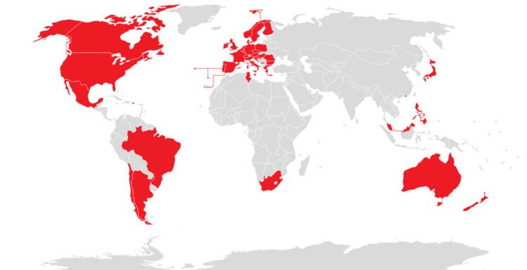
On April 15, 2008 with version 4.3, Google fully integrated its Street View into Google Earth. Google Street View provides 360° panoramic street-level views and allows users to view parts of selected cities and their surrounding metropolitan areas at ground level. When it was launched on May 25, 2007 for Google Maps, only five cities were included. It has since expanded to more than 40 U.S. cities, and includes the suburbs of many, and in some cases, other nearby cities. Recent updates have now implemented Street View in most of the major cities of Canada, Mexico, Denmark, South Africa, Japan, Spain, Norway, Finland, Sweden, France, the UK, Republic of Ireland, the Netherlands, Italy, Switzerland, Portugal, Taiwan, and Singapore.
Google Street View, when operated, displays photos that were previously taken by a camera mounted on an automobile, and can be navigated by using the mouse to click on photograph icons displayed on the screen in the user's direction of travel. Using these devices, the photos can be viewed in different sizes, from any direction, and from a variety of angles.
Water and ocean
Introduced in version 5.0 (February 2009), the Google Ocean feature allows users to zoom below the surface of the ocean and view the 3D bathymetry beneath the waves. Supporting over 20 content layers, it contains information from leading scientists and oceanographers. On April 14, 2009, Google added underwater terrain data for the Great Lakes.
In June 2011, higher resolution of some deep ocean floor areas increased in focus from 1-kilometer grids to 100 meters thanks to a new synthesis of seafloor topography released through Google Earth. The high-resolution features were developed by oceanographers at Columbia University's Lamont-Doherty Earth Observatory from scientific data collected on research cruises. The sharper focus is available for about 5 percent of the oceans (an area larger than North America). Underwater scenery can be seen of the Hudson Canyon off New York City, the Wini Seamount near Hawaii, and the sharp-edged 10,000-foot-high Mendocino Ridge off the U.S Pacific Coast. There is a Google 2011 Seafloor Tour for those interested in viewing ocean deep terrain.
Historical Imagery
Introduced in version 5.0, Historical Imagery allows users to traverse back in time and study earlier stages of any place. This feature allows research that require analysis of past records of various places.
Other bodies in the Solar System
Google Earth 5 includes a separate globe of the planet Mars, that can be viewed and analysed for research purposes. The maps are of a much higher resolution than those on the browser version of Google Mars and it also includes 3D renderings of the Martian terrain. There are also some extremely-high-resolution images from the Mars Reconnaissance Orbiter's HiRISE camera that are of a similar resolution to those of the cities on Earth. Finally, there are many high-resolution panoramic images from various Mars landers, such as the Mars Exploration Rovers, Spirit and Opportunity, that can be viewed in a similar way to Google Street View. Interestingly enough, layers on Google Earth (such as World Population Density) can also be applied to Mars. Layers of Mars can also be applied onto Earth. Mars also has a small application found near the face on Mars. It is called Meliza, and features a chat between the user and an automatic robot speaker. It is useful for research on Mars, but is not recommended for normal conversations.
On July 20, 2009, the 40th anniversary of the Apollo 11 mission, Google introduced the Google Earth version of Google Moon, which allows users to view satellite images of the Moon. It was announced and demonstrated to a group of invited guests by Google along with Buzz Aldrin at the Newseum in Washington, D.C.
Liquid Galaxy
Liquid Galaxy is a cluster of computers running Google Earth creating an immersive experience. On September 30, 2010, Google made the configuration and schematics for their rigs public, placing code and setup guides on the Liquid Galaxy wiki.
Liquid Galaxy has also been used as a panoramic photo viewer using KRpano, as well as a Google Street View viewer using Peruse-a-Rue Peruse-a-Rue is a method for synchronizing multiple Maps API clients.
3D Imagery
Google Earth shows 3D building models in some cities, including photorealistic 3D imagery. The first 3D buildings in Google Earth were created using 3D modeling applications such as SketchUp and, beginning in 2009, Building Maker, and were uploaded to Google Earth via the 3D Warehouse. However, In June 2012, Google announced that it would be replacing user made 3D buildings with an auto-generated 3D mesh. This would be phased in, starting with select larger cities, with the notable exception of cities such as London and Toronto which required more time to process detailed imagery of their vast number of buildings. The reason given is to have greater uniformity in 3D buildings, and to compete with other platforms already using the technology such as Nokia Here and Apple Maps. The coverage began that year in 21 cities in four countries. By March 2015, 3D imagery covering more than 300,000 km² was available and by early 2016 had been expanded to hundreds of cities in over 40 countries, including every U.S. state and encompassing every continent except Antarctica.
In 2009, in a collaboration between Google and the Museo del Prado in Madrid, the museum selected 14 of its most important paintings to be photographed and displayed at the ultrahigh resolution of 14,000 megapixels inside the 3D version of the Prado in Google Earth and Google Maps.
Traffic
Google Earth includes a feature that allows users to monitor traffic speeds in real-time. In 2007, Google began offering traffic data in real-time, based on information crowdsourced from the GPS-identified locations of cellular phone users. In version 4.3 released on April 15, 2008, Google Street View was fully integrated into the program allowing the program to provide an on the street level view in many locations.
Influences
Google Earth can be traced directly back to a small company named Autometric, now a part of Boeing. A team at Autometric, led by Robert Cowling, created a visualization product named Edge Whole Earth. Bob demonstrated Edge to Michael T. Jones, Chris Tanner and others at SGC in 1996. Several other visualization products using imagery existed at the time, including Performer-based ones, but Michael T. Jones stated emphatically that he had "never thought of the complexities of rendering an entire globe ..." The catch phrase "from outer space to in your face" was coined by Autometric President Dan Gordon, and used to explain his concept for personal/local/global range. Edge blazed a trail as well in broadcasting, being used in 1997 on CBS News with Dan Rather, in print for rendering large images draped over terrain for National Geographic, and used for special effects in the feature film Shadow Conspiracy in 1997.
Gordon was a huge fan of the 'Earth' program described in Neal Stephenson's sci-fi classic Snow Crash. Indeed, a Google Earth co-founder claimed that Google Earth was modeled after Snow Crash, while another co-founder said it was inspired by the short science education film Powers of Ten. In fact Google Earth was at least partly inspired by a Silicon Graphics demo called "From Outer Space to in Your Face" which zoomed from space into the Swiss Alps then into the Matterhorn. This launch demo was hosted by an Onyx 3000 with InfiniteReality4 graphics, which supported Clip Mapping and was inspired by the hardware texture paging capability (although it did not use the Clip Mapping) and "Powers of Ten". The first Google Earth implementation called Earth Viewer emerged from Intrinsic Graphics as a demonstration of Chris Tanner's software based implementation of a Clip Mapping texture paging system and was spun off as Keyhole Inc.
Versions and variations
Google Earth has been released on macOS, Linux, iOS and Android. The Linux version began with the version 4 beta of Google Earth, as a native port using the Qt toolkit. The Free Software Foundation consider the development of a free compatible client for Google Earth to be a High Priority Free Software Project. Google Earth was released for Android on February 22, 2010, and on iOS on October 27, 2008. The mobile versions of Google Earth can make use of multi-touch interfaces to move on the globe, zoom or rotate the view, and allow to select the current location. An automotive version of Google Earth was made available in the 2010 Audi A8.
Google Earth Plus (Discontinued in 2008)
Discontinued in December 2008, Google Earth Plus was an individual-oriented paid subscription upgrade to Google Earth that provided customers with the following features, most of which are now available in the free Google Earth.
The Linux version of the Google Earth Plus application does not include any GPS functionality.
Google Earth Pro
Google Earth Pro is a business-oriented upgrade to Google Earth that has more features than the Plus version. It is the most feature-rich version of Google Earth available to the public, with various additional features such as a movie maker and data importer. In addition to business-friendly features, it has also been found useful for travelers with map-making tools. Up until late January 2015, it was available for $399/year, however Google decided to make it free to the public. It is now for free and Google does not mention anything about new policy changes. The Pro version includes add-on software such as:
Google Earth Pro is available for Windows (NT-based versions), macOS 10.4 or later.
Google Earth Enterprise
Google Earth Enterprise is designed for use by organizations whose businesses could take advantage of the program's capabilities, for example by having a globe that holds company data available for anyone in that company. As of March 20, 2015, Google has retired the Google Earth Enterprise product, with support ending March 22, 2017.
Google Earth Enterprise (GEE) allows developers to build and host their own private maps and 3D globes. GEE Fusion, GEE Server and GEE Portable Server source code (470,000+ lines) will be published on GitHub under the Apache2 license in March 2017.
Google Earth Plug-in
The Google Earth API is a free beta service, available for any web site that is free to consumers. The Plug-in and its JavaScript API let users place a version of Google Earth into web pages. The API enables sophisticated 3D map applications to be built. At its unveiling at Google's 2008 I/O developer conference, the company showcased potential applications such as a game where the player controlled a milktruck atop a Google Earth surface.
The Google Earth API has been deprecated as of 15 December 2014 and will remain supported until the 15th of December 2015. Google Chrome aims to end support for the Netscape Plugin API (which the Google Earth API relies on) by the end of 2016.
Google Earth Outreach
Google Earth Outreach is a charity program, through which Google promotes and donates to various non-profit organizations. Beginning in 2007, donations are often accompanied by layers featured in Google Earth, allowing users to view a non-profit's projects and goals by navigating to certain related locations. Google Earth Outreach offers online training on using Google Earth and Google Maps for public education on issues affecting local regions or the entire globe. In June 2008, training was given to 20 indigenous tribes in the Amazon rainforest, such as the Suruí, to help them preserve their culture and raise awareness for the problem of deforestation.
People who create content for the public benefit sector can create KML files detailing their efforts to the Showcase Gallery, where content is posted in the categories of Global Development, Public Health, Environment and Science, Culture and Education, and Social Services. The program has been launched in 9 countries: US, UK, France, Italy, Germany, the Netherlands, Spain, Switzerland, and Brazil.
Non-profit organizations featured in Google Earth via the Outreach program include ARKive, the Global Heritage Fund, Greenpeace, WaterAid, and the World Wide Fund for Nature.
Controversy and criticism
The software has been criticized by a number of special interest groups, including national officials, as being an invasion of privacy and even posing a threat to national security. The typical argument is that the software provides information about military or other critical installations that could be used by terrorists.
Google Earth has been blocked by Google in Iran and Sudan since 2007 due to US government export restrictions. The program has also been blocked in Morocco since 2006 by Maroc Telecom, a major service provider in the country.
Some citizens may express concerns over aerial information depicting their properties and residences being disseminated freely. As relatively few jurisdictions actually guarantee the individual's right to privacy, as opposed to the state's right to secrecy, this is an evolving point. Perhaps aware of these critiques, for a time, Google had Area 51 (which is highly visible and easy to find) in Nevada as a default placemark when Google Earth is first installed.
As a result of pressure from the United States government, the residence of the Vice President at Number One Observatory Circle was obscured through pixelization in Google Earth and Google Maps in 2006, but this restriction has since been lifted. The usefulness of this downgrade is questionable, as high-resolution photos and aerial surveys of the property are readily available on the Internet elsewhere. Capitol Hill also used to be pixelized in this way. The Royal Stables in The Hague, Netherlands also used to be pixelized, and are still pixelized at high zoom levels.
Critics have expressed concern over the willingness of Google to cripple their dataset to cater to special interests, believing that intentionally obscuring any land goes against its stated goal of letting the user "point and zoom to any place on the planet that you want to explore".
In the United Kingdom, critics have also argued that Google Earth has led to the vandalism of private property, highlighting the graffiti of a penis being drawn on the roof of a house near Hungerford, on the roof of Yarm School at Stockton on Tees and on the playing fields of a school in Southampton as examples of this.
In Hazleton, Pennsylvania, media attention and critics focused on Google Earth once more because of the defacing of the Hazleton Area High School football field. Grass was removed to create the image of a penis approximately 35 yards long and 20 yards wide.
Late 2000s versions of Google Earth require a software component running in the background that will automatically download and install updates. Several users expressed concerns that there is not an easy way to disable this updater, as it runs without the permission of the user.
In the academic realm increasing attention has been devoted to both Google Earth and its place in the development of digital globes more generally. In particular, the International Journal of Digital Earth now features many articles evaluating and comparing the development Google Earth and its differences when compared to other professional, scientific and governmental platforms.
Elsewhere, in the Humanities and Social Sciences, Google Earth's role in the expansion of "earth observing media" has been examined. Leon Gurevitch in particular has examined the role of Google Earth in shaping a shared cultural consciousness regarding climate change and humanity's capacity to treat the earth as an engineerable object. Gurevitch has described this interface between earth representation in Google Earth and a shared cultural imaginary of geo-engineering as "Google Warming".
Copyright
Every image created from Google Earth using satellite data provided by Google Earth is a copyrighted map. Any derivative from Google Earth is made from copyrighted data which, under United States Copyright Law, may not be used except under the licenses Google provides. Google allows non-commercial personal use of the images (e.g. on a personal website or blog) as long as copyrights and attributions are preserved. By contrast, images created with NASA's globe software World Wind use The Blue Marble, Landsat or USGS layer, each of which is a terrain layer in the public domain. Works created by an agency of the United States government are public domain at the moment of creation. This means that those images can be freely modified, redistributed and used for commercial purposes.