
Population 363 (2011 census Sovereign state United Kingdom Area 11.29 km² | OS grid reference TF7622002111 Post town Kings Lynn Dialling code 01366 | |
 | ||
Gooderstone is a village situated in the Breckland District of Norfolk and covers an area of 11.29 km2 (4.36 sq mi) with an estimated population of 390 in 2007, reducing to 363 at the 2011 Census. It lies 6 miles (9.7 km) south west from Swaffham.
Map of Gooderstone, UK
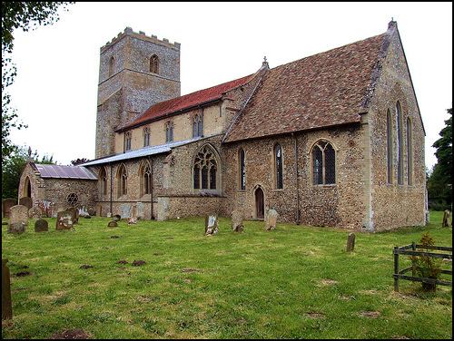
Gooderstone is served by St.Georges church in the Benefice of Cockley Cley.
Gooderstone Primary School also serves the villages of Foulden and Oxborough.
Gooderstone Water Gardens and Nature Trail is open daily throughout the year.
References
Gooderstone Wikipedia(Text) CC BY-SA