
Area 80.41 km² | Population 5,131 (2006) | |
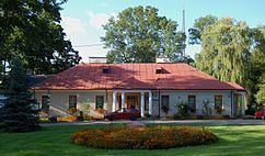 | ||
Gmina Borowie is a rural gmina (administrative district) in Garwolin County, Masovian Voivodeship, in east-central Poland. Its seat is the village of Borowie, which lies approximately 11 kilometres (7 mi) north-east of Garwolin and 61 km (38 mi) south-east of Warsaw.
Contents
Map of Gmina Borowie, Poland
The gmina covers an area of 80.41 square kilometres (31.0 sq mi), and as of 2006 its total population is 5,131.
Villages
Gmina Borowie contains the villages and settlements of Borowie, Brzuskowola, Chromin, Dudka, Filipówka, Głosków, Gościewicz, Gózd, Iwowe, Jaźwiny, Kamionka, Laliny, Łętów, Łopacianka, Nowa Brzuza, Słup Drugi, Słup Pierwszy, Stara Brzuza and Wilchta.
Neighbouring gminas
Gmina Borowie is bordered by the gminas of Garwolin, Górzno, Latowicz, Miastków Kościelny, Parysów, Stoczek Łukowski and Wodynie.