
Postcode(s) 5411 Local time Tuesday 10:04 AM | Postal code 5411 Federal division Division of Wakefield | |
 | ||
Weather 22°C, Wind SE at 3 km/h, 60% Humidity | ||
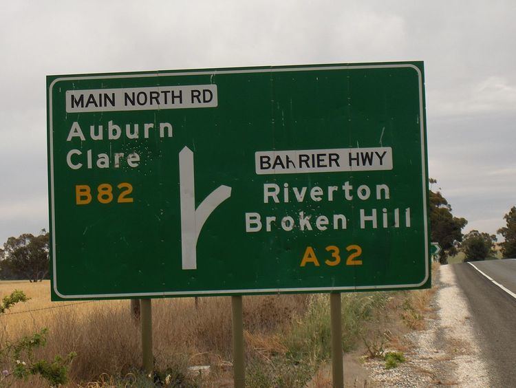
Giles Corner (formerly Giles' Corner) (Postcode 5411) is the name of the intersection of Main North Road (now called Horrocks Highway) and the Barrier Highway, halfway between the towns of Tarlee and Rhynie. The Barrier Highway branches off from Horrocks Highway at this location, heading north towards Riverton, Burra and eventually Broken Hill. Horrocks Highway continues in a northerly direction, on to the towns of Rhynie, Auburn and Clare. There is also an unsealed back road starting just north of the junction which heads west and ends at the road between Balaklava and Owen, approximately 20 kilometres away. Although not a town, Giles Corner is sign posted to mark its location.
Map of Giles Corner SA 5411, Australia
The name is in honour of Thomas Giles, one of the fifteen sons (and six daughters) of William Giles, Colonial Manager of the South Australian Company (1841-1860). Thomas Giles was a business partner of George Alexander Anstey, who was an early pastoralist on the Yorke Peninsula and is remembered by the landmark Anstey Hill Recreation Park in the Adelaide Hills, overlooking the Adelaide suburb of Hope Valley.