
Area 451.3 km² | Time zone BST (UTC+6) Population 417,939 (2011) | |
 | ||
Website Official Website of Ghatail | ||
Ghatail is an upazila located in Tangail District, Bangladesh. The upazila is bounded by Gopalpur and Madhupur upazilas on the north, Fulbaria and Bhaluka upazilas on the east, Kalihati and Sakhipur upazilas on the south, Bhuapur and Gopalpur upazilas on the west. Main rivers are Bangshi, Jhenai, Lohajang, Salisunda. Noted hills are Deopara, Dhalapara and Sagardighi (river)|Sagardighi]].
Contents
History
Naming: According to Akbarnama, one fight happened between Ishakha Army and Mughal Army on 1601 and Mughal Bahini defeated Ishakha on Atia fight. There was small soldger post of ishakha on Bank of Toke river which called GHAT as well, and connecting road between Ghat and Ghuiler Gor( hilly area of eastern part of ghatail,which is also part of Madhupurer gor) called AIL, joiting this two part Ghat and Ail created name Ghatail.
Early history
During the rule of the Pala Dynasty this area was used as corridor between Borendro Somapura MahaBihara and Mayanamti Mahabihara.Lausen established Pala ruling at Mymensisg area, Lauasen who was general of Dabaplala, second Pala King of Pala Dynasty.There was small Pala land lord named Kalidash Pala, Josho Pala and Harishchanda Pala was ruling as zonal king under Debapala.Joshopala's capital was located between vawal and Miadhupur Gor. Many old superstructure, building still exist at Shohor Gopinpur, Shamsher Chala of Ghatail and the name of surrounding area( Fulmalir chala, Malir Chala, Besshar Chala,) also state the existence of that king. Bangshi River once used as river way that time supporting the thousands years old light house located on a top of deopara hill. there is a local Myth son of Dharamapala name Shagar Pala came here and start living, Shagar Pala had made one big pond, still name of that pond is Shagardighi size 12.80 Acre.
Ghatail at Freedom fight 1971
Ghatail has unparallel contribution in 1971, highest number of freedom fighters from tangail has participated at freedom fight out of sixty four districts, but ghatail has contributed with highest number of freedom fighters, 1101 authentic freedom fighters from Ghatail upzilla only.One person named Habibur Rahman was awarded as Bir Bikrom and three person Khorshed alam, Fazlul Haque and Khosru Miah was awarded as Bir Protik. Historical events: During the War of Liberation a Pakistan military cargo carrying arms and ammunitions was captured by the Muktibahini under the leadership of Habibur Rahman (Bir Bikram). In the battle that followed 30 members of the Pakistan army were killed.
Marks of War of Liberation:
A memorial pillar at Kumar Para of Makrai.
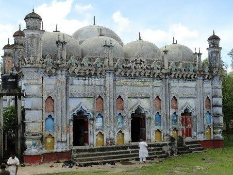
Religious institutions:
Mosque 510, temple 8.
Population: Total: 341376; male 51.14%, female 48.86%; Muslim 95.4%, Hindu 3.4, ethnic and others 1.2%. Literacy:
Average literacy 27.4%; male 33.7% female 20.3.8%.
Newspapers and periodicals: 'Monthly Ghatail' (extinct).
Economy
Main occupations:' Agriculture 59.46%, agricultural laborer 16.7%, wage labourer 1.47%, commerce 7.78%, transport 1.54%, service 5.23%, others 7.82%.
Land use: Total land under cultivation 33300 hectares; fallow land 11871 hectares; single crop 22%, double crop 49% and treble crop land 29%. Land control: Among the peasants 48% are landless, 35% small, 11% marginal and 6% rich.
Value of land: The market value of the land of the first grade is Tk 8500 per 0.01 hectare. Main crops: Paddy, jute, mustard seed and potato, pineapple, ginger, turmeric and banana. Extinct and nearly extinct crops: Sesame, linseed, wheat, garlic.
Main fruits: Mango, jackfruit, banana, papaya, berry, watermelon and pineapple. Fisheries, dairies, poultry: Livestock welfare center 3, artificial insemination center 3, diary 7, poultry 21. Communication facilities Roads: pucca 4722 km, semi pucca 28.98 km, mud road 844.59 km. Traditional transport: palanquin, horse carriage, bullock cart, buffalo cart and dhuli. These means of transport are either extinct or nearly extinct. Cottage industries: Goldsmith 150, blacksmith 50, potteries 780, wood work 540. Hats, bazaars and fairs: Hats and bazaars are 22, most noted of which are Hamidpur, Ghatail, Dhalapara, Sagardighi and Pakutia; fairs 3. Main exports: Jute, pineapple, watermelon, paddy, oil and pipe. NGO activities: Operationally important NGOs are BRAC, Prosika, ASA, BURO Tangail, Thengamara Mohila Sabuj Songa, Palli Unnayan Sangstha, Shamadha and Jibika. Health centersP: Upazila health complex 1, satellite clinic 6, family welfare center 10 and community clinic 24.
Administration
Ghatail Upazila has 1 municipality(Ghatail), 11 Unions, 294 Mauzas/Mahallas, and 411 villages.
The Union Parishads are-
Education
one University college( GBG university college), Three colleges and one women's college, 3 higher secondary schools, one English medium School( Ghatail International School, Play group to O level, Sponsored by ghatail Cantonment ) 37 secondary schools, 103 government primary schools, 52 non-government primary schools, 10 community primary schools and 52 madrasas.