
Length 303.8 km | ||
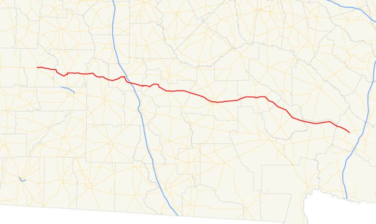 | ||
State Route 32 (SR 32) is a 188.8-mile-long (303.8 km) state highway that travels west-to-east through portions of Terrell, Lee, Worth, Turner, Irwin, Coffee, Bacon, Pierce, Brantley, and Glynn counties in the southern part of the U.S. state of Georgia. The highway connects Dawson with Sterling, via Leesburg, Ashburn, Fitzgerald, Douglas, and Alma.
Contents
- Map of GA 32 Georgia USA
- Dawson to Sycamore
- Sycamore to Sterling
- Leesburg truck route
- Sycamore connector
- Douglas truck route
- References
Map of GA-32, Georgia, USA
Dawson to Sycamore
SR 32 begins at an intersection with SR 45/SR 520 in Dawson, within Terrell County. Approximately 3,500 feet (1,100 m) later, it meets the western terminus of SR 118 (Crawford Street NE). Then, it leaves town, heading east. On the eastern city limits is Chickasawhatchee Cemetery. Farther to the east is Bethel Cemetery. After the highway enters Lee County, it curves to the south-southeast. Then, it gradually curves to the southeast. Just before entering Leesburg, SR 32 curves to the northeast, crosses over Kinchafoonee Creek, and then curves to the east. In town, it intersects US 19 Byp./SR 3 Byp. The three highways travel concurrent to the southeast for just over 1,000 feet (300 m), to an intersection with US 19/SR 3 (Walnut Street). At this intersection, US 19 Byp./SR 3 Byp. meet their southern terminus, and SR 32 travels to the north, concurrent with US 19/SR 3. At 4th Street East, SR 32 departs the concurrency to the east northeast. One block later, it meets the southern terminus of SR 195 (Leslie Highway). At this intersection, it turns to the south-southeast and curves to the east. Just before leaving town, the highway passes Leesburg Cemetery. Farther to the east, it crosses over Muckalee Creek. Then, it meets the northern terminus of SR 91 before crossing over the Flint River into Worth County. Just under 2 miles (3.2 km) into the county, it intersects SR 300 (Georgia–Florida Parkway). It curves southeast to an intersection with SR 313 in Doles. Continuing to the southeast, it intersects SR 33. Just over 0.5 miles (0.80 km) later, it enters Turner County. The highway curves back to the northeast and enters Ashburn. In the city, it intersects SR 112 (West Washington Street). The two highways begin a concurrency to the main part of the city. At the intersection with US 41/SR 7, SR 112 continues to the northeast, while SR 32 turns right onto US 41/SR 7. The three highways head concurrent into Sycamore. Just outside Ashburn, they pass the Turner County Airport.
Sycamore to Sterling
In Sycamore, SR 32 splits off to the east-northeast and immediately meets the eastern terminus of SR 32 Conn. Just to the east is an interchange with Interstate 75 (I-75). Then, it passes Pleasant Hill Cemetery and curves to the east. After that, it passes Bethel Cemetery and curves again to the southeast. Later on, it curves to the east-northeast and enters Irwin County a short distance later. SR 32 curves to the northeast and begins a concurrency with SR 125 (Waterloo Highway). The two highways head northeast over the Alapaha River, pass Burton Lake, Oak Grove Cemetery, and Brown Lake, before traveling through Irwinville. At Hogan Lake, SR 32 departs to the southeast and enters Ocilla. In the western part of the city, it intersects US 319/SR 35. The three highways travel concurrently into the main part of the city. They have an intersection with US 129/SR 11/SR 90 (Irwin Avenue). At this intersection, SR 35 reaches its northern terminus, while US 319 turns left onto US 129/SR 11/SR 90, and SR 32 continues to the east. Along its routing, it crosses over the Willacoochee River, curves to the east-southeast, and enters Coffee County. South-southwest of Ambrose, the highway has an intersection with both the northern terminus of SR 149 and the southern terminus of SR 268. SR 32 continues to the southeast, traveling through rural areas of the county and enters Douglas. There, it intersects SR 206 (Bowens Mill Road). Then, it intersects US 441/SR 31 in the main part of the city. Just before leaving Douglas, it intersects US 221/SR 135 (Bowens Mill Road SE). About 3 miles (4.8 km) later, the highway passes General Coffee State Park and crosses over 17 Mile River. It travels through Nicholls and curves to the northeast into Bacon County. The highway heads northeast and curves to the east to enter Alma. There, it intersects SR 4 Alt. (Dixon Street). A few blocks later, in the main part of town, it intersects US 1/SR 4 (Pierce Street). The highway travels one block north of Rose Hill Cemetery. It travels to the east and curves to the southeast just before intersecting SR 203 in New Lacy. The two highways have a very brief concurrency to the southeast. Continuing southeast, it enters Pierce County. SR 32 travels through Mershon and enters Bristol, where it intersects SR 15/SR 121. Farther to the southeast, in Patterson, is an intersection with US 84/SR 38. The highway crosses over the Little Satilla River into Brantley County. In Hortense, it intersects US 301/SR 23, then proceeds to Needmore, where it meets the northern terminus of SR 110. It curves to the southeast and enters Glynn County. In Anguilla, it begins a concurrency with SR 99. The two highways curve to the northeast, curve back to the east, and enter Sterling. There, they intersect US 25/US 341/SR 27. At this intersection, SR 32 meets its eastern terminus, while SR 99 continues to the east.
All of SR 32 is included as part of the National Highway System, a system of roadways important to the nation's economy, defense, and mobility.
Leesburg truck route
State Route 32 Truck (SR 32 Truck) is a 2.6-mile-long (4.2 km) truck route that directs truck traffic from the main part of Leesburg. It begins at an intersection with US 19/SR 3/SR 32 (Walnut Street) in the south-central part of the city. This intersection is also the southern terminus of US 19 Byp./SR 3 Byp. (Dawson Road). It travels due east on Robert B. Lee Drive. It passes a U.S. Post Office and crosses over some railroad tracks of Norfolk Southern Railway and then enters a rural area of the city. The truck route passes [[Lee County Elementary School before intersecting Lovers Lane Road. At this intersection, it leaves the city limits of Leesburg and turns left to a due north direction. It continues to the north until it meets its eastern terminus, a second intersection with SR 32 east of Leesburg. Here, the roadway continues as Old Stage Road.
The entire route is in Lee County.
Sycamore connector
State Route 32 Connector (SR 32 Conn.) is a 217-foot-long (66 m) connector route that exists entirely within the city limits of Sycamore, in the south-central part of Turner County.
It begins at an intersection with US 41/SR 7 (East Railroad Avenue). It travels in a northeasterly direction until it meets its eastern terminus, an intersection with the SR 32 mainline (Jefferson Davis Highway). Due to the format to the intersection of US 41/SR 7 and the SR 32 mainline, SR 32 Conn. is an easier way for drivers to travel from US 41/SR 7 north to SR 32 east and from SR 32 west to US 41/SR 7 south.
The entire route is in Sycamore, Turner County.
Douglas truck route
State Route 32 Truck (SR 32 Truck) is a truck route around Douglas traveling south of mainline SR 32. It is named Bowens Mill Road Southwest, and Bowens Mill Road Southeast.
The highway begins as it joins southbound SR 206 and former SR 353, traveling southwest. The first site it encounters is a bridge over a former Seaboard Coast Line Railroad line. Around the vicinity of a Walmart distribution center, and before reaching the intersection with Thompson Drive, it curves from southwest to southeast. At SR 158, the highway is joined by SR 158 Truck. Just before a local farm and ranch supply store, the highways curve towards the east before encountering SR 135, which joins the concurrency. The highways travel along the north side of the Douglas Municipal Airport. SR 206 ends at US 221/US 441/SR 31, and US 221 joins the concurrency. Just before reaching Brantley Boulevard the concurrency starts to curve northeast. SR 158 Truck ends at SR 158, but US 221/SR 32 Truck/SR 135 continues northeast. At a grade crossing with the same former Seaboard Coast Line Railroad line it previously crossed over, the highways encounter an intersection with Spooner Road and Iron Road, and then curves to the northwest. SR 32 Truck ends at the east end of a short concurrency between US 221/SR 135/SR 32.