
Founded 1920 Unemployment rate 6.9% (Apr 2015) | Area 1,158 km² Population 18,292 (2013) Largest city Nahunta | |
 | ||
Website www.brantleycountyga. blogspot.com Rivers Satilla River, Buffalo Creek, Cross Swamp | ||
Brantley County is a county located in the U.S. state of Georgia. As of the 2010 census, the population was 18,411. The county seat is Nahunta.
Contents
- Map of Brantley County GA USA
- History
- Geography
- Adjacent counties
- 2000 census
- 2010 census
- Communities
- References
Map of Brantley County, GA, USA
Brantley County is part of the Brunswick, Georgia Metropolitan Statistical Area.
History
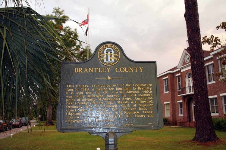
Georgia voters passed a state constitutional amendment on November 2, 1920, to form Brantley County from pieces of Charlton, Pierce, and Wayne counties. The younger Brantley served as a state representative, state senator, and eight-term United States representative.
Since the Okefenokee Swamp is to the south and west of the county, passage through Brantley County was essential to the railroads running from the coast through the southern part of the state.
Fort McIntosh was built in the early years of the American Revolutionary War to protect the extensive herds of cattle. It was placed under siege from Tories in 1777 and eventually surrendered.
Fort Mudge was built in the county at about the same time. This fort was immortalized by Walt Kelly in the Pogo comic strip.
Geography
According to the U.S. Census Bureau, the county has a total area of 447 square miles (1,160 km2), of which 442 square miles (1,140 km2) is land and 4.8 square miles (12 km2) (1.1%) is water. The Satilla River runs through Brantley County.
The bulk of Brantley County, from east of Hortense south to west of Waynesville and west to east of Waycross, is located in the Satilla River sub-basin of the St. Marys-Satilla basin. The county's eastern border area, east of Waynesville, is located in the Cumberland-St. Simons sub-basin of the St. Marys-Satilla River basin. A small northwestern corner, west of Hortense, is located in the Little Satilla sub-basin of the larger St. Marys-Satilla River basin, and a very small southwestern corner of Brantley County is located in the Upper Suwannee River sub-basin of the larger Suwannee River basin.
Adjacent counties
2000 census
As of the census of 2000, there were 14,629 people, 5,436 households, and 4,153 families residing in the county. The population density was 33 people per square mile (13/km²). There were 6,490 housing units at an average density of 15 per square mile (6/km²). The racial makeup of the county was 94.36% White, 3.98% Black or African American, 0.14% Native American, 0.09% Asian, 0.01% Pacific Islander, 0.35% from other races, and 1.08% from two or more races. 1.04% of the population were Hispanic or Latino of any race.
There were 5,436 households out of which 38.20% had children under the age of 18 living with them, 60.90% were married couples living together, 10.60% had a female householder with no husband present, and 23.60% were non-families. 20.40% of all households were made up of individuals and 7.70% had someone living alone who was 65 years of age or older. The average household size was 2.68 and the average family size was 3.06.
In the county, the population was spread out with 28.30% under the age of 18, 8.50% from 18 to 24, 29.90% from 25 to 44, 23.20% from 45 to 64, and 10.10% who were 65 years of age or older. The median age was 35 years. For every 100 females there were 100.80 males. For every 100 females age 18 and over, there were 98.10 males.
The median income for a household in the county was $30,361, and the median income for a family was $35,534. Males had a median income of $29,269 versus $20,709 for females. The per capita income for the county was $13,713. About 12.10% of families and 15.60% of the population were below the poverty line, including 19.70% of those under age 18 and 16.90% of those age 65 or over.
2010 census
As of the 2010 United States Census, there were 18,411 people, 6,885 households, and 5,075 families residing in the county. The population density was 41.6 inhabitants per square mile (16.1/km2). There were 8,086 housing units at an average density of 18.3 per square mile (7.1/km2). The racial makeup of the county was 94.4% white, 2.9% black or African American, 0.3% American Indian, 0.2% Asian, 0.7% from other races, and 1.5% from two or more races. Those of Hispanic or Latino origin made up 1.9% of the population. In terms of ancestry, 25.6% were English, 15.1% were Irish, 12.7% were American, and 8.9% were German.
Of the 6,885 households, 38.2% had children under the age of 18 living with them, 54.6% were married couples living together, 13.2% had a female householder with no husband present, 26.3% were non-families, and 22.1% of all households were made up of individuals. The average household size was 2.66 and the average family size was 3.08. The median age was 37.8 years.
The median income for a household in the county was $37,343 and the median income for a family was $43,028. Males had a median income of $39,260 versus $28,154 for females. The per capita income for the county was $18,905. About 18.2% of families and 21.4% of the population were below the poverty line, including 28.6% of those under age 18 and 10.7% of those age 65 or over.